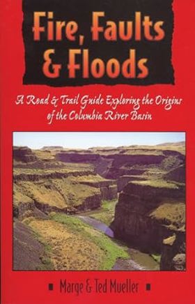
Fire, faults & floods a road & trail guide exploring the origins of the Columbia River basin
|
Fifty-three trips are targeted to assist readers in finding and understanding the area's major geologic features. Among the regions covered are: Missoula, Montana and the lower Clark Fork drainage; Grande Ronde and Joseph Creek Canyons on the borders of Washington, Oregon, and Idaho; the Columbia River Gorge; and the northern Oregon Coast. Includes b&w photos and maps. c. Book News Inc |
| Author(s): | Marge Mueller, Ted Mueller |
| Document: | Book · Paperback · CIRC [ 1 ] |
| Edition: | 1st Edition |
| Published: | 1997 |
| Physical Description: | 288 pages : illustrations, maps ; 22 cm |
| Genre: | Guidebooks |
| Contents: | The Washington-Oregon-Idaho Border: The Source Dikes and Vents for the Columbia River Basalt Flows The Lower Grande Ronde River and Joseph Creek Canyon The Grande Ronde River, Washington Highway 129 to Troy, Oregon Wenaha River Trail #3106, Wenaha-Tucannon Wilderness Joseph, Oregon, Wallowa Lake, and the Eagle Cap Wilderness Cornucopia and the Eagle Cap Wilderness Hamilton, Montana, to Sandpoint, Idaho: The Basin Filled by Glacial Lake Missoula Nine Mile, Montana Missoula, Montana, and the Bitterroot Valley Grant Creek and the Missoula Snowbowl The Little Bitterroot Valley and Camas Prairie Ravalli, Montana, to Clark Fork, Idaho Spokane to Pasco, Washington: The Cheney-Pasco Scabland Corridor Rock Lake Coulee Washtucna Coulee and the Palouse Divide The Lower Palouse River and Palouse Falls Lower Monumental Dam and Devils Canyon The Lower Snake River Juniper Dunes Wilderness Lind Coulee Spokane to Ephrata, Washington: The Upper Crab Creek Flood Channel Crab Creek Coulee and the Sylvan Lake Ring Dike Craters Ring Dike Craters of Lake Creek and the Lakeview Ranch Washington Highway 21 to Washington Highway 28 via Irby Road Wilson Creek Flood Bars Pinto Ridge and Dry Coulee Grand Coulee Dam to Quincy, Washington: The Grand Coulee and Other Northwest Flood Channels Upper Grand Coulee Lower Grand Coulee The Waterville Plateau Moses Coulee Quincy to Vantage, Washington: The Middle Columbia River Drainage Crater Coulee Potholes Coulee Frenchman Springs Coulee Vantage, Washington, and Vicinity Ginkgo Petrified Forest State Park Moses Lake to Richland, Washington: Lower Crab Creek and the Yakima Fold Belt Drumheller Channels The Saddle Mountains Sentinel Gap Wallula Gap North-Central Oregon: The Picture Gorge Basalt Subgroup of the Columbia River Basalts The Monument Dike System Oregon Highway 19 Kimberly, Oregon, to Picture Gorge Oregon Highway 207 Service Creek to Mitchell, Oregon, and the Painted Hills Biggs to Portland, Oregon: The Columbia River Gorge Crown Point Vicinity Bridal Veil Falls State Park Multnomah Falls Oneonta Gorge Mitchell Point Mayer State Park and the Rowena Plateau The Dalles, Oregon, and Celilo Falls Horsethief Lake State Park to White Salmon, Washington Dog Mountain to Stevenson, Washington The Bonneville Landslides, Beacon Rock State Park, and Cape Horn The Oregon Coast: The Columbia River Basalt Flows Meet the Ocean Astoria, Oregon Saddle Mountain State Park Tillamook Head, Ecola State Park, and Cannon Beach Hug Point State Park and Arch Cape Neahkahnie Mountain and Cape Falcon Cape Meares State Park Boiler Bay State Park and Depoe Bay Yaquina Head |
| Subjects: | Columbia River Watershed Guidebooks, Columbia, Bassin de la Guides, Geology, Geology Columbia River Watershed Guidebooks, Géologie Columbia, Bassin de la Guides, Guidebooks, United States Columbia River Watershed, Volcanism, Volcanism Columbia River Watershed Guidebooks |
Circulation
Here are a list of places where this title can be found and the various formats it can be found in.
| Collection | Resource | Available | Edition | Published | Publisher |
|---|---|---|---|---|---|
| The Cascade District: Encyclopedia Library | Book | Paperback | 1st Edition | 1997 | University of Idaho Press, Moscow, Idaho, 1997 |
Last updated: 2024-06-17