Washington State
Named after George Washington, the first President of the United States, the state was made out of the western part of the Washington Territory, which had been ceded by Britain in 1846 in accordance with the Oregon Treaty in the settlement of the Oregon Boundary Dispute. It was admitted to the Union as the 42nd state in 1889.
Mapped Location
Washington: The mapped location is an approximation and should not be used for navigation or wayfinding.
Information
General information on Washington
- Feature Type: State
- State Capitol: City of Olympia
- Established as a Territory: Wednesday, March 2, 1853
- Admitted to the Union: Tuesday, November 11, 1890
Official, historical, colloquial and alternative toponyms for Washington
A brief list of names that this geographic feature has been named
| Name | Description |
|---|---|
| State of Washington | Official |
| Territory of Columbia | Historical · Proposed name in 1852 upon requesting to the US Congress to split from the Territory of Oregon. |
| Nova Albion | Historical |
Origin Notes and History of Washington
References to Washington that document the origin of its place name
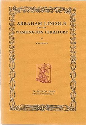
On October 25, 1852 the people north of the Columbia River petitioned Congress to partition the Territory of Oregon and form the Territory of Columbia. When the petition reached the Congress, the proposed name met opposition in that there were was already a District of Columbia and that there would be confusion between it and a like-named territory. The proposal to change the name to Territory of Washington drew the same response, but on vote, the name change stood.

WASHINGTON, State of. In 1535 and 1539, the Spaniards applied to the west coast of North America the beautiful name of California. Captain George Davidson, of the United States Coast Survey, has traced the origin of that name. (Pacific Coast Pilot, page 15, and The Origin and Meaning of the Name California reprinted from the publications of the Geographical Society of the Pacific in 1910.) In those beginning years the name extended along the coast indefinitely to the northward. The next name for the coast was Nova Albion applied by the English captain, in June, 1578, who, after completing his remarkable voyage around the world was knighted by Queen Elizabeth and became a world figure under the name of Sir Francis Drake. The record says: "Our Generall called this countrey Nova Albion, and that for two causes: the one in respect of the white bankes and cliffs, which ly towardes the sea, and the other, because it might have some affinitie with our Countrey in name, which sometime was so called." (Hakluyt's Voyages, Glasgow, 1906, Volume IX., page 325.) The name of Oregon, like that of California, has been much discussed as to origin and meaning. It is usually claimed that the name was first applied to the "River of the West" by Jonathan Carver in his Three Years Travels Through the Interior Parts of North America, who began those travels in 1766. The latest and most definitive discussion of this subject appeared in years 1920-1922, when Mr. T. C. Elliott published three studies: "The Strange Case of Jonathan Carver and the Name Oregon," "The Origin of the Name Oregon," "Jonathan Carver's Source of the Name Oregon (Quarterly of the Oreqon Historical Society, Volumes XXI., No. 4; XXII., No. 2; XXIII., No 1 ) On June 4, 1792, Captain George Vancouver celebrated the anniversary of the birth of George III., by taking possession of the regions he had been exploring and by conferring some geographic names. The ceremony took place where the present City of Everett stands and the harbor there he called Possession Sound. The great interior waterway, now known as Puget Sound, he called "Gulf of Georgia" and the mainland "binding the said gulf, and extending southward to the 45th degree of north latitude", he call "New Georgia, in honor of His present Majesty." He recognized Drake's name, changed slightly, by referring to the coast under the general name of "New Albion." (Voyage Round the World, second edition, Volume II., pages 169-170.) The purchase of Louisiana, 1803, was by many thought to include the lands in the Pacific Northwest. As evidence of that error's long life, see the United States General Land Office Map of the United States and Territories, 1896. On June 20, 1803, President Jefferson signed his famous instructions for the Lewis and Clark expedition in which he twice refers to the "Oregan or Columbia." The explorers contented themselves with charting but one general name for the country, and that in the interior, "Columbia Valley." (Elliott Coues, History of the Lewis and Clark Expedition, Volume I., pages xxvi, xxxi, and map.) Oregon, as a name for the great river before it was actually discovered by Captain Robert Gray in 1792 and by him named Columbia, was made to apply in an indefinite way to the country west of the "Shining" or Rocky Mountains. The area thus named was first restricted by the Florida Purchase Treaty, 1819, in which the 42d parallel of north latitude was made to mark the northern extent of Spanish claims. Treaties by Russia, with the United States and Great Britain, 1824-1825, marked the southern extent of Russian claims at 54°40'. By the Treaty of Washington, 1846, joint occupancy of the country with Great Britain was ended by dividing the area at the 49th parallel of north latitude. The Provisional Government in 1841 acted for "the inhabitants of the Willamette Valley", but on July 5, 1843, it was enacted that Oregon Territory should be the name. On the last named date it was also enacted that within the vast area four Districts should be created. Two of these applied to lands now in Washington. Twality District took in all the land west of the Willamette River and the meridian prolonging that line to the northward. The southern boundary was the Yamhill River and the northern boundary was at 54°40'. The lands eastward to the Rocky Mountains and north of the Anchiyoke River were placed in Clackamas District. These two Districts embraced all of the present State of Washington and much more to the north, south and east. (La Fayette Grover, The Oregon Archives pages 5, 25.) As further subdivisions were made the word "district" was supplanted by "county." On August 14, 1848, an act of Congress was approved by which a Federal organization of Oregon Territory would take the place of Provisional Government. The Oregon settlers north of the Columbia River became ambitious for a separate government. These ambitions were voiced at the Fourth of July celebrations in Olympia in 1851 and 1852, resulting in the Cowlitz and Monticello Conventions where memorials to Congress were adopted. (Edmond S. Meany, "The Cowlitz Convention: Inception of Washington Territory", in the Washington Historical Quarterly, Volume XIII., pages 3-19.) General Joseph Lane, Delegate to Congress from Oregon Territory, acting on the memorial from the Cowlitz Convention, secured the passage of a resolution on December 6, 1852, asking that the Committee on Territories bring in a bill to divide Oregon by forming a new Territory of the lands north of the Columbia by the name oi Columbia Territory. On February 8, 1853, during a debate on the bill, Representative Richard H. Stanton, of Kentucky, moved to amend by striking out the word "Columbia" and inserting in its place "Washington," as an honor for the "Father of His Country." The amendment was adopted, the bill was pass& and was signed by President Millard Fillmore on March 2, 1853. It is interesting to recall that Vancouver's honor for George III., was thus changed to an honor for the opposing leader in the American Revolution who also bore the name of George. The new Territory extended from the Pacific Ocean to the Rocky Mountains, the northern boundary being the 49th parallel, and the southern boundary the Columbia River and the 46th parallel of north latitude. Oregon was admitted to statehood on February 14, 1859, with boundaries as at present. The eastern lands between the 42d and 46th parallels of north latitude were at that time attached to Washington Territory. Idaho Territory was created by act of Congress dated March 3, 1863, cutting Washington Territory down to the present boundaries. The Territories of Montana and Wyoming were created on May 26, 1864, and July 25, 1868, respectively. Each of these took a part of Idaho land, which had formerly been within Washington Territory. The Enabling Act for the admission of Washington to statehood was approved by President Cleveland on February 22, 1889. A constitution was framed and approved by the people and on November 11, 1889, President Benjamin Harrison issued his proclamation that Washington was admitted as the forty-second State of the Union.
Related Catalog Titles
A Bibliography for Washington, State
New land southeast asian refugees finding home in Washington by John C. Hughes , Edward Echtle , Legacy Washington (Program) (Publisher), Washington (State). Office of the Secretary of State (Publisher)
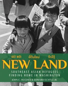
Published by the Office of the Secretary of State's Legacy Washington program, New Land: Southeast Asian Refugees Finding Home in Washington chronicles the profound humanitarian effort and individual resilience surrounding the resettlement of Vietnamese, Cambodian, and Laotian refugees in the Pacific Northwest following the 1975 fall of Saigon. Drawing on extensive oral histories and archival research, authors John C. Hughes and Edward Echtle trace how thousands of displaced families rebuilt their lives from the ground up, establishing enduring cultural, economic, and civic roots across the state. A keen insight drawn from the book is how Washington's successful integration of these communities—spearheaded by pioneering political leadership under figures like Governor Dan Evans—fundamentally transformed the state's cultural landscape. By shifting the historical perspective away from distant geopolitical conflict to focus on grassroots local welcome, the book highlights how regional humanitarian action successfully countered national xenophobia and redefined the Pacific Northwest as a vibrant, multicultural diaspora.
327 pages, 14 unnumbered pages : illustrations, portraits ; 26 cm.
CIRC [ 0 ]
Washington state's round barns preserving a vanishing rural heritage by Tom J. Bartuska , Helen Bartuska
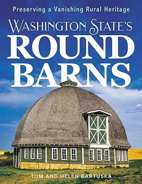
"Enchanted by their beauty, complexity, and historical significance, Tom and Helen Bartuska spent decades researching, visiting, and photographing twenty-one Washington round barns over fifty years old, at least two stories, and over fifty feet in diameter. They share what they learned-who built each structure and when, original and current uses, individual characteristics, construction details, and more. They also discuss the fascinating history, re-use, and creative preservation of round barns and other rural buildings and communities across the United States"-- Provided by publisher
pages cm
CIRC [ 0 ]
The Evergreen Collection exceptional stories from across Washington State by Larry Clark , Adriana Janovich
"While working for Washington State Magazine, eleven journalists traveled throughout the region to interview farmers, chefs, wine tasters, mountain climbers, scientists, and more. The resulting stories highlight the Evergreen State's captivating people, industries, and history, describing influential programs, cities from Aberdeen to Zillah, as well as a wide variety of trends, research, and innovative solutions"--
xiii, 273 pages : color illustrations ; 23 cm
CIRC [ 0 ]
Maritime names of Washington by Richard W. Blumenthal
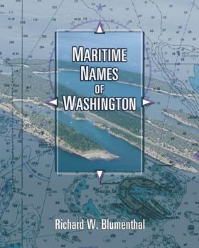
Maritime Names of Washington is a wonderful companion if you are a boating enthusiast or simply curious about Washington’s maritime history. This book is a scholarly study on the origins of place names for our coastal and inland waters. It covers every name that appears on current nautical charts, from the Pacific Coast to the Strait of Juan de Fuca, the San Juans, and Puget Sound from Port Townsend to Olympia. It includes every named island, bay, point, inlet, pass, harbor, rock, channel, strait, canal, peninsula, sound, and shoal. The book also features many local and historical names that are not shown on the charts. The manuscript generally identifies the individual who named the place, when, why, and for whom. It also identifies the chart where the name first appeared and the early settlement history of many places. The manuscript is richly annotated and uses many quotes from the observations of our earliest explorers to give readers a glimpse of what Puget Sound country looked like 200+ years ago. Each of our early explorations is discussed in detail as they relate to individual place names. The book contains 170 pictures and 44 historical nautical charts from 1790 to 1900 that show many of the names
ix, 501 pages : illustrations, maps, charts ; 26 cm
CIRC [ 1 ]
Tree fruit trade an agricultural economist reviews fifty years of Washington state's key orchard crops by Desmond O'Rourke

"Filled with personal anecdotes as well as expert observation, investigation, and analysis, longtime agricultural economist Desmond O'Rourke recounts fifty years of Washington State's dynamic, internationally competitive tree fruit industry. He discusses major changes, players, and organizations, as well as significant challenges and emerging threats"--Provided by publisher
xiii, 277 pages : illustrations ; 23 cm
CIRC [ 0 ]
Trailblazing Black women of Washington State by Marilyn Morgan
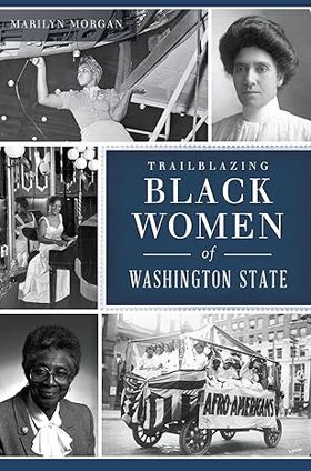
"Breaking glass ceilings, organizing clubs and making history as the first in their fields, these trailblazing Black women paved the way for new generations. From Nettie Craig Asberry, founder of the Tacoma NAACP, to Dr. Dolores Silas, now honored by a school bearing her name, these women forged a path amid adversity. Black women were crucial to the war effort, working as Rosies at Boeing during World War II, and in the postwar years, Seattle musicians like Edyth Turnham and Her Knights of Syncopation were in high demand. These teachers, scientists and politicians served on boards, led protests and fought for civil rights across the state. Join author and historian Marilyn Morgan as she chronicles the incredible lives and contributions of Washington's Black women." -- Back cover
159 pages : illustrations ; 23 cm
CIRC [ 0 ]
Scoundrels of the Salish Sea tales of crime and punishment in Washington State's history by Carol Turner
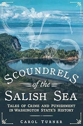
"From Orcas Island to Tacoma, and west to the Kitsap and Olympic Peninsulas, the American section of the Salish Sea serves as an abundant setting for a wild ride through Washington's history of crime and punishment. These stories came primarily from the pages of old newspapers--the earliest occurred in 1856, the latest in 1938. They are the tales of crimes and criminals, of the lawmen who hunted them down, and the lawyers and judges who threw them into our system of justice. They are also the stories of lost lives and shattered families. Most of these tales from Washington State's boisterous history generated enormous headlines at the time, and local newspapers sometimes played an outsize role in the unfolding drama. Other stories simply offer an irresistible cast of characters or a stunning twist in our justice system. Although the language and manners might seem quaint and occasionally absurd, and the iniquities and prejudices of the day were blatant, the details often show that, after all, not much has changed."--Amazon.com
160 pages, 16 unnumbered pages of plates : illustrations (some color), color map ; 24 cm.
CIRC [ 1 ]
Crossing Puget Sound from Black Ball steamer to Washington State Ferries by Steven J. Pickens
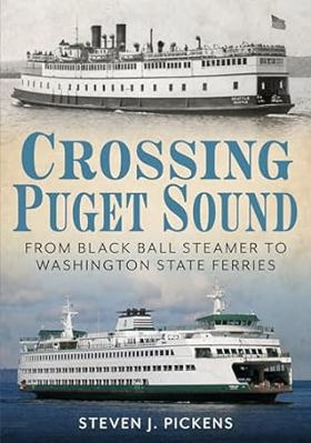
For over a century, water has connected the communities on Puget Sound, starting with days of the iron-hulled steamers of the Black Ball Line and continuing to the vessels of Washington State Ferries. Puget Sound continues to be a vital link between cities, well into the era of smart phones and self-driving cars. From the recycled ferries of San Francisco Bay to the elegant pocket liners of the Canadian Pacific Railway, transporting people from one isolated community to another has grown to carrying 25 million commuters and tourists every year. Modern ferry travel on Puget Sound begins with the converted passenger steamers at the early part of the twentieth century. Built in the days before cars became the main mode of travel, these small steamers morphed into the blueprint of today's largest double-ended ferries in the United States. Ferry travel today is as scenic as in the days of Model Ts and steamships. Puget Sound remains a nautical highway as much now as it was in the era of high button shoes and derby hats.
143 pages : illustrations (chiefly color), facsimiles ; 24 cm
CIRC [ 1 ]
Field guide to the grasses of Oregon and Washington by Cindy Talbott Roché , Richard E. Brainerd , Barbara L. Wilson , Nick Otting , Robert C. Korfhage
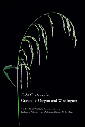
Field Guide to the Grasses of Oregon and Washington is an illustrated guide to all 365 species, subspecies, and varieties of grasses--both native and introduced--that grow wild in Oregon and Washington. It also has broad applicability in neighboring states and provinces. Grasses are important functional components in a variety of ecosystems and are highly valued for habitat restoration in ecosystems ranging from wetlands to deserts, and from sea level to alpine. They are important weeds and are also cultivated as ornamental plants. --Publisher
ix, 460 pages : color illustrations, color maps ; 23 cm
CIRC [ 0 ]
The panic of 1893 the untold story of Washington State's first depression by Bruce A. Ramsey
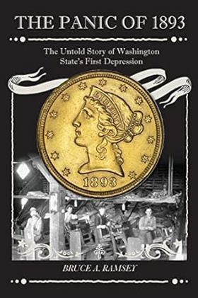
"In 1893 Washington, a new state with new people, plunged into the last depression of the 19th century. Banks failed. Railroad building stopped. Money became so scarce that Port Angeles and Bellingham made their own. Jobless men sawed wood, picked blackberries, and dug clams. In Spokane, the town's richest man was wiped out, and from Tacoma and Seattle protesters set off for Washington, D.C., on foot and by stealing rides on trains. In The Panic of 1893, former Seattle newspaper columnist Bruce A. Ramsey tells the story of how people survived and how their resilience defined their new state."-- Back cover
324 pages : illustrations, maps ; 23 cm
CIRC [ 1 ]
Territorial hues the color print and Washington state, 1920-1960 by David F. Martin , Cascadia Art Museum
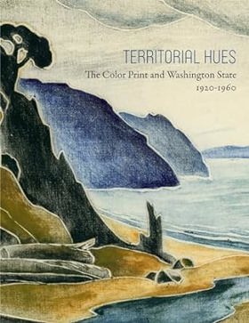
Territorial Hues: The Color Print and Washington State, 1920-1960' will consist of prints that display the cultural and stylistic influences used by Washington State artists to produce highly exceptional works that reflect the color, light, and atmosphere that is unique to this region. The book focuses on several mediums including color woodcut, intaglio, serigraphy, and lithography. The influences of Japanese prints and regional appropriations of international movements will be examined as well as the local production of white-line prints. Exhibition: Cascadia Art Museum, Edmonds, USA (05.10.2017-07.01.2018)
160 pages : illustrations (chiefly color), portraits ; 29 cm
CIRC [ 1 ]
The Chinese in Washington State by Art Chin, Doug Chin
Published in 2013 by Art Chin and Doug Chin, The Chinese in Washington State chronicles over a century of Chinese American history, detailing the trials, contributions, and enduring resilience of pioneers who helped shape the Pacific Northwest. Drawing on rich archival photographs and community narratives, the book documents early immigration waves, the harsh realities of labor discrimination and anti-Chinese expulsion movements, and the eventual establishment of vibrant cultural enclaves like Seattle's Chinatown-International District. A keen insight drawn from the text is how it deliberately shifts the historical lens away from passive victimhood, emphasizing instead how early Chinese communities actively built robust mutual-aid networks, economic institutions, and political coalitions that transformed them into foundational architects of modern Washington society.
144 pages : illustrations ; 23 cm
CIRC [ 1 ]
The nature of borders salmon, boundaries, and bandits on the Salish Sea by Lissa K. Wadewitz, Center for the Study of the Pacific Northwest
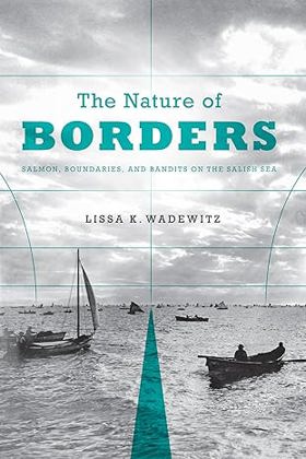
For centuries, borders have been central to salmon management customs on the Salish Sea, but how those borders were drawn has had very different effects on the Northwest salmon fishery. Native peoples who fished the Salish Sea--which includes Puget Sound in Washington State, the Strait of Georgia in British Columbia, and the Strait of Juan de Fuca--drew social and cultural borders around salmon fishing locations and found ways to administer the resource in a sustainable way. Nineteenth-century Euro-Americans, who drew the Anglo-American border along the forty-ninth parallel, took a very different approach and ignored the salmon's patterns and life cycle. As the canned salmon industry grew and more people moved into the region, class and ethnic relations changed. Soon illegal fishing, broken contracts, and fish piracy were endemic--conditions that contributed to rampant overfishing, social tensions, and international mistrust. The Nature of Borders is about the ecological effects of imposing cultural and political borders on this critical West Coast salmon fishery. This transnational history provides an understanding of the modern Pacific salmon crisis and is particularly instructive as salmon conservation practices increasingly approximate those of the pre-contact Native past. The Nature of Borders reorients borderlands studies toward the Canada-U.S. border and also provides a new view of how borders influenced fishing practices and related management efforts over time.
xi, 271 pages, 27 unnumbered pages of plates : illustrations, maps ; 23 cm.
CIRC [ 0 ]
New land, north of the Columbia historic documents that tell the story of Washington State from territory to today by Lorraine McConaghy
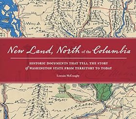
New Land North of the Columbia features an 1860 letter protesting the escape of an Olympia slave to Victoria on the Puget Sound Underground Railroad. There's also territorial Governor Pickering's telegram to Abraham Lincoln sent on the brand-new telegraph--and Lincoln's hand-signed response. Other ephemera include posters and letters that support and condemn women's right to vote, prohibition of the sale of alcohol, and aid to the unemployed during the Great Depression. Here are documents about the massive, secret Hanford Engineering Works that was Washington's Manhattan Project. The book includes an ad for the first Lame Fest concert featuring Mudhoney and Nirvana, the original box that contained Windows 95, and a poster calling all protesters to the 1999 WTO conference. Historian Lorraine McConaghy has traversed the state and sifted through the files of three dozen archives to cull the 400 fascinating documents that bring to life Washington's last 150 years.
vi, 153 pages : illustrations (some color), maps (some color) ; 25 x 29 cm
CIRC [ 1 ]
Moving Washington timeline the first century of the Washington State Department of Transportation, 1905-2005 by Walt Crowley, Kit Oldham , HistoryLink (Firm) (Publisher), Washington (State). Department of Transportation
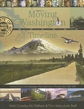
"This book retraces how the leaders and employees of the Washington State Department of Transportation and their predecessors helped to shape Washington's transportation system during a century of technological revolution and dramatic transformation of its communities and landscapes." "Moving Washington Timeline was prepared for the Washington State Department of Transportation with the support of private donors and a Federal Highway Administration grant to commemorate the creation of the
127, [1] pages : illustrations (some color), maps (some color), portraits (some color) ; 22 cm
CIRC [ 1 ]
Exploring Washington's past a road guide to history by Ruth Kirk, Carmela Alexander, David L. Nicandri, Louis Kirk
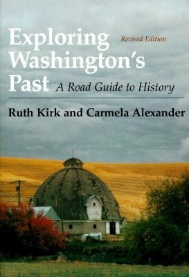
Exploring Washington’s Past tells the state’s story in terms of where to go and what to see. With words, photographs, and maps, the authors evoke the cultural landscape and portray Washington’s people and events from the days of the fur trade and pioneer settlement to the recent past. Capsule descriptions of small communities -- from Altoona to Zillah -- are interwoven with those of better known cities, and eastern and western Washington receive equal attention. More than two hundred photographs portray our historical landscape through images of today intermixed with a sampling of the past. This book will be an indispensable guide for residents, tourists, and armchair travelers.
xiii, 543 pages : illustrations, maps (some color) ; 26 cm
CIRC [ 1 ]
History of the flower bulb industry in Washington State by Charles J. Gould
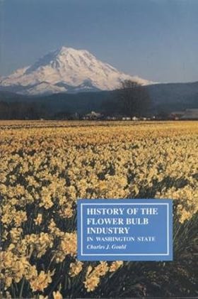
Published by the Washington State University Agricultural Experiment Station and authored by plant pathologist Charles J. Gould, History of the Flower Bulb Industry in Washington State details the remarkable mid-20th-century rise of commercial bulb production in the Pacific Northwest. The text chronicles how immigrant growers and agricultural innovators capitalized on the region's mild, maritime-influenced climate—particularly in the Puget Sound and Skagit valleys—to successfully rival traditional European floral markets. Through detailed historical accounts and horticultural data, the book documents the labor-intensive cultivation of daffodils, tulips, and iris that transformed local farmland into vibrant floral landscapes. A keen insight drawn from the work is how regional agricultural booms often rely on imported microclimates; by identifying that Western Washington's cool, damp springs closely mirrored the prized growing conditions of the Netherlands, the industry proved that niche economic success can be engineered by aligning local ecological quirks with international market demands.
ix, 309 pages : illustrations, maps ; 23 cm
CIRC [ 1 ]
Sine die a guide to the Washington State legislative process by Edward D. Seeberger
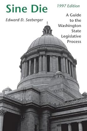
This 1997 edition of Sine Die is a completely new book. Since the first edition of Sine Die was published in 1987, there have been dramatic changes in the Washington State Legislature and in state politics. Limits have been placed on campaign contributions and reporting requirements are expanded; ethics laws were passed following revelations of improper use of caucus staff; Initiative 601 was passed by the voters imposing limitations on state taxing and spending powers; the legislative process has been computerized and information is now easily and quickly accessible electronically to all; and term limits, passed in 1992, start taking their toll on state legislators in 1998. Even more significant, there has been a gender revolution in the legislature. Women are on the verge of having an equal place in numbers and power and are having a dramatic effect on the legislative climate and on state policy. Sine Die is a clear and up-to-date description of how the Washington State Legislature works. Presenting substantially more information on women in the legislature, the role of the governor, and the various origins of legislation, the 1997 edition explains the process by which thousands of proposed laws are introduced each year and are culled down to the approximately twenty percent that are eventually enacted.
xiii, 203 pages : illustrations ; 23 cm
CIRC [ 1 ]
Early churches of Washington State by Arnold Pearson, Esther Pearson
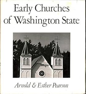
Author is an alumnus of Evanston Township High School, class of 1932
ix, 182 pages : illustrations, map ; 27 cm
CIRC [ 1 ]
Origin of Washington geographic names by Edmond S. Meany
Published in 1923 by the University of Washington Press, Origin of Washington Geographic Names is a comprehensive reference work compiled by noted regional historian and professor Edmond S. Meany. The book catalogs the etymology and historical background of place names across Washington State, serving as a foundational text for Pacific Northwest history. Originally serialized as a collection of articles in the Washington Historical Quarterly, the 357-page volume documents how various towns, waterways, and landforms received their designations. Today, it remains a valuable resource for understanding the geographic, indigenous, and pioneer heritage of the region
ix, 357 pages ; 21 cm
ONLINE CIRC [ 2 ] CIRC [ 1 ]
Related Online Resources
Washington State Historical Society
Founded in 1891 and now into its second century of service, the Washington State Historical Society is dedicated to collecting, preserving, and vividly presenting Washington’s rich and storied history.
WEB LINKThe National Archives at Seattle
We maintain and provide access to permanent records created by Federal agencies and courts in the following states: Alaska, Idaho, Oregon, Washington
WEB LINKWashington State Archives
The mission of the Washington State Archives is to help local governments improve their retention, management, and disclosure of public records.
WEB LINKWashington State Library: Classics in Washington History
The State Library is delighted to present Classics in Washington History. This digital collection of full-text books brings together rare, out of print titles for easy access by students, teachers, genealogists and historians. Visit Washington's early years through the lives of the men and women who lived and worked in Washington Territory and State.
WEB LINKEncyclopedia of Puget Sound
The Encyclopedia of Puget Sound is a comprehensive guide to the science of Salish Sea ecosystem recovery. Articles on this site describe the region's major environmental threats and areas of concern, but also the facts and stories that make the Salish Sea an estuary of international importance. The website is a product of the University of Washington Puget Sound Institute and receives major support from the Environmental Protection Agency's National Estuary Program.
WEB LINKAtlas of the Pacific Northwest: 2019 Edition
Since 1953, the Atlas of the Pacific Northwest has been an invaluable reference for Northwesterners and newcomers alike—an authoritative portrait of the region. Nine editions have been released by OSU Press, the most recent in 2003 (currently out of print). This 2019 edition is the second to be released in a digital, fully-interactive format, designed to highlight facets of the Pacific Northwest landscape with novel approaches to data presentation. Where previous editions of the atlas were designed to ask and answer questions, this atlas serves as a platform for the geographically curious to explore the region, providing as many critical questions as it does critical answers.
WEB LINKCommunism in Washington State History and Memory Project
This site explores the controversial history of the Communist Party in the Pacific Northwest from 1919 to 2002. The project is sponsored by the Harry Bridges Center for Labor Studies at the University of Washington and is part of the Civil Rights and Labor History Consortium
WEB LINKNorthwest Digital Heritage
A partnership between the Washington State Library, the Oregon Heritage Commission, and the State Library of Oregon, Northwest Digital Heritage leverages existing infrastructure and best practices to enhance access to libraries, museums, and cultural heritage organizations throughout Oregon and Washington.
WEB LINKBlack Washington
Black Washington – the first app and educational platform dedicated to exploring the remarkable statewide stories and rich cultural legacy of Washington State’s Black community. Black Washington is an award-winning app and educational platform that explores the vibrant statewide history of Black Washingtonians through captivating stories, influential icons, and significant landmarks. Black Washington features over 60 entries, with plans for adding more over time. Each entry provides a glimpse into people, places, and moments that shaped Black history across the state and provides links to resources where users can explore this history in more detail. Engaging multimedia elements such as photographs, ephemera, maps, music, videos, essays, and oral histories bring the entries to life. In addition, educators will have access to curriculum materials, allowing them to integrate the app into their classrooms. WSHS encourages people across Washington to contribute their Black history stories, landmarks, and icons, f
WEB LINK
Political Boundaries
Washington
- Adams County
- Asotin County
- Benton County
- Chelan County
- Clallam County
- Clark County
- Columbia County
- Cowlitz County
- Douglas County
- Ferry County
- Franklin County
- Garfield County
- Grant County
- Grays Harbor County
- Island County
- Jefferson County
- King County
- Kitsap County
- Kittitas County
- Klickitat County
- Lewis County
- Lincoln County
- Mason County
- Okanogan County
- Pacific County
- Pend Oreille County
- Pierce County
- San Juan County
- Skagit County
- Skamania County
- Snohomish County
- Spokane County
- Stevens County
- Thurston County
- Wahkiakum County
- Walla Walla County
- Whatcom County
- Whitman County
- Yakima County
Last updated: 2025-09-23