British Columbia Province
The province's name was chosen by Queen Victoria, when the Colony of British Columbia, i.e., "the Mainland", became a British colony in 1858. It refers to the Columbia District, the British name for the territory drained by the Columbia River, in southeastern British Columbia, which was the namesake of the pre-Oregon Treaty Columbia Department of the Hudson's Bay Company. Queen Victoria chose British Columbia to distinguish what was the British sector of the Columbia District from that of the United States ("American Columbia" or "Southern Columbia"), which became the Oregon Territory on August 8, 1848, as a result of the treaty.
Mapped Location
British Columbia: The mapped location is an approximation and should not be used for navigation or wayfinding.
Information
General information on British Columbia
- Feature Type: Province
- Provincial Capitol: City of Victoria
- Established as a Crown Colony: Monday, August 2, 1858
- Articles of Confederation: Thursday, July 20, 1871
Official, historical, colloquial and alternative toponyms for British Columbia
A brief list of names that this geographic feature has been named
| Name | Description |
|---|---|
| British Columbia | Official |
| New Caledonia | Historical · The fur-trading district of the Hudson's Bay Company comprised mostly of north-central portions of present day British Columbia. Colony name was changed by Queen Victoria to 'British Columbia' in 1858. |
| New Hanover | Historical · The fur-trading distrcit of the Hudson's Bay Company running along the interior BC Coast. |
| New Georgia | Historical · The fur-trading district of the Hudson's Bay Company from the BC Sunshine Coast to the end of Puget's Sound |
| New Cornwall | Historical · The fur-trading district of the Hudson's Bay Company starting at around Prince Rupert and northwesterly along the coast. |
Origin Notes and History of British Columbia
References to British Columbia that document the origin of its place name
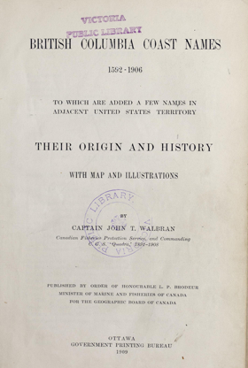
British Columbia. Named by Her Majesty Queen Victoria in 1858. In the Letters of Queen Victoria, which were published in 1907, appears one having an historical interest for this province. It is dated Osborne, 24 July 1858, and was addressed by the Queen to Sir E. Bulwer Lytton. At that time objections were being made in France to the name of New Caledonia being given to the proposed colony between the Pacific and Rocky Mountains. The Queen wrote:-
"The Queen has received Sir E. Bulwer Lytton's letter. If the name of New Caledonia is objected to as being already borne by another colony or island claimed by the French, it may be better to give the colony west of the Rocky mountains another name. New Hanover, New Cornwall and New Georgia appear from the maps to be names of subdivisions of that country, but do not appear on all maps. The only name which is given to the whole territory in every map the Queen has consulted is 'Columbia,' but as there exists also a Columbia in South America, and the citizens of the United States call their country also Columbia, at least in poetry, 'British Columbia' might be, in the Queen's opinion, the best name."
And in this way and for the reasons stated the province was named British Columbia by Queen Victoria.
Related Catalog Titles
A Bibliography for British Columbia, Province
Points of Interest In Search of the Places, People, and Stories of BC by David Beers, Andrea Bennett
Take a trip across British Columbia with this enchanting collection of essays from thirty local writers. What makes wandering the vibrant land called British Columbia really special? Encounters with locals who are ready to share, over a coffee or a beer, quirky tales and powerful truths rooted in place and time. Consider this book a meet-up with 30 such storytellers, the perfect road companion for your journey real or imagined. The Tyee is the province’s oldest and most-read independent source of online news and ideas, renowned for its range of voices on politics, culture and nature. This anthology marking The Tyee’s 20th anniversary includes pieces published over the last two decades and includes the distinct perspectives of some of the region’s most celebrated writers, including J.B. MacKinnon, Alisa Smith, Cúagilákv (Jess H̓áust̓i), Arno Kopecky, Harrison Mooney, Michelle Cyca, Christopher Cheung, Andrew Nikiforuk, and many more, as well as illustrations by Nora Kelly. Pull up a chair and get their inside scoops on the places they call home.
288 p.
CIRC [ 0 ]
British Columbia in the balance 1846-1871 by Jean Barman
"Esteemed historian Jean Barman brings new insights on the seemingly disparate events that converged to lay the foundation of the present-day province. By examining newly accessible private correspondence exchanged with the Colonial Office in London, Barman pieces together the chain of events that caused the distant colony of British Columbia to join the Canadian Confederation as opposed to the very real possibility of becoming one or more American states. Following the division of the Pacific Northwest between Britain and the United States in 1846, it took British Columbia just a quarter of a century to be transformed from a largely Indigenous territory in 1871, into a province of the recently formed Canada Confederation. In this detailed exploration of colonial politics, including fur trader and politician James Douglas's governance and the critical role played by the many unions between white settlers and and Indigenous women, Barman expertly weaves together seemingly disparate events that converged to lay the foundations of today's Canadian province."-- Provided by publisher
319 pages : illustrations, map ; 24 cm
CIRC [ 0 ]
Joseph William McKay a Métis business leader in colonial British Columbia by Greg N. Fraser
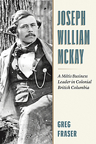
"An intriguing look at the accomplishments and contradictions of Joseph William McKay, best known as the founder of Nanaimo, BC, and one of the most successful Métis men to rise through the ranks of the Hudson's Bay Company in the late nineteenth century. When examining the history of British Columbia, one would be hard-pressed to find an Indigenous person who so successfully navigated the echelons of colonial power as did Joseph William McKay (1829-1900). McKay was Métis, born in Quebec, and began his career in Oregon during the dispute over the international boundary in 1845-46. After moving north, he met his mentor James Douglas and, at age twenty-three, was given the job of building the city of Nanaimo from the ground up and establishing its coal mines. McKay made several exploratory trips with Douglas during the Gold Rush, and he surveyed the route for the Overland Telegraph, which ran throughout BC. He rose through the ranks of the Hudson's Bay Company, eventually earning the appointment of Chief Factor, the company's highest rank. This was at a time when few Indigenous employees of HBC were permitted to rise beyond the rank of postmaster. After leaving the company in 1878, McKay began a second career in the Department of Indian Affairs. He was a federal Indian Agent and later the Assistant Commissioner of Indian Affairs for British Columbia. A product of his time who had found personal success working within the colonial system, McKay is a complicated figure when viewed through a twenty-first-century lens. He advocated on behalf of Indigenous Peoples when he tried to prevent the trespass of CPR crews and European settlers on their ancestral land. Between 1886 and 1888, he personally inoculated more than a thousand Indigenous people with the smallpox vaccine. Yet, he also participated in a system that did untold harm to First Nations, Métis, and Inuit people. This fascinating new biography, endorsed by the BC Métis Federation, sheds light on an accomplished and complex man."-- Provided by publisher
xii, 199 pages : illustrations, maps ; 23 cm
CIRC [ 0 ]
The Birdcages British Columbia's First Legislative Buildings, 1859-1957 by Robert Ratcliffe Taylor
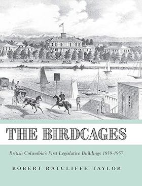
Revealing a little-known chapter in the history of Victoria, British Columbia, The Birdcages, the province's first legislative buildings, were built 1859-1864, the formative, tumultuous time of the Gold Rushes. Constructed on the site of the present Legislature, they were built amid controversy and derided for their style. The brainchild of Governor James Douglas, they resembled, according to journalist/politician Amor de Cosmos, "something between a Dutch toy and a Chinese pagoda." Readers will discover how civil servants and politicians felt about them as a workplace and what the general public thought about them as civic architecture. The career of their designer, the mysterious Hermann Otto Tiedemann, one of Victoria's vivid early "characters," is recounted as are the contributions of local contractors and tradesmen. The site of events of national importance until their demise in 1898, the Birdcages reflected the history, character, and heritage of Victoria and played an important role in the developing political traditions of the province and the young Dominion of Canada. A place for political demonstrations and community celebrations, the House of Assembly was where the MLAs debated joining Confederation, granting the vote to women, and excluding Asian immigrants. Based on personal memoirs and letters, government documents, photographs and plans, this book will interest both students and adults, history buffs and professional historians
CIRC [ 0 ]
E. J. Hughes paints British Columbia by Robert Amos , E. J. Hughes
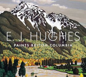
"A retrospective on one of BC's most famous artists that features beautifully reproduced landscape paintings from all over mainland BC, and unveils new photographs, sketches, and ephemera from the artist's estate. E. J. Hughes (1913-2007) is British Columbia's best-loved landscape painter. His lavish, picturesque views of the province are appreciated by art professionals and the public alike. Following the success of his previous volume, E. J. Hughes Paints Vancouver Island, author and artist Robert Amos tracks the footsteps of Hughes as he travelled throughout mainland British Columbia, from Stanley Park to Savary Island, from the Fraser Valley to the Okanagan, and from the Kootenays to the Rockies between the 1930s and 1970s. Working the with Estate of E. J. Hughes, Amos has crafted a nuanced representation of the activities and life of this exceptionally talented and private man. Both biography and monograph, this book features full-page, full-colour reproductions of Hughes's finest paintings, many of them published here for the first time. Each painting is accompanied by supporting sketches, drawings, and photographs from Hughes's personal archive."-- Provided by publisher
ix, 189 pages : illustrations (some color), colour map ; 24 x 26 cm
CIRC [ 1 ]
British Columbia waters the explorations of Vancouver and the Spanish by Richard W. Blumenthal
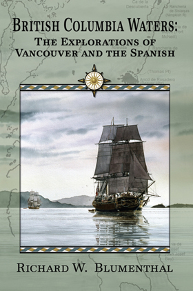
British Columbia Waters: The Explorations of Vancouver and the Spanish is a continuation of the author’s previous narratives which included the original source material from the earliest maritime exploration in the Pacific Northwest. The author’s first two books traced the visits by the Spanish and George Vancouver to inland Washington waters. These books included transcriptions of the actual journals of our earliest explorers. This follow-up book resumes the saga and follows Vancouver and the Spanish in 1792 through British Columbia waters while they complete their circumnavigation of Vancouver Island. It contains the journals of George Vancouver, Alcala Galiano and Cayetano Valdéz and four of Vancouver’s men. These journals provide the first European descriptions and observations of our inland waters as well as the First Nations encountered while they rowed their longboats through previously uncharted territory. Complete with all of their charts, this is a fascinating read directly from the men who made our early history.
288 pages : illustrations, maps ; 23 cm
CIRC [ 0 ]
British Columbia a new historical atlas by Derek Hayes
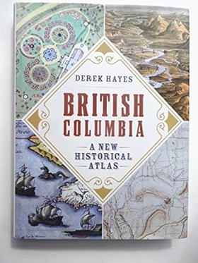
British Columbia was among the last temperate places on Earth to appear on the map of the world, a function of its position-remote from Europe. When gold was finally discovered in quantity in 1858, leading to the gold rush that created British Columbia as a new colony, the interior was mostly unknown except for the routes blazed by the fur traders seeking the "soft gold" that characterized the exploration of much of Canada. The efforts of the explorers, the fur traders, the gold seekers, and the railway builders all involved the production of maps that showed what they had found, the routes and the settlements, the plans and the strategies that developed the province into what we know today. In British Columbia: A New Historical Atlas, acclaimed map historian Derek Hayes has curated nearly a thousand maps the majority of which have never been published before along with concise text, and extensive captions. Added to numerous other illustrations, the result is a geographically visual history, a unique and fascinating viewpoint on our province's past.
1 atlas (368 pages) : illustrations (some color), maps (some color) ; 35 cm
CIRC [ 1 ]
The Punjabis in British Columbia location, labour, First Nations, and multiculturalism by Kamala E. Nayar
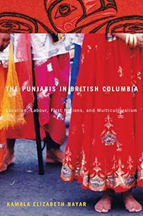
"In this richly detailed study, Kamala Nayar documents the social and cultural transformation of the Punjabi community in British Columbia. From their initial settlement in the rural Skeena region to the communities that later developed in larger urban centres, The Punjabis in British Columbia illustrates the complex and diverse experiences of an immigrant community that merits greater attention. Exploring themes of gender, employment, rural and urban migrant life, and the relationships between the Punjabis and surrounding First Nations and other immigrant groups, Nayar creates a portrait of a community in transition. Shedding light on the ways in which economic circumstances affect immigrant communities, Nayar presents findings from interviews conducted with over one hundred participants. She details the relocation of Punjabi populations from the Skeena region to British Columbia's lower mainland during the decline of the forestry and fishery industries, how their second migration changed their professional and personal lives, and how their history continues to shape the identities and experiences of Punjabis in Canada today. A nuanced look at the complexities of social and cultural adaptation, The Punjabis in British Columbia adds an essential perspective to what it means to be Canadian."--Publisher
xxi, 361 pages : illustrations, maps, portraits ; 24 cm
CIRC [ 0 ]
The nature of borders salmon, boundaries, and bandits on the Salish Sea by Lissa K. Wadewitz, Center for the Study of the Pacific Northwest
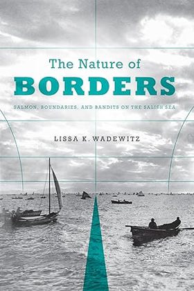
For centuries, borders have been central to salmon management customs on the Salish Sea, but how those borders were drawn has had very different effects on the Northwest salmon fishery. Native peoples who fished the Salish Sea--which includes Puget Sound in Washington State, the Strait of Georgia in British Columbia, and the Strait of Juan de Fuca--drew social and cultural borders around salmon fishing locations and found ways to administer the resource in a sustainable way. Nineteenth-century Euro-Americans, who drew the Anglo-American border along the forty-ninth parallel, took a very different approach and ignored the salmon's patterns and life cycle. As the canned salmon industry grew and more people moved into the region, class and ethnic relations changed. Soon illegal fishing, broken contracts, and fish piracy were endemic--conditions that contributed to rampant overfishing, social tensions, and international mistrust. The Nature of Borders is about the ecological effects of imposing cultural and political borders on this critical West Coast salmon fishery. This transnational history provides an understanding of the modern Pacific salmon crisis and is particularly instructive as salmon conservation practices increasingly approximate those of the pre-contact Native past. The Nature of Borders reorients borderlands studies toward the Canada-U.S. border and also provides a new view of how borders influenced fishing practices and related management efforts over time.
xi, 271 pages, 27 unnumbered pages of plates : illustrations, maps ; 23 cm.
CIRC [ 0 ]
The West beyond the West a history of British Columbia by Jean Barman
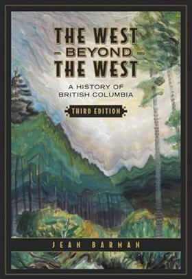
"British Columbia is regularly described in superlatives both positive and negative - most spectacular scenery, strangest politics, greatest environmental sensitivity, richest Aboriginal cultures, most aggressive resource exploitation, closest ties to Asia. Jean Barman's The West beyond the West presents the history of the province in all its diversity and apparent contradictions. This critically acclaimed work is the premiere book on British Columbian history, with a narrative beginning at the point of contact between Native peoples and Europeans and continuing into the twenty-first century." "First published in 1991 and revised in 1996, this third edition of The West beyond the West, has been supplemented by statistical tables incorporating the 2001 census, two more extensive illustration sections portraying British Columbia's history in images, and other new material bringing the book up to date. Barman's deft scholarship is readily apparent and the book demands to be on the shelf of anyone with an interest in British Columbian or Canadian history."--Jacket
xx, 539 pages, 48 unnumbered pages of plates : illustrations, maps, portraits ; 25 cm
CIRC [ 1 ]
The first nations of British Columbia an anthropological survey by Robert J. Muckle
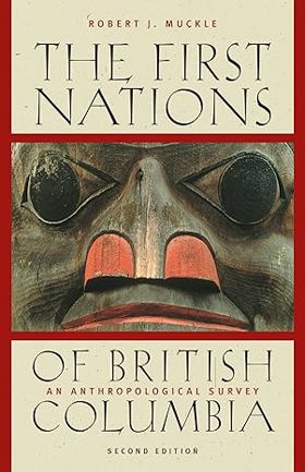
The First Nations of British Columbia, Second Edition, is a concise and accessible overview of First Nations peoples, cultures, and issues in the province. Robert Muckle familiarizes readers with the history, diversity, and complexity of First Nations to provide a context for contemporary concerns and initiatives. This fully revised edition explains the current treaty negotiation process and provides highlights of agreements between First Nations and governments. It also details past and present government policies, identifies the territories of major groups in the province, gives information on populations, reserves, bands, and language groups, and summarizes archaeological, ethnographic, historical, legal, and political issues.
IX, 146 Seiten : Illustrationen, Karten
CIRC [ 1 ]
British Columbia land of promises by Patricia Roy, John Herd Thompson
"For more than two centuries, people from around the world have been irresistibly drawn to British Columbia. Some have sought to make their fortunes in furs, or gold, or lumber, some have dreamt of establishing utopian communities, many others have hoped simply to find a steady job, or a piece of land to farm and raise a family on. At times BC has lived up to the most extravagant expectations. But at times it has not, and in either case the costs have often been high, especially for the region's First Nations. In British Columbia: Land of Promises Patricia E. Roy and John Herd Thompson trace the social, economic, and political history of the province through a lively narrative and a wealth of carefully annotated illustrations, including maps, paintings, photographs, and cartoons."--Jacket
216 pages, 10 unnumbered pages of plates : illustrations (some color), maps (some color), portraits (some color) ; 24 cm
CIRC [ 1 ]
Roadside geology of southern British Columbia by William Henry Mathews, J. W. H. Monger
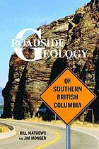
Southern British Columbia, from the northern tip of Vancouver Island to the Alberta border east of Golden, spans the Canadian Cordillera, a mountainous region with a tumultuous geologic history that continues to evolve with every volcanic eruption, landslide, and earthquake. Introductory sections of this guidebook interpret the geologic complexity of four regions-Vancouver Island, the Coast, the Interior Plateaus, and the Columbia and Rocky Mountains-and thirty-one road guides describe the
xi, 403 pages : illustrations, maps ; 23 cm.
CIRC [ 0 ]
Raincoast chronicles 20 lilies and fireweed : frontier women of British Columbia by Stephen Hume
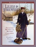
Lilies and Fireweed is packed with unforgettable stories of women surviving in the unforgiving, sometimes hostile environment of pioneer and aboriginal British Columbia. Based on award-winning journalist Stephen Hume's popular series "Frontier Women of BC" that appeared in the Vancouver Sun in 2002, this collection of essays contains stories, photographs and other materials that have never before been published. From hospitals to dance halls, and from the classroom to the cannery floor, this insightful pictorial history examines indigenous and immigrant women's positions in the workplace, home and wilderness. Hume delves into the lives of aboriginal and pioneer women who had an important and multifaceted influence on the development of British Columbia. We meet women such as 17-year-old Frances Barkley, who insisted on accompanying her husband on a merchant voyage to British Columbia in 1786 and subsequently twice circumnavigated the world; Lady Amelia Douglas - a Cree woman and wife of Governor James Douglas - who had her own important but often overlooked role in the forging of British Columbia; Mrs. Washiji Oya, the first Japanese woman to settle in Canada in 1887; and Maria Pollard Grant, who, in 1895, became the first woman elected to public office in BC. Brimming with fascinating historical photographs, Lilies and Fireweed brings to light the forgotten stories of mothers, dance-hall girls, artists, teachers and adventurers that are as enthralling and diverse as BC itself.
80 p. : ill., ports. ; 28 cm.
CIRC [ 0 ]
Surveying Northern British Columbia a photojournal of Frank Swannell by Jay Sherwood, F. C. Swannell
"Frank Swannell surveyed much of northern British Columbia in the early part of the 20th century. As well as keeping a journal of what he saw and what his survey crews did, he also kept a photographic record of his seven trips through the North." "This book includes both well-known photographs and others previously unpublished. As the 100th year of the Corporation of Land Surveyors of British Columbia approaches, Surveying Northern British Columbia is finally being produced and acknowledges the contributions of a man, a surveyor, a photographer, and a journalist."--BOOK JACKET
vii, 166 p. : ill., maps, ports ; 27 cm.
CIRC [ 0 ]
Potlatch people Indian lives & legends of British Columbia by Mildred Valley Thornton
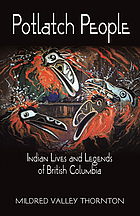
"Mildred Valley Thornton had an abiding passion which she pursued with almost missionary fervor throughout her life - the preservation of Canada's Native culture. For over fifty years she dedicated herself to that purpose through the medium of her paintings, writings and lectures. During the course of her career, Mildred not only painted the portraits of many prominent and historical Native Canadians, but she assembled an accompanying catalogue of anecdotes, folklore and legends, which today provide a unique chronicle of a vanished age. This publication is a collection of both Thornton's colorful portraits and the fascinating story behind each one."--pub. desc
317 pages : illustrations (some color) ; 22 cm
CIRC [ 0 ]
A traveller's guide to historic British Columbia by Rosemary Neering
Published by Whitecap Books, Rosemary Neering's A Traveller's Guide to Historic British Columbia serves as an engaging geographical and historical companion that maps the province's rich tapestry of past human endeavors. The book navigates the reader across various regional landscapes—from the gold-rush trails of the Cariboo and the rugged mountain passes of the interior to coastal Indigenous settlements and early European trading posts. By intertwining travel logistics with historical vignettes, anecdotes, and archival context, the text brings physical landmarks and forgotten settlements vividly back to life. A keen insight drawn from the work is how travel guides to historical frontiers function as chronological bridges; by grounding sweeping provincial history in specific, visitable coordinates on a modern map, the book demonstrates that physical travel through British Columbia is inherently an act of temporal exploration across layers of competing human ambitions.
xvii, 334 pages : illustrations (some color), maps ; 23 cm
CIRC [ 1 ]
First across the continent Sir Alexander Mackenzie by Barry M. Gough
Seeking the Northwest Passage and the fabled link to Russia, Japan, and Cathay, Alexander Mackenzie drove himself and his men relentlessly, by canoe and portage, across the uncharted rivers, valleys, and mountains of North America. Mackenzie's 1789 journey to the Arctic Ocean and his arduous journey to the Pacific in 1793 predate the Lewis and Clark expedition. By the age of thirty-one, Alexander Mackenzie had become the first man to cross North America from the northwestern hub of the interior trade, Lake Athabasca, to the Pacific Ocean. He had opened the continent to trade and exploration. In his research, Barry Gough traveled from Mackenzie's birthplace to his tomb and from Montreal to both the Arctic Ocean and the Pacific. He takes the reader along with Mackenzie on his hazardous travels and voyages, using contemporary accounts to bring to life the perils faced by the young explorer. First Across the Continent reveals the international impact of Sir Alexander Mackenzie's expeditions and places him among the elite of New World Explorers, illuminating his vital role in the history of the fur trade and the American West
xxi, 232 pages : illustrations ; 23 cm
CIRC [ 1 ]
Roaring days Rossland's mines and the history of British Columbia by Jeremy Mouat
In the 1890s, the name of Rossland was on every investor’s lips. Known at one time as the new Johannesburg, this small town in southeastern British Columbia was the most important mining centre in the region. Apparently possessed of vast quantities of ore, the town’s mines seemed to promise wealth for all, and Rossland grew dramatically throughout the decade. By the early 1900s, it was the province’s fourth largest centre. During that time, hard rock mining changed from a loosely structured pioneer activity to a fully fledged industry that relied on sophisticated technology, a complex corporate infrastructure, and economies of scale. Despite these advances, Rossland’s success was shortlived. A bitter strike in 1901 signalled the beginning of the Golden City’s slow decline. Nearby Trail, originally a subsidiary of Rossland’s mining industry, soon surpassed its neighbour in size and importance.. Roaring Days explores the history of the mining industry in British Columbia. Mouat examines the many different aspects of mining, from work underground to corporate strategies, and he also brings to life the unique individuals who were a part of this history--the miners who toiled long hours in semi-darkness, the hardy citizens who built a bustling town out of the wilderness, and the wealthy mine owners and corporate entrepreneurs whose wealth exceeded all expectations. --From publisher's description
xviii, 236 pages : illustrations, maps ; 23 cm
CIRC [ 0 ]
Francis Rattenbury and British Columbia architecture and challenge in the Imperial Age by Anthony Barrett, Rhodri Windsor Liscombe
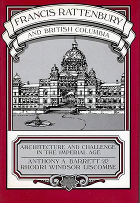
Yorkshire-born Francis Mawson Rattenbury (1867-1935) emigrated to British Columbia as a young architect in 1892. Within months of his arrival in Victoria he launched his brilliant, if abbreviated, career by winning an international competition to design the legislative buildings. While his life was marred by controversy, scandal and, in the end, tragedy, Rattenbury's architecture had an enduring impact on the Canadian landscape and his commercial ventures were important to the economic development of the West. Richly illustrated with over 200 drawings and photographs, Francis Rattenbury and British Columbia is the first major critical study of a Canadian architect in the context of his times. Using unpublished primary sources, including his recently discovered private letters, the authors document Rattenbury's professional career and the evolution of his architectural style. Detailed descriptions are given of some of his most famous projects, notably the legislative buildings and the Empress Hotel in Victoria. Besides working on a number of government commissions, Rattenbury became chief architect for the Canadian Pacific Railway and designed "chateau-like" buildings for C.P.R.hotels in the Rockies, Vancouver, and Victoria. Other projects such as the Vancouver and Nanaimo Courthouses and Bank of Montreal branches set the pattern for institutional architecture in British Columbia. His buildings not only drew attentionto the growing importance of the province, but also lent dignity and character to its major centres. Filled with the vigour and confidence of the imperial age, Rattenbury initiated a number of commercial ventures. These included the founding of a transportation system to the Yukon goldfields and extensive land speculations. As the authors point out, these investments were perhaps not undertaken solely for monetary gain but reflected Rattenbury's firm belief in the future of British Columbia and his desire to play an active role in its growth. Unfortunately, his entrepreneurial adventures involved heavy financial losses, among which were ruinous lawsuits involving the provincial government. This pioneering work on Western Canadian architecture will serve asa valuable design source for both the specialist and lay reader. It also includes an important account of the part played by major Canadian companies and government patronage in the development of British Columbia. This professional biography reveals new facets of Rattenbury's life and character which have been the subject of both public and literary controversy.
xii, 391 pages : illustrations ; 24 cm
CIRC [ 0 ]
Oceanography of the British Columbia coast by Richard E. Thomson
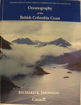
This book deals with the physical aspects of the sea as exemplified by the Pacific Ocean and the contiguous waters of the British Columbia coast. Although principally devoted to waves, currents and tides, the book spans a broad spectrum of topics ranging from meteorology and marine biology to past and present marine geology. It attempts to elucidate the nature of oceanic motions and to relate them to everyday experience for the general interest of the casual reader and for the practical benefit of the professional mariner, scientist, or engineer
xii, 291 pages : illustrations ; 28 cm
CIRC [ 1 ]
Early Indian village churches wooden frontier architecture in British Columbia by John Veillette , Gary White
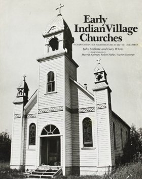
Photographs and descriptions of wood churches in native settlements of B.C
xx, 195 pages : illustrations (black and white) ; 29 cm
CIRC [ 1 ]
British Columbia a history by Margaret A. Ormsby
British Columbia and the United States the north Pacific slope from fur trade to aviation by H. F. Angus , F. W. Howay, W. N. Sage
The region dealt with contains those parts of North Pacific Slope where British interests have prevailed. Before the year 1846 this included the valley of the Columbia River, and also, in a sense, the Snake River Country. The backbone of the narrative, which extends from the early maritime fur-trade days of the eighteenth century down to the present, is largely economic in character.
xv, 408 pages illustrations (maps) 25 cm
CIRC [ 0 ]
British Columbia from the earliest times to the present by E. O. S. Scholefield, F. W. Howay

Co-authored by Provincial Librarian E. O. S. Scholefield and historian F. W. Howay, British Columbia from the Earliest Times to the Present is a monumental four-volume history detailing the province's evolution from Indigenous territories and fur-trade outposts into a modernized Canadian province. The exhaustive 1914 work extensively chronicles the era of maritime exploration, the monopoly of the Hudson’s Bay Company, and the chaotic gold rushes that forced the rapid implementation of British colonial administration. In keeping with the era's subscription-based publishing model, the historical narrative is heavily supplemented with flattering biographical sketches of prominent local patriarchs, effectively celebrating the region's industrial and political development as a triumph of Anglo-Saxon enterprise. A keen insight drawn from the work is how the collaboration between the state's chief archivist and a sitting judge served to officially institutionalize a legalistic justification for colonial expansion; by framing the province's history as an orderly, bureaucratic progression from corporate rule to British law, the authors deliberately obscured the unceded nature of First Nations land behind a veneer of inevitable constitutional progress.
4 volumes frontispieces, plates, portraits, maps, facsimiles 27 cm
ONLINE CIRC [ 4 ]
British Columbia coast names by John T. Walbran
During his years as captain of the Canadian government steapship Quadra, John T. Walbran became fascinated with the BC coast and set to work on his classic British Columbia Coast Names, which was published in 1909
546 pages, plates : 1 folded map
ONLINE CIRC [ 1 ] CIRC [ 1 ]
History of British Columbia from its earliest discovery to the present time by Alexander Begg
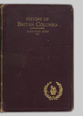
Published in 1894, Alexander Begg's comprehensive volume chronicles the political and economic evolution of British Columbia, tracing its trajectory from early maritime exploration and the fur trade era to its eventual confederation with Canada. A keen insight drawn from the text is how Begg’s narrative functions simultaneously as a historical record and a piece of deliberate economic boosterism, actively framing the region's transition from a guarded Hudson's Bay Company monopoly into a civilized province as a triumph of British imperial progress designed to attract settlers and investment. The author meticulously details the transformative impacts of the Fraser River and Cariboo gold rushes, the administrative leadership of James Douglas, and the critical unifying role of the Canadian Pacific Railway. Ultimately, the book stands as an exhaustive, albeit heavily pro-colonial, late 19th-century archive documenting the foundational events that integrated a rugged frontier into the Canadian dominion.
xvii, [7]-568 pages : illustrations, folded map, portraits ; 23 cm
ONLINE CIRC [ 1 ]
History of British Columbia Bancroft's works, vol. xxxii by Hubert H. Bancroft
Published in 1887 as the thirty-second volume of his colossal western history series, Hubert Howe Bancroft’s History of British Columbia meticulously traces the region's development from late 18th-century maritime explorations through its 1871 integration into the Canadian Confederation. The narrative provides an exhaustive account of the Hudson's Bay Company's autocratic rule under Chief Factor James Douglas, the disruptive influx of American prospectors during the Fraser River Gold Rush, and the subsequent political unification of the mainland and Vancouver Island. A keen insight drawn from the volume is how Bancroft—an American historian steeped in the ideology of Manifest Destiny—inherently filters the Canadian colonial experience through a distinctly U.S. nationalist lens. By frequently contrasting the paternalistic, corporate monopoly of the British administration with the chaotic, democratic individualism of American miners, the text inadvertently functions as a fascinating comparative study of two competing imperial philosophies vying for economic and cultural dominance across the 19th-century Pacific Northwest.
xxxi, 792 pages : maps
ONLINE CIRC [ 1 ] CIRC [ 1 ]
Four years in British Columbia and Vancouver Island an account of their forests, rivers, coasts, gold fields and resources for colonisation by Richard C. Mayne, John Murray (Firm) (Publisher), William Clowes and Sons (Printer), Northern Pacific Railroad Company (Former owner), Northern Transcontinental Survey (Associated name)
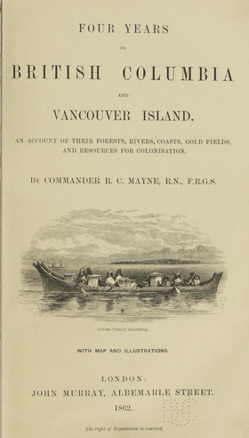
Published in 1862, Royal Navy Commander Richard C. Mayne’s Four Years in British Columbia and Vancouver Island provides a detailed firsthand account of the region's geography, indigenous populations, and natural resources during the height of the Fraser River Gold Rush. Based on his extensive coastal and inland surveying expeditions aboard the HMS Plumper and Hecate, the narrative captures the rapid transformation of the territory from a remote fur-trade outpost into an actively managed British colony. A keen insight drawn from the text is how Mayne's meticulous cartographic and resource-focused observations demonstrate the Royal Navy's crucial role as agents of colonial statecraft, systematically converting a rugged, Indigenous-inhabited landscape into a legible, commodified space designed specifically for imperial investment. Furthermore, the volume's historical provenance as property of the Northern Pacific Railroad Company perfectly illustrates how these early military surveys ultimately functioned as direct strategic blueprints for subsequent corporate and infrastructural expansion across the Pacific Northwest.
xi, 468 pages, 20 unnumbered pages of plates + 32 pages publisher's ads : illustrations, maps (1 folded) ; 23 cm
ONLINE CIRC [ 1 ]
Related Online Resources
British Columbia Historical Federation
The British Columbia Historical Federation (BCHF) began its life as the British Columbia Historical Association, established on October 12, 1922.
WEB LINKBC History Digitization Program
The British Columbia History Digitization Program promotes increased access to British Columbia’s historical resources by providing matching funds to undertake digitization projects that will result in free online access to unique historical material
WEB LINKBritish Columbia Regional Digitized History
The University of British Columbia's Okanagan Campus Library has cultivated regional partnerships with community memory institutions across B.C.'s southern interior and enhanced access to archival records and primary sources through the British Colum
WEB LINKThe Canadian Letters and Images Project
The Canadian Letters and Images Project is an online archive of the Canadian war experience, from any war, home front and battlefront, as told through the letters and images of Canadians themselves. Begun in August 2000, the Project is located in the Department of History at Vancouver Island University. Through the digitization of contemporary letters, diaries, photographs, and other related materials, the Project permits Canadians to tell their story, and Canada’s story, through their own words
WEB LINKUniversity of Northern British Columbia: Northern BC Digital Collection
The Northern BC Digital Collection holds digitized publications pertaining to Northern BC history, culture, and industrial development. Use the map below to navigate to content from each of Northern BC's regions.
WEB LINKBritish Columbia Black History Timeline
The BC Black History Timeline covers events in British Columbia as well as some significant events in Canada, the United States and globally that affected Black settlement and the experiences of Black people in BC. The first Black settlers arrived in BC in April 1858, 24 years after the Abolition of Slavery Act; however Black Canadian history dates back to the 1600s.
WEB LINKSociété historique francophone de la Colombie-Britannique
The Francophone Historical Society of British Columbia is a non-profit society incorporated in March 2009 and whose mission is: to promote the history and culture of Francophones in British Columbia; the support of historical studies through the encouragement of research, teaching and publication; the collection and preservation of historical documents and artifacts; the dissemination of information and historical records.
WEB LINKÁtl’ka7tsem | Howe Sound Marine Reference Guide
A Marine Reference Guide (interactive map) that displays data associated with Átl’ka7tsem’s ocean and watersheds. This will support decision-making, marine spatial planning, and community education by visualizing how human and natural systems interact and overlap.
WEB LINKVancouver Island Local History Society
Vancouver Island Local History Society’s Mission: a) To promote, encourage, and engage the study of local and regional history within the communities of Vancouver Island and the Gulf Islands. b) To develop and support local history initiatives that take a critical and exploratory approach to Indigenous and non-Indigenous relations. c) To develop and support projects that are inclusive, diverse, and representative of communities in the past and present. d) To act as a facilitator of local efforts that build relationships between organizations and communities and situate history as a foundational or key element. Includes a wiki type resource of transcribed documents from the Point Ellice House & Museum collection.
WEB LINKCity of Vancouver Archives' database
Welcome to the City of Vancouver Archives' database, the system for searching descriptions of the Archives’ holdings. You can view records by visiting the Archives in person; digitized or born-digital material, if available, may be viewed and downloaded directly from the database.
WEB LINK360 Riot Walk - Vancouver, British Columbia
360 Riot Walk is an interactive walking tour of the 1907 Anti-Asian Riots in Vancouver, the ancestral territory of the Musqueam, Squamish and Tseil-Waututh people. It utilizes 360 video technology to trace the history and route of the mob that attacked the Chinese Canadian and Japanese Canadian communities following the demonstration and parade organized by the Asiatic Exclusion League in Vancouver. Participants are brought into the social and political environment of the time where racialized communities were targeted through legislated as well as physical acts of exclusion and violence. The soundtrack is available in four languages of the local residents of the period: English, Cantonese, Japanese and Punjabi.
WEB LINKWest Vancouver Archives and Collections
The West Vancouver Archives collects, preserves, and provides meaningful access to the records that tell the story of West Vancouver.
WEB LINKBritish Columbia Regional Digitized History (BCRDH)
The University of British Columbia's Okanagan Campus Library has cultivated regional partnerships with community memory institutions across B.C.'s southern interior and enhanced access to archival records and primary sources through the British Columbia Regional Digitized History (BCRDH) project. The project's primary purpose has been to connect UBCO Library's Special Collections and Archives program to community repositories in the pursuit of creating a shared digital portal compiling a wide range of local historical resources including photographs, oral histories, video, maps, and newspapers.
WEB LINK
Political Boundaries
British Columbia
- Regional District of Alberni-Clayoquot
- Regional District of Bulkley-Nechako
- Capital Regional District
- Cariboo Regional District
- Central Coast Regional District
- Regional District of Central Kootenay
- Regional District of Central Okanagan
- Columbia-Shuswap Regional District
- Comox Valley Regional District
- Cowichan Valley Regional District
- Regional District of East Kootenay
- Fraser Valley Regional District
- Regional District of Fraser-Fort George
- Regional District of Kitimat-Stikine
- Regional District of Kootenay-Boundary
- Metro Vancouver Regional District
- Regional District of Mount Waddington
- Regional District of Nanaimo
- North Coast Regional District
- Regional District of North Okanagan
- Northern Rockies Regional Municipality
- Regional District of Okanagan-Similkameen
- Peace River Regional District
- qathet Regional District
- Squamish-Lillooet Regional District
- Stikine
- Strathcona Regional District
- Sunshine Coast Regional District
- Thompson-Nicola Regional District
Last updated: 2025-09-23