Native river the Columbia remembered : Priest Rapids to the international boundary
|
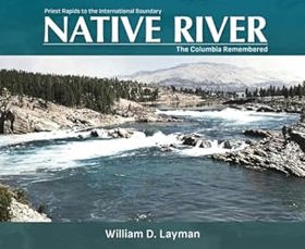
In images and narratives, Native River recreates the untamed Mid-Columbia--the river as it once was, before the building of seven major dams. Featuring a wealth of illustrations, maps, and photographs, many never before published, this finely crafted book focuses on the 350-mile reach of the middle Columbia River from Priest Rapids in south-central Washington to the U.S. Canadian border. William Layman affords each segment of this waterway with its own rich visual documentation, forming a backdrop to many absorbing river stories. -- Amazon |
| Author(s): | William D. Layman |
| Document: | Book · Paperback · CIRC [ 1 ] |
| Edition: | 1st Edition |
| Published: | 2002 |
| Physical Description: | xii, 195 pages : illustrations, maps ; 24 x 29 cm |
| Genre: | Anecdotes |
| Notes: | Includes index |
| Contents: | The Columbia The Mid-Columbia Priest Rapids to Rock Island Rapids Priest Rapids Chalwash Chilni Priest Rapids Petroglyphs P'na at Priest Rapids Sentinel Gap Vantage Basalt Formations Ginkgo Petrified Forest Vantage Pictographs and Petroglyphs Vantage II Picture Rocks Bay Skookumchuck Canyon [similar] Crescent Bar Spanish Castle Victoria Rock Buffalo Cave Cabinet Rapids Rock Island Rapids Rock Island Petroglyphs Rock Island Rapids to Okanogan River Bishop Rock Above Stemilt Creek Saddle Rock Wenatchee Landing Confluence of Wenatchee and Columbia Rivers Rocky Reach Entiat Rapids Confluence of Entiat and Columbia Rivers Ribbon Cliff Knapps Hill The Great Terrace Confluence of Chelan and Columbia Rivers Azwell Methow Rapids Confluence of Methow and Columbia Rivers Brewster Riffle Brewster Brewster Flat Okanogan River to Spokane River Confluence of Okanogan and Columbia Rivers Stillwater Bay Foster Creek Rapids Above Foster Creek Nespelem Canyon Box Canyon Kalichen Rock Gaviota Bend Parson Rapids Mah-kin Rapids Equilibrium Rapids Coulee Bend Confluence of Sanpoil and Columbia Rivers Hell Gate Whitestone Rock Castle Cove Confluence of Hawk Creek and Columbia River Confluence of Spokane and Columbia Rivers/Spokane Rapids Spokane River to International Boundary Elbow Bend Landslide Elbow Bend and Hunters Landing Deception Rock Turtle Rapids Gifford Rapids Driftwood Rocks Grand Rapids Kettle Falls Lower Falls Upper Falls Kettle Falls Fishery Hayes Island St. Paul's Mission Fort Colvile North of Hayes Island Confluence of Kettle and Columbia Rivers Marcus Flat Marcus Rapids Pingstone's Rapids Narrow Channel at Marble Mountain Marble Mountain Little Dalles Bay above Little Dalles Onion Creek Sheep Creek Bend Murphy's Rapids International Boundary River Miles Showing Dams and Major Communities Principal River Villages [similar] circa 1850 River Settlements and Towns [similar] after 1858 |
| Subjects: | Anecdotes, Columbia (Fleuve) Histoire Anecdotes, Columbia (Fleuve) Histoire Ouvrages illustrés, Columbia River History Anecdotes, Columbia River History Pictorial works, Columbia River Valley History, Local, Columbia, Vallée de la Histoire locale, Folklore, Folklore Columbia (Fleuve), Folklore Columbia River, History, Local history, Pictorial wor |
Circulation
Here are a list of places where this title can be found and the various formats it can be found in.
| Collection | Resource | Available | Edition | Published | Publisher |
|---|---|---|---|---|---|
| The Cascade District: Encyclopedia Library | Book | Paperback | 1st Edition | 2002 | WSU Press |
Last updated: 2024-06-15