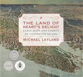
The land of heart's delight early maps and charts of Vancouver Island
|
"Just how, and why, did Vancouver Island get onto the map? How was knowledge of our immediate geography acquired and recorded? With 130 maps, dating between 1593 and 1915, this cartographic history tells the story of how Vancouver Island and the surrounding area came to be mapped. The book shows local cartographic milestones, marking progress in our knowledge through the island's rich--although comparatively short--recorded history. However, the maps, by themselves and without context, cannot tell the whole story. The accompanying text reveals the motives, constraints, agendas, and intrigues that underpin their making."--Publisher's description |
| Author(s): | Michael Layland |
| Document: | Book · Hardcover · CIRC [ 1 ] |
| Edition: | 1st Edition |
| Published: | 2013 |
| Physical Description: | 232 pages : maps (chiefly color) ; 25 cm |
| Genre: | Atlases |
| Contents: | Pages:1 to 25; Pages:26 to 50; Pages:51 to 75; Pages:76 to 100; Pages:101 to 125; Pages:126 to 150; Pages:151 to 175; Pages:176 to 200; Pages:201 to 225; Pages:226 to 240 |
| Subjects: | British Columbia Vancouver Island, Cartographie Colombie-Britannique Vancouver, Île de Histoire, Cartography, Cartography British Columbia Vancouver Island History, Electronic books, HISTORY / Oceania, History, Maps, REFERENCE Atlases & Gazetteers, TRAVEL Maps & Road Atlases, Vancouver Island (B.C.) Maps, Vancouver, Île de (C.-B.) Cartes |
| Related Places: | Vancouver Island |
Circulation
Here are a list of places where this title can be found and the various formats it can be found in.
| Collection | Resource | Available | Edition | Published | Publisher |
|---|---|---|---|---|---|
| The Cascade District: Encyclopedia Library | Book | Hardcover | 1st Edition | 2013 | Touchwood Editions |
Last updated: 2026-09-11