George Vancouver 1757-1798
Captain George Vancouver was a British Royal Navy officer best known for commanding a monumental 1791–1795 expedition to explore and chart the complex coastlines of North America's Pacific Northwest. His painstaking surveys produced the most detailed navigational maps of the era for the waters of present-day Washington, British Columbia, and Alaska, effectively disproving the existence of a navigable Northwest Passage at those latitudes. Along the way, he permanently shaped the region's modern geography by naming numerous prominent landmarks after his officers, friends, and patrons, including Mount Rainier, Puget Sound, Mount Hood, and Vancouver Island itself.
Biographical Overview
- Lived from 1757 to 1798
- Born: Jun 22, 1757, King's Lynn, Norfolk, England
- Died: May 10, 1798, Petersham, Surrey, England
Historical Events
- No referenced events linked
Catalog Resources
Captain Vancouver, North-West navigator by E. C. Coleman
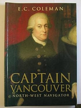
When Captain Cook set out to seek a western entrance to the fabled North West Passage, his instructions allowed him no more than the briefest contact with the coast of north-west America. Extraordinarily young crews, inexperienced officers and a doctor set on Vancouver's downfall, all combined to test Vancouver's leadership to the limit.
158 pages : illustrations, maps ; 26 cm
CIRC [ 1 ]
The interwoven lives of George Vancouver, Archibald Menzies, Joseph Whidbey, and Peter Puget exploring the Pacific Northwest Coast by John Michael Naish
The Vancouver Voyage exemplifies the extraordinary upsurge in optimism and adventure in the last two decades of the 18th century. Four men were the lynch-pins of that enterprise and this volume examines their achievements and sufferings. It particularly examines the interplay and stress between the men, both physical and psychological, during the voyage. Evidence as to the nature of Vancouver's own chronic disease (which killed him in his 41st year) is presented, and his psychological state is analysed. The achievement of both Vancouver and Menzies in defeating scurvy during the voyage is described. Menzies' largely unpublished and voluminous journal provides the major source of information on the lands explored and the peoples encountered, and the work also contains original material about Whidbey's later life and relationships. Although unusual in format, this work seeks to illuminate the history of those times by applying a physician's eye to four outstanding representatives of an age of optimism. With nineteen photos and eight maps.
537 pages ; 24 cm.
CIRC [ 1 ]
The voyage of George Vancouver, 1791-1795 by George Vancouver, W. Kaye Lamb
Four of the greatest maritime exploring expeditions were crammed into two decades late in the 18th century - Cook's third voyage, the French expedition commanded by La Pérouse, the Malaspina expedition sent out by Spain, and George Vancouver's Voyage of Discovery. All four visited the northwest coast of North America, but weather and circumstances prevented Cook from making more than what Beaglehole calls ' a magnificent, an epoch-making reconnaissance'; La Pérouse only touched the coast in a significant way at Yakutat Bay and Lituya Bay, and Malasina's memorable visits were to Yakutat Bay and Nootka Sound. Vancouver, by contrast, surveyed the enormous extent of coast from Lower California to Cook Inlet, and his meticulous survey literally set out on the map of the world the intricacies of Puget Sound and the western coast of mainland Canada. It was an achievement that places him with his mentor, Cook, in the first rank of marine surveyors. As a midshipman Vancouver had been with Cook when he discovered the Sandwich (Hawaiian) Islands in 1778. They attracted his interest, and the attention he devoted to the islands, their inhabitants and their political future when he twice later wintered there will surprise many. This is the first annotated edition of Vancouver's journal as he revised it for publication in 1798. The original manuscript has disappeared, but fortunately no fewer than 25 partial or complete logs or journals by other members of the expedition have survived. These supplement Vancouver's narrative at many points. It has been possible to identify virtually all the host of islands, channels and inlets that Vancouver encountered, and the provenance of most of the approximately 400 place names he bestowed, nine out of ten of which are still in use, is indicated. Book 1 of a new and annotated edition of A Voyage of Discovery ... (London, 1798). The main pagination of this and the following three volumes is continuous. The voyage to Australia and Tahiti,
4 volumes illustrations 1 chart
CIRC [ 4 ]
Having begun his naval career as a midshipman in Captain Cook's second and third voyages (1772-1778), in 1791 George Vancouver was commissioned by the Admiralty to travel to the Pacific north-west coast of Canada to negotiate a solution to the escalating trade conflict between Britain and Spain in the Nootka Sound and to further and explore the coastline of the region. In April 1791, Vancouver, commanding the sloop HMS Discovery, set sail from Britain under the escort of the gunship HMS Chatham. Following brief stops in Tenerife, Cape Town and Australia, the ships arrived in the Pacific Northwest in June 1792 and Vancouver began to survey the rugged coast of the Straits of Georgia. Landing at the site of the present-day city of Vancouver on 13 June, the expedition encountered a welcoming Coast Salish community, who fed and accompanied them while they spent the night ashore. The voyage later circumnavigated and surveyed the island now known as Vancouver Island before returning to Britain in 1795. The extensive account of the voyage was edited by Vancouver's brother, John, and published in three volumes in 1798. Though not as gripping as earlier travel accounts, tending to focus on surveys and nautical charts, Vancouver's surveys were nevertheless important in establishing British dominance in the region into the nineteenth century.
3 volumes : illustrations (engravings), map (engraving) ; 32 cm (4to) + 1 atlas ([16] leaves of plates (6 folded) : illustrations, maps ; 46 cm)
ONLINE CIRC [ 3 ]
Entry Details
Related Online Resources
- No external online resources or related links found
Last updated: 2026-09-11