John Meares 1756-1809
John Meares was a controversial British naval officer and maritime fur trader whose aggressive commercial ventures heavily influenced the geopolitical fate of the Pacific Northwest during the late eighteenth century. In 1788, he established a trading outpost at Nootka Sound on Vancouver Island, where he directed the construction of the North West America, the first European-style vessel built and launched in the region. The subsequent seizure of his company's ships by a Spanish naval commander sparked the famous Nootka Crisis, an international standoff that ultimately forced Spain to relinquish its exclusive territorial claims to the Pacific coast. Additionally, Meares's extensive coastal voyages left a lasting geographic legacy, as he was responsible for charting and naming prominent regional landmarks such as Mount Olympus, Cape Disappointment, and the Strait of Juan de Fuca.
A navigator, explorer, and maritime fur trader.
Biographical Overview
- Lived from 1756 to 1809
- Born: Jan 1, 1756, County Mayo, Ireland
- Died: Jan 29, 1809, Bath, Somerset, England
Historical Events
- No referenced events linked
Bibliography for John Meares
A listing of books related by subject
John Meares' approach to Oregon by John Meares

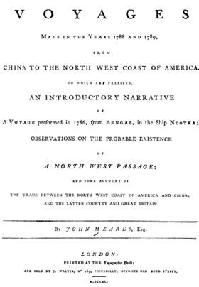
"Some copies issued on larger paper with coloured plates. Streeter noted variations in copies and describes one with an extra plate on the Philippines. Meares commanded the Felice Adventurer and Iphigenia, Captain Douglas, on a trading voyage for the Associated Merchants. The seizure of his ships by the Spanish at Nootka led to an international crisis, eventually resolved by the Nootka Convention of 1790. His exaggerated claims concerning his exploits and hardships were strongly attacked by George Dixon (no. I48). The account of voyages was edited by William Combe from Meares's papers, ref. D.N.B. The appendices contain the official instructions for the voyage, and various documents concerning the seizure, including Meares's Memorial to the House of Commons which was also published separately (no.363)." -- Strathern, G. M., & Edwards, M. H. (1970). Navigations, traffiques & discoveries, 1774-1848: A guide to publications relating to the area now British Columbia. Victoria, BC: U
viii, [12], xcv, [1], 372, [108] pages, 26 unnumbered leaves of plates (some folded) : illustrations, maps ; 30 cm
ONLINE Circulation [ 1 ]
Entry Details
Related Online Resources
- No external online resources or related links found
Last updated: 2026-09-30