David Thompson 1770-1857
David Thompson was a British-Welsh explorer, fur trader, and master cartographer whose unprecedented surveying efforts produced the first comprehensive, accurate maps of the vast Pacific Northwest interior. Working primarily for the Montreal-based North West Company, Thompson crossed the Rocky Mountains in 1807 and spent the next several years establishing a vital network of inland trading posts across present-day British Columbia, Idaho, and Montana, including Kootanae House and Kullyspell House. In 1811, he achieved his most famous regional milestone by becoming the first European to navigate and map the entire 1,200-mile length of the Columbia River from its Canadian headwaters to the Pacific Ocean. Although he arrived at the river's mouth just months after American competitors had already founded Fort Astoria, Thompson's meticulous surveying and forging of enduring economic alliances with the Indigenous tribes of the Columbia Basin solidified a lucrative British commercial foothold in the inland territory. His monumental 1814 map of the North West Territory served as the definitive geographic record of the region for over a half-century, cementing his legacy as one of the greatest land geographers in human history and the pioneering architect of the inland Pacific Northwest fur trade.
First person of European descent to navigate the Columbia River's entire length
Biographical Overview
- Lived from 1770 to 1857
- Born: Apr 30, 1770, Westminster, London, England
- Died: Feb 10, 1857, Longueuil, Quebec
Historical Events
- No referenced events linked
Bibliography for David Thompson
A listing of books related by subject
Sources of the River, 2nd Edition Tracking David Thompson Across North America by Jack Nisbet
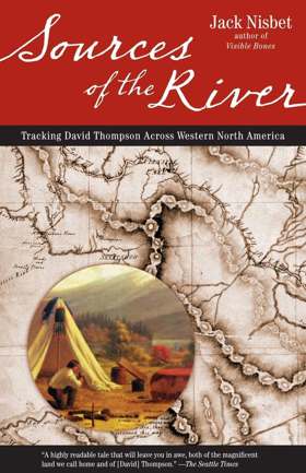
The awe-inspiring story of explorer David Thompson, whose expeditions helped shape western North America In this true story of adventure, author Jack Nisbet re-creates the life and times of David Thompson--fur trader, explorer, surveyor, and mapmaker. From 1784 to 1812, Thompson explored western North America, and his field journals provide the earliest written accounts of the natural history and indigenous cultures of the what is now British Columbia, Alberta, Montana, Idaho, Washington, and Oregon. Thompson was the first person to chart the entire route of the Columbia river, and his wilderness expeditions have become the stuff of legend. Jack Nisbet tracks the explorer across the content, interweaving his own observations with Thompson's historical writings. The result is a fascinating story of two men discovering the Northwest territory almost two hundred years apart
1 online resource (288 p.)
Non-circulating [ 1 ]
The mapmaker's eye David Thompson on the Columbia Plateau by Jack Nisbet

"David Thompson is a hero in Canada, yet has remained largely unknown in the United States. Between 1801 and 1812, this fur trader, explorer, and cartographer established two viable trade routes across the Rocky Mountains in Canada and systematically surveyed the entire 1,250-mile course of the Columbia River. In succeeding years he distilled his mathematical notations from dozens of journal notebooks into the first accurate maps of the northwest quadrant of North America. Information from some of his earlier mapwork was even used by the Lewis and Clark Expedition."
xii, 180 pages : illustrations (some color), facsimiles, maps (some color), portraits ; 27 cm
Non-circulating [ 1 ]
New light on the early history of the greater North-west. The manuscript journals of Alexander Henry ... and of David Thompson ... 1799-1814. Exploration and adventure among the Indians on the Red, Saskatchewan, Missouri, and Columbia rivers by Alexander Henry, David Thompson, Elliott Coues

Published in 1897 and meticulously annotated by historian Elliott Coues, this foundational three-volume work compiles the raw manuscript journals of North West Company fur trader Alexander Henry and master topographer David Thompson from 1799 to 1814. A keen insight drawn from the text is how Henry’s brutally candid daily entries shatter the romanticized myth of the heroic frontiersman, exposing the early North American fur trade as a ruthlessly pragmatic enterprise heavily reliant on the deliberate weaponization of alcohol to control and exploit Indigenous populations. The narrative tracks their extensive expeditions across the Red, Saskatchewan, Missouri, and Columbia river basins, providing granular details on frontier survival, commercial logistics, and complex tribal negotiations. Ultimately, by fusing Thompson’s unparalleled geographical surveys with Henry’s gritty cultural observations, the compilation stands as an indispensable primary source for understanding the harsh geopolitical realities of the early Pacific Northwest.
3 volumes frontispiece (portrait) maps (in pocket) 25 cm
ONLINE Circulation [ 3 ]
Entry Details
Related Online Resources
- No external online resources or related links found
Last updated: 2026-09-30