Owyhee County County
Established December 31, 1863 with its county seat at Ruby City. This was the first county to be established by the first Territorial Legislature. In 1867 the county seat was moved to Silver City and in 1934 to Murphy. Named for the river, mountains and mining area explored by Hawaiian fur trappers in 1819-1820. Hawaii and Owyhee are different spellings of the same word. Gold was discovered on Jordan Creek in 1863, and millions of dollars of gold and silver were taken from the Silver City region until the industry declined in the early 1900s.
Mapped Location
Owyhee County: The mapped location is an approximation and should not be used for navigation or wayfinding.
Information
General information on Owyhee County
- Feature Type: County
- County Seat: Murphy
- Established: Thursday, December 31, 1863
Official, historical, colloquial and alternative toponyms for Owyhee County
A brief list of names that this geographic feature has been named
| Name | Description |
|---|---|
| Owyhee County | Official |
Origin Notes and History of Owyhee County
References to Owyhee County that document the origin of its place name

OWYHEE.—Named for the Owyhee River (q.v.). The county seat is Silver City, named, in 1863, by the prospectors who discovered rich silver float near there.
OWYHEE RIVER. Owyhee County. This is the name which Capt. James Cook gave to the Sandwich Islands in 1778, but the word is now spelled "Hawaii." In 1819 Donald Mackenzie outfitted three Owyhees who were employed by the Hudson Bay Company to trap this stream for beaver during the winter. The Indians found and murdered them, since which time this stream has been called the Owyhee River.
Related Catalog Titles
A Bibliography for Owyhee County, County
Historic Silver City the story of the Owyhees by Mildretta Adams

A historical, descriptive and commercial directory of Owyhee County, Idaho, January 1898 Silver City, De Lamar, and Guffey by Press of The Owyhee Avalanche
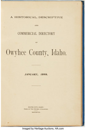
Published in 1898 by the Press of The Owyhee Avalanche, this volume serves as both a foundational historical record and a practical commercial guide to Owyhee County, Idaho, during its late 19th-century resource boom. The text provides detailed accounts of the region's geography, emerging rail infrastructure, and lucrative mining operations, while also cataloging the local businesses, civic leaders, and pioneer residents who populated towns like Silver City, De Lamar, and Guffey. A keen insight drawn from the publication is how frontier newspapers actively functioned as regional boosters, utilizing these exhaustively detailed directories to legitimize rugged, isolated mining camps into permanent, investment-worthy municipalities by projecting a highly organized image of commerce and rapid modernization.
154 pages : illustrations, portraits ; 24 cm
ONLINE CIRC [ 1 ]
Owyhee County
- Bengoechea Place
- Bruneau
- Buncel Place
- Carothers Place (historical)
- China Hat
- Claytonia
- Cliffs
- Collier Place
- Comical Turn
- Cottonwood (historical)
- Crill Place
- Dans Place
- De Lamar
- Democrat
- Dew Drop Place
- Dewey
- Dickens Place
- Dickshooter
- Doyle Place
- Dry Forty
- Empire City (historical)
- Fairylawn
- Flint
- Four Corners
- Frost Place
- Givens Hot Springs
- City of Grand View
- Grasmere
- Guffey
- Harvey Place
- City of Homedale
- Hot Springs
- James Place
- Little Sugar Loaf
- City of Marsing
- Miller Creek Settlement
- Morgan Place
- Murphy
- Murphy Hot Springs
- Oreana
- Owyhee Heights
- Petersons Crossing
- Pleasant Valley Place
- Reynolds
- Rickard Crossing
- Riddle
- Rockville
- Sands (historical)
- Silver City
- Sinker (historical)
- Slacks Corner
- South Mountain
- Spiry Place
- Telegraph Hill
- Three Creek
- Tindall (historical)
- Triangle
- Wickahoney
- Wilson
Political Boundaries
Last updated: 2016-12-20