Harney County County
In 1826, Peter Skene Ogden became the first white man to explore this area when he led a fur brigade for the Hudson’s Bay Company. In 1889, Harney, the largest county in Oregon, was carved out of Grant County and named for Major General William S. Harney, commander of the Department of Oregon, U.S. Army, from 1858–1859. Harney was instrumental in opening areas of Eastern Oregon for settlement.
Mapped Location
Harney County: The mapped location is an approximation and should not be used for navigation or wayfinding.
Information
General information on Harney County
- Feature Type: County
- County Seat: City of Burns
- Established: Monday, February 25, 1889
Official, historical, colloquial and alternative toponyms for Harney County
A brief list of names that this geographic feature has been named
| Name | Description |
|---|---|
| Harney County | Official |
Related Catalog Titles
A Bibliography for Harney County, County
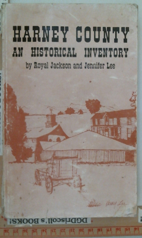
Harney County an historical inventory by Royal G. Jackson, Jennifer A. Lee, Harney County Historical Society (Or)
Harney County, Oregon, and its range land by George Francis Brimlow
An Illustrated history of Baker, Grant, Malheur and Harney counties, with a brief outline of the early history of the state of Oregon by Western Historical Publishing Company

Published in 1902 by the Western Historical Publishing Company, this comprehensive volume documents the early settlement and economic foundation of eastern Oregon's vast frontier. Following a brief overview of the state's early years, the text provides detailed local histories and extensive biographical sketches of the pioneers who built communities across Baker, Grant, Malheur, and Harney counties. A keen insight drawn from the narrative is how the region's harsh, arid geography necessitated an economy based heavily on cattle ranching and mining, forging a rugged cultural identity that sharply contrasted with the agrarian settlements of the Willamette Valley. Ultimately, the book serves as both a valuable genealogical resource for these four counties and a historical testament to the sheer endurance required to establish industry in the high desert.
788 pages, 70 unnumbered leaves of plates : illustrations, portraits
ONLINE CIRC [ 1 ]
Harney County
- Andrews
- Buchanan
- City of Burns
- Crane
- Diamond
- Drewsey
- Dunnean
- Fields
- Frenchglen
- Frost Mill
- Harney
- City of Hines
- Indian Village
- Lawen
- Narrows
- New Princeton
- Princeton (historical)
- Riley
- Suntex
- Trout Creek
- Van
- Venator
- Voltage
- Wagontire
Political Boundaries
Last updated: 2013-01-08