Murray Shoshone County, Idaho
Mapped Location
Murray: The mapped location is an approximation and should not be used for navigation or wayfinding.
Information
General information on Murray
- Feature Type: Place
Official, historical, colloquial and alternative toponyms for Murray
A brief list of names that this geographic feature has been named
| Name | Description |
|---|---|
| Murray | Official |
A Selected Bibliography of Murray, Shoshone County, Idaho
A compilation of essential readings detailing the history, geography, and culture of the region.
Idaho's bonanza years ghost towns, their history and how to find them by Rex Painter, Dorothy Povey
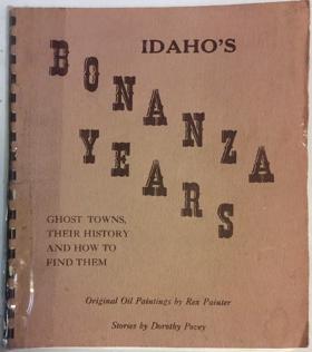
Rex Painter and Dorothy Povey’s Idaho's Bonanza Years: Ghost Towns, Their History and How to Find Them serves as both a pioneer chronicle and a physical navigational guide to the abandoned mining settlements scattered across the Gem State. The narrative maps the rugged, isolated topography that dictated Idaho's late-nineteenth-century mineral rushes, tracing routes through the steep, timbered gulches of the central Salmon River Mountains southward to the arid, high-elevation basins of the Owyhee range. By detailing the rapid rise and inevitable collapse of these remote boomtowns—often built precariously along narrow canyon walls and deep within unforgiving alpine valleys—the authors illustrate the extreme environmental challenges prospectors faced in extracting wealth from the state's formidable interior. Ultimately, the text captures the transient geographical footprint of resource extraction in the inland Pacific Northwest, demonstrating how the harsh physical realities of these isolated mountainous enclaves eventually reclaimed the ambitious pioneer architecture of Idaho's gold and silver rushes.
46 pages illustrations, map 25 cm
Non-circulating [ 1 ]
Shoshone County
- Adair
- Avery
- Black Bear
- Blackcloud
- Bogle
- Borax (historical)
- Bullion (historical)
- Bunn
- Burke
- Calder
- Carbon Center
- Carbonate (historical)
- Cataldo
- Clarkia
- Cornwall
- Delta
- Dorsey (historical)
- Eagle
- Elizabeth Park
- Elk Creek
- Emerald Creek
- Enaville
- Erlmo
- Ethelton
- Falcon
- Ferguson
- Frisco
- Gem
- Gentry
- Golconda
- Gold Creek
- Herrick
- Horsecamp
- Hoyt
- Keeler
- City of Kellogg
- Kingston
- Kyle (historical)
- Larson
- Linfor
- Mace
- Marble Creek
- Masonia (historical)
- McCarthy
- McDonalds
- City of Mullan
- Murray
- Nelson (historical)
- Nuckols
- Olsons
- City of Osburn
- Page
- Pearson
- Pine Creek
- City of Pinehurst
- Pocono
- Pottsville (historical)
- Prichard
- Roland
- Silverton
- City of Smelterville
- Steamboat (historical)
- Steamboat Rocks
- Stetson
- Stull
- Sunset (historical)
- Sweeney
- Tammany
- Thiard
- City of Wallace
- City of Wardner
- Webb
- Woodland Park
Political Boundaries
Last updated: 2016-10-01