Texada Island Feature
Island - Land area surrounded by water or marsh. E side Strait of Georgia, S of Powell River (city), Texada Island Land District
Mapped Location
Texada Island: The mapped location is an approximation and should not be used for navigation or wayfinding.
Information
General information on Texada Island
- Feature Type: Feature
Official, historical, colloquial and alternative toponyms for Texada Island
A brief list of names that this geographic feature has been named
| Name | Description |
|---|---|
| Texada Island | Official |
Origin Notes and History of Texada Island
References to Texada Island that document the origin of its place name
Adopted 27 April 1945 on C.3591, as labelled on British Admiralty chart 580, 1862 et seq.
Named in 1791 by Jose Maria Narvaez, in command of the small exploring vessel "Santa Saturnina", one of Lieutenant Commander Eliza's two vessels. Spelt on the old Spanish charts of Eliza (1791) and Galiano (1792) as "Texada", but mentioned by Captain Vancouver under the name of "Favada" in 1792.
Spanish naval officer Jose Narváez, who explored the Strait of Georgia in 1791 (the first European to do so) with the Santa Saturnina originally gave the name San Felix what is now Texada Island, probably because he was there on July 12, the feast day of the 3rd-century Christian martyr from Milan. Confusingly, Narváez applied the name Isla Texada to today’s Lasqueti Island. These names appear on the chart drawn by Juan Pantoja y Arriaga, the pilot aboard the San Carlos, the other vessel in the 1791 expedition. Francisco Eliza, the overall expedition Commander, shifted the names around on his official chart, changing San Felix de Tejada (Texada) was a prominent Spanish naval officer at the time of Eliza’s expedition; he later became a Captain General, responsible for the navy’s northern department, based at the important port and shipbuilding centre of El Ferrol in Galicia. Captain George Vancouver adopted the name on his 1792 expedition but mistakenly spelled it Favida in his journal and Feveda on his chart, an error that was corrected on subsequent editions. The 287-sq-km island, which had a population of about 1,100 in the early 2000s, has a long history as a mining centre, with gold, iron ore and limestone all important exports. There are three small communities, Van Anda, Gillies Bay and Blubber Bay, the last of which is connected by ferry to Powell River. The Schelt First Nation knows the island as Lháwtíkán and Spílksen.
A Selected Bibliography of Texada Island, Feature
A compilation of essential readings detailing the history, geography, and culture of the region.
Texada tapestry a history by Heather Harbord
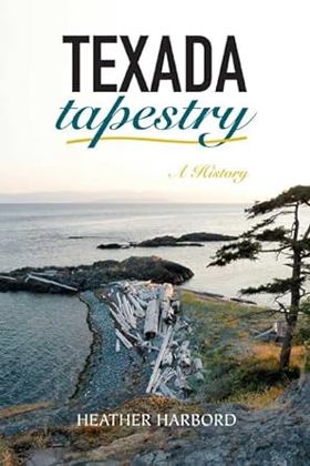
"Texada is the largest island in the Strait of Georgia, a long strip of richly mineralized granite and limestone dividing the upper gulf. Travel time from Vancouver is six hours via three ferries. A newcomer's first impression is of an idyllic place with a big sandy beach, a Sunday farmer's market and a scant population of aging loggers, miners, pot-growers and other retirees, but this belies Texada's intriguing history. Although today Texada is better known as the home of the illegal agricultural product called Texada Gold, it was once the focus of a real gold rush that lured no less a figure than cookie tycoon William Christie. Later, Texada was the site of British Columbia's first major political scandal when squabbles over a rich iron ore claim forced the resignation of Premier Amor de Cosmos in February 1874. The rich mineral deposits in time gave rise to three booming towns--Gillies Bay, Blubber Bay and Van Anda, noted as the town with everything: not just a whorehouse, but an opera house. Population ebbed and flowed with mineral prices and Texada went in and out of the news. Its association with illegal intoxicants dates back to 1928 when the biggest whisky still north of Vancouver was busted in romantic Pocahontas Bay. The bitter Blubber Bay strike of 1938 put Texada in the news again as the Pacific Lime Company faced off against the International Woodworkers' Association labour union in a bloody riot. This is also the feisty island that repelled the might of the Greater Vancouver Regional District when it wanted to dump metropolitan garbage in the abandoned pit of the once-famous Texada Mine. Author Heather Harbord has dedicated years to research, including over a hundred interviews of locals and old-timers to create a captivating book full of unforgettable characters, humorous anecdotes and well-researched fact, accompanied by many previously unpublished photographs. Once again, she has created a valuable volume on the history of the BC coast." --Publisher's description
288 p. : ill., map, ports. ; 24 cm.
Non-circulating [ 1 ]
Last updated: 2026-10-14