Lane County County
Lane County was named for General Joseph Lane, a rugged frontier hero who was Oregon’s first territorial governor. Pioneers traveling the Oregon Trail in the late 1840s came to Lane County mainly to farm.
Mapped Location
Lane County: The mapped location is an approximation and should not be used for navigation or wayfinding.
Information
General information on Lane County
- Feature Type: County
- County Seat: City of Eugene
- Established: Tuesday, January 28, 1851
Official, historical, colloquial and alternative toponyms for Lane County
A brief list of names that this geographic feature has been named
| Name | Description |
|---|---|
| Lane County | Official |
Related Catalog Titles
A Bibliography for Lane County, County
Atlas of Lane County, Oregon by James E. Meacham, Lane County (Or), University of Oregon, Lane Council of Governments (Or)
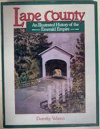
Lane County an illustrated history of the Emerald Empire by Dorothy Velasco, Dianne Donovan, Lane County Historical Society (Or)
Lane County
- Acme
- Alma
- Alpha
- Alvadore
- Amos (historical)
- Armet (historical)
- Belknap Springs
- Bethel
- Blachly
- Black Butte
- Blue River
- Bohemia (historical)
- Bolly (historical)
- Brickerville
- Canary
- Cedar Flat
- Cheshire
- Cloverdale
- City of Coburg
- College Hill
- City of Cottage Grove
- City of Creswell
- Crow
- Culp Creek
- Cushman
- Deadwood
- Deerhorn
- Dexter
- Disston
- Dorena
- Dorena (historical)
- City of Dunes City
- Earl (historical)
- Elmira
- Estrup (historical)
- City of Eugene
- Fall Creek
- Fern Ridge Shores
- Finn Rock
- Fir Grove
- City of Florence
- Foley Springs
- Fox Hollow (historical)
- Franklin
- Gap
- Glenada
- Glenwood
- Glenwood (historical)
- Goldson
- Goshen
- Greenleaf
- Hadleyville
- Heceta Beach
- Horton
- Indiola
- Irving
- Jasper
- City of Junction City
- Lancaster
- Latham
- Leaburg
- Linslaw
- London
- London Springs
- Lorane
- Low Pass
- City of Lowell
- Mabel
- Mapleton
- Marcola
- McCredie Springs
- McKenzie Bridge
- Mercer (historical)
- Mill Camp
- Minerva
- Mohawk
- Mohawk Post (historical)
- Mound (historical)
- Nimrod
- North Beach
- North Springfield
- Noti
- City of Oakridge
- Paris
- Pleasant Hill
- Point Terrace
- Rainbow
- Rainrock
- Reed
- River Road
- Roosevelt Beach
- Royal
- Saginaw
- Searose Beach
- Siltcoos
- Siuslaw (historical)
- City of Springfield
- Starrs Point (historical)
- Swisshome
- Thurston
- Tide
- Tiernan
- Trent
- Triangle Lake
- Unity
- Vaughn
- Veatch
- City of Veneta
- Vida
- Walden
- Walker
- Wallace (historical)
- Walterville
- Walton
- Wendling
- City of Westfir
- Wildwood
- Winberry
- Wolf Creek
Political Boundaries
Last updated: 2013-01-08