City of Ashland Jackson County, Oregon
Mapped Location
City of Ashland: The mapped location is an approximation and should not be used for navigation or wayfinding.
Information
General information on City of Ashland
- Feature Type: Incorporated
Official, historical, colloquial and alternative toponyms for City of Ashland
A brief list of names that this geographic feature has been named
| Name | Description |
|---|---|
| City of Ashland | Official |
| Ashland | Official |
Related Catalog Titles
A Bibliography for City of Ashland, Jackson County, Oregon
Ashland, an Oregon oasis an Oregon documentary by Janelle Davidson, Bert Webber
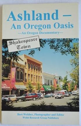
Authored by Janelle Davidson and Bert Webber, Ashland, an Oregon Oasis: An Oregon Documentary chronicles the development of the southern Oregon town from a pioneer milling settlement into a vibrant cultural haven renowned for its natural mineral springs and the Oregon Shakespeare Festival. The book weaves together historical photographs, local archives, and narrative documents to trace how the community leveraged its unique natural geography and artistic ambitions to survive economic shifts. Through these collected records, the text captures the deliberate transformation of a remote Rogue Valley stopover into a thriving destination for travelers and intellectuals alike. A keen insight drawn from the work is how intentional cultural institutions can insulate a regional economy from resource dependency; by pivoting from local timber and agriculture toward world-class theater and holistic tourism, Ashland demonstrated that remote communities can engineer their own prosperity by transforming local geographic assets into an internationally recognized cultural brand.
160 pages : illustrations, maps ; 22 cm
CIRC [ 1 ]
Ashland the first 130 years by Marjorie O'Harra
Related Online Resources
SODA: Southern Oregon Digital Archives
The Southern Oregon Digital Archives (SODA) was funded originally by a grant from the Institute of Museum and Library Services (IMLS). From July of 2001 through December of 2004, IMLS funding enabled Hannon Library to create a digital library of over 1,500 documents in two text collections, the Bioregion Collection and First Nations Collection, using the PTFS platform called ArchivalWare (currently, Knowvation). The digitized books, documents, and articles were drawn from Hannon Library’s rich collections of federal, state, and county publications, other library materials, and from outreach to regional agencies. Public access to the SODA database began in October 2002.
WEB LINK
Jackson County
- Applegate
- Asbestos (historical)
- City of Ashland
- Barron (historical)
- Beagle
- Bitter Lick
- Brownsboro
- Buckhorn Springs
- Buncom
- Town of Butte Falls
- Bybee Corner
- Cameron (historical)
- Cascade Gorge
- City of Central Point
- Climax
- Colestin
- Copper
- Dardanelles
- Derby (historical)
- Draper (historical)
- Dudley (historical)
- City of Eagle Point
- Edsalla (historical)
- Etna (historical)
- Foots Creek
- Four Corners
- City of Gold Hill
- City of Jacksonville
- Lake Creek
- Lincoln
- McKee Bridge
- McLeod
- City of Medford
- Mountain View
- Mountain View (historical)
- Perrydale (historical)
- Persist (historical)
- City of Phoenix
- Pinehurst
- Prospect
- Provolt
- Rogue Elk
- City of Rogue River
- Ruch
- Sams Valley
- Seven Oaks
- City of Shady Cove
- Spikenard (historical)
- Starvation Heights
- Steamboat
- Table Rock
- City of Talent
- Tolo
- Trail
- Union Creek
- Wellen (historical)
- White City
- Williams Creek (historical)
- Wimer
Political Boundaries
Last updated: 2017-01-15