City of Coos Bay Coos County, Oregon
Mapped Location
City of Coos Bay: The mapped location is an approximation and should not be used for navigation or wayfinding.
Information
General information on City of Coos Bay
- Feature Type: Incorporated
Official, historical, colloquial and alternative toponyms for City of Coos Bay
A brief list of names that this geographic feature has been named
| Name | Description |
|---|---|
| City of Coos Bay | Official |
| Coos Bay | Official |
A Selected Bibliography of City of Coos Bay, Coos County, Oregon
A compilation of essential readings detailing the history, geography, and culture of the region.
The mills that built Coos Bay, Oregon and the men who made it happen by William A. Lansing
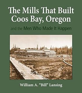
The author states that the purpose of this book is to "identify and describe the scores of mills that populated the shores of Coos Bay from the 1850s to the 1960s; to record how these mills came into existence, then drifted into history; and to tell the stories of the entrepreneurs who made it all happen."--Dust jacket
xviii, 574 pages : illustrations (some color), facsimiles, maps (some color) ; 29 cm + 2 maps (color ; 77 x 61 cm and 81 x 61 cm)
Desiderata
Coos Bay Plundertown, USA by Al Sandine

Published in local editions by Al Sandine, Coos Bay Plundertown, USA is a blistering polemical history examining the corporate exploitation and environmental degradation of Oregon’s largest coastal port. The book chronicles how powerful timber and industrial interests, in collusion with local political figures, systematically gutted the region's natural resources and bypassed community oversight to maximize short-term profits. Through sharp critique and detailed local documentation, the text exposes the severe economic and ecological fallout left in the wake of unchecked industrial ambition. A keen insight drawn from the work is how resource-dependent towns are frequently treated by outside corporate forces as disposable sacrifice zones; the narrative reveals that "plundertown" status is not an accidental policy failure, but the predictable end-result of an extractive economic model that privatizes public wealth while socializing long-term environmental ruin.
175 pages : illustrations, maps, portraits ; 22 cm
Non-circulating [ 1 ]
Hard times in paradise Coos Bay, Oregon, 1850-1986 by William G. Robbins
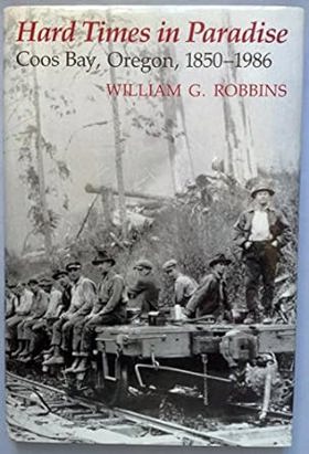
Blessed with vast expanses of virgin timber, a good harbor, and a San Francisco market for its lumber, the Coos Bay area once dubbed itself "a poor man's paradise." A new Prologue and Epilogue by the author bring this story of gyppo loggers, longshoremen, millwrights, and whistle punks into the twenty-first century, describing Coos Bay’s transition from timber town to a retirement and tourist community, where the site of a former Weyerhaeuser complex is now home to the Coquille Indian Tribe’s The Mill Casino.
xiv, 194 pages, 16 unnumbered pages of plates : illustrations ; 23 cm
Non-circulating [ 1 ]
The Coos Bay region, 1890-1944 life on a coastal frontier by Nathan Douthit
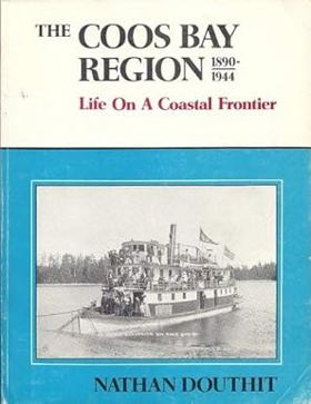
About two-thirds of the way from San Francisco Bay to the Columbia River lies Coos Bay, the larges natural harbor on the Oregon coast.... the subject of this book. It is a book about the social and economic development of a small corner of the Pacific Northwest from a coastal frontier into a major population and forest industrial center of Oregon.
163 pages : illustrations ; 28 cm
Desiderata
Coos Bay the pioneer period, 1851-1890 by Stephen Dow Beckham
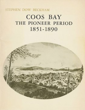
Study of the Coos Bay region focusing on the years 1851-1890. During this period a little known estuary on the southwest coast of Oregon became a thriving center for lumbering, shipbuilding, coal mining, and agriculture. This work is not intended to be a complete local history of Coos Bay, however the author examines those events and undertakings that have had special significance in the development of the area.
v, 70 pages illustrations 28 cm
Non-circulating [ 1 ]
Coos River echoes a story of the Coos River Valley by Charlotte L. Mahaffy

Charlotte L. Mahaffy’s Coos River Echoes provides a detailed pioneer history of the isolated, resource-rich Coos River Valley on the rugged southwestern Oregon coast. The narrative meticulously maps the intricate estuarine and riverine geography that dictated early settlement, illustrating how the dense, nearly impenetrable timber of the Coast Range forced early inhabitants to rely entirely on the river network as their primary transportation and commercial highway. By detailing the establishment of early dairy farms along the fertile, tidal bottomlands and the grueling logging operations that utilized splash dams to violently flush timber down steep, narrow tributaries toward the coastal mills of Coos Bay, the book highlights the profound pioneer reliance on the region's hydrology. Ultimately, the text captures the severe physical isolation of this coastal environment, demonstrating how the challenging topography and dynamic waterways shaped the distinct cultural and industrial development of the valley.
253, [2] pages illustrations, map (on lining papers) portraits 23 cm
Non-circulating [ 1 ]
Coos County
- Allegany
- Arago
- Bancroft
- City of Bandon
- Barview
- Bay Park
- Bridge
- Broadbent
- Bullards
- Bunker Hill
- Cedar Point
- Charleston
- Coaledo
- City of Coos Bay
- Coos City (historical)
- Coos River
- Cooston
- City of Coquille
- Cranberry Corners
- Crown Point
- Dellwood
- Delmar
- Dew Valley
- Dora
- Englewood
- Estabrook
- Etelka (historical)
- Fairview
- Fourmile
- Gaylord
- Glasgow
- Gravelford
- Green Acres
- Hauser
- Kings Landing (historical)
- City of Lakeside
- Lampa (historical)
- Laurel Grove
- Lee (historical)
- Leneve
- Libby
- McKinley
- Millington
- City of Myrtle Point
- City of North Bend
- Norway
- Parkersburg
- City of Powers
- Prosper
- Randolph
- Remote
- Riverton
- Saunders Lake
- Shorewood
- Sitkum
- Sumner
- Templeton
- Tenmile
- Winterville
Political Boundaries
Last updated: 2017-01-16