City of Richland Benton County, Washington
Mapped Location
City of Richland: The mapped location is an approximation and should not be used for navigation or wayfinding.
Information
General information on City of Richland
- Feature Type: Incorporated
Official, historical, colloquial and alternative toponyms for City of Richland
A brief list of names that this geographic feature has been named
| Name | Description |
|---|---|
| City of Richland | Official |
| Richland | Official |
Origin Notes and History of City of Richland
References to City of Richland that document the origin of its place name

RICHLAND, a town in the east central part of Columbia County, named by Nelson Rich in 1904. Mr. Rich owned large tracts of land in that vicinity. Benton was proposed as a name but was rejected because of its frequent use elsewhere. (Advocate of Richland, in Names MSS. Letter 358.)
Related Catalog Titles
A Bibliography for City of Richland, Benton County, Washington
Nowhere to remember Hanford, White Bluffs, and Richland to 1943 by Robert Bauman (Editor of compilation), Robert Franklin (Editor of compilation)
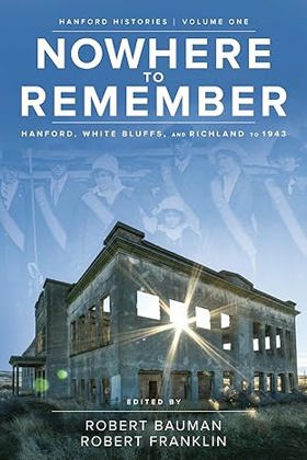
Euro-American Priest River Valley settlers turned acres of sagebrush into fruit orchards. Although farm life required hard work and modern conveniences were often spare, many former residents remember idyllic, close-knit communities where neighbors helped neighbors. Then, in 1943, families received forced evacuation notices. "Fruit farmers had to leave their crops on their trees. And that was very hard on them, no future, no money...they moved wherever they could get a place to live," Catherine Finley recalled. Some were given just thirty days, and Manhattan Project restrictions meant they could not return. Drawn from Hanford History Project personal narratives, Nowhere to Remember highlights life in Hanford, White Bluffs, and Richland--three small agricultural communities in eastern Washington's mid-Columbia region. It covers their late 1800s to early 1900s origins, settlement and development, the arrival of irrigation, dependence on railroads, Great Depression struggles, and finally, their unique experiences in the early years of World War II. David W. Harvey examines the impact of wagon trade, steamships, and railroads, grounding local history within the context of American West history. Robert Franklin details the tight bonds between early residents as they labored to transform scrubland into an agricultural Eden. Laura Arata considers the early twentieth century experiences of women who lived and worked in the region. Robert Bauman utilizes oral histories to tell forced removal stories. Finally, Bauman and Franklin convey displaced occupants' reactions to their lost spaces and places of meaning--and explore ways they sought to honor their heritage.
xvi,196 pages : illustrations, maps, portraits ; 23 cm
CIRC [ 0 ]
Tales of Richland, White Bluffs & Hanford, 1805-1943, before the atomic reserve by Martha Berry Parker
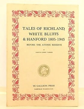
From back This book, Tales of Richland, White Bluffs and Hanford, tells the story of these three towns before there was an atomic project. They were farming communities, rich in a wide variety of early bearing fruit, and with a long growing season for vegetables, feed grains and alfalfa hay. The author lived in Richland from 1932 to 1941. Her mother's family, the Charles Sawyers, came to the Fruitvale District in 1909. The Sawyers had a 19-acre farm just upriver from where the Graduate Center is at present (1986), north of Richland's Hanford School. Mrs Parker has a deep interest in Northwest history and has written two other books, Kin-i-wak, Kenewick, Tehe, Kennewick, and Washington, Oregon; a Map History of the Oregon Country. She is also an amateur archaeologist and is actively interested in Geology and Genealogy.
407 pages : illustrations ; 29 cm
CIRC [ 1 ]
Benton County
- Apricot
- Audrey
- Badger
- City of Benton City
- Berrian
- Bettie
- Chaffee
- East White Bluffs
- Edna
- Ethel
- Finley
- Geneva Junction
- Gibbon
- Ginger
- Hanford
- Hedges
- Helen
- Highland
- Horse Heaven
- Island View
- City of Kennewick
- Kinneyville (historical)
- Kiona
- Longview (historical)
- May Junction
- Nancy
- North McNary
- North Prosser
- Paterson
- Pearl
- Pierce
- Plymouth
- Port of Kennewick
- City of Prosser
- City of Richland
- Richland Junction
- Richland Y
- Ruby
- Ruth
- South Highlands
- Susie
- Vista
- Wahluke
- West Highlands
- City of West Richland
- Whitcomb
- White Bluffs
- Whitstran
- Willa
- Yellepit
Political Boundaries
Last updated: 2017-07-01