City of Pocatello Bannock County, Idaho
Mapped Location
City of Pocatello: The mapped location is an approximation and should not be used for navigation or wayfinding.
Information
General information on City of Pocatello
- Feature Type: Incorporated
Official, historical, colloquial and alternative toponyms for City of Pocatello
A brief list of names that this geographic feature has been named
| Name | Description |
|---|---|
| City of Pocatello | Official |
| Pocatello | Official |
Origin Notes and History of City of Pocatello
References to City of Pocatello that document the origin of its place name
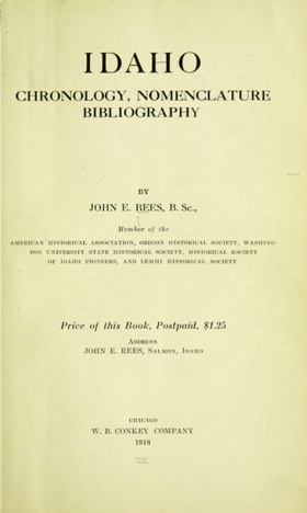
BANNOCK.—Named for the Bannack Indians (q. v.), but the Scotch word is used. The county seat is Pocatello, named for Chief Pokatello (q.v.).
POKATELLO, Bannock County.—This is a Shoshoni Indian word meaning "Po," "road," "ka," "not" and "tello," "to follow" or "He does not follow the road," and was applied to this chief of the Bannack Indians because of his stealthy habits and thieving raids. In 1862 he and his followers massacred a California emigrant train near the City of Rocks in Cassia County, for which deed Gen. P. E. Connor of Fort Douglas, Utah, surrounded his winter camp on Bear River on January 29, 1863, and almost annihilated the entitre band. On July 29, 1863, the Government made a treaty with Pokatello and his followers, called the Northwestern Bands, as follows: It is agreed that friendly and amicable relations shall be re-established and it is declared that a firm and perpetual peace shall henceforth be maintained. And the said Northwestern Bands hereby acknowledge to have received provisions and goods to the amount of $2,000 to relieve their immediate necessities, the said bands having been reduced by war to a state of utter destitution. The country claimed by Pokatello, for himself and his people is bounded on the west by Raft River and on the east by the Portneuf Moimtains. When the Fort Hall Indian Reservation (q.v.) was formed in 1869 most of this country was included in that reserve and all the Indians were placed upon it. In 1864 Ben Holliday opened a stage route from Salt Lake City to Virginia City, Montana, and located a station along the route which he named "Pocatello" for this chief. The place developed into the present town of Pocatello which is near Batise springs, a great Indian camp and resort in olden days.
A Selected Bibliography of City of Pocatello, Bannock County, Idaho
A compilation of essential readings detailing the history, geography, and culture of the region.
Know your town Pocatello, Idaho gate city to the great Northwest by League of Women Voters of Pocatello

Know your town Pocatello, Idaho: gate city to the great Northwest examines the strategic urban development and critical transportation role of a settlement positioned at a crucial geographic chokepoint of southeastern Idaho. The League of Women Voters of Pocatello details how the region's formidable physical barriers—specifically the narrowing, rugged corridor of the Portneuf River Valley flanked by the imposing peaks of the Bannock Range—strictly dictated the flow of overland migration and the subsequent expansion of transcontinental rail networks onto the vast Snake River Plain. By mapping the deliberate establishment of massive railroad infrastructure designed to funnel freight and pioneer traffic through this narrow topographic gateway, the narrative highlights the immense logistical effort required to anchor a modern industrial hub in a demanding, semi-arid inland environment. The absolute geographic necessity of traversing this specific mountain pass forced both early overland pioneers and the Oregon Short Line Railroad into a strict reliance on the valley's contours, permanently concentrating human settlement and economic survival around this vital transportation nexus. Ultimately, this civic and historical record serves as a deeply localized spatial history, demonstrating how the specific topographical funnels and severe environmental realities of the inland Pacific Northwest fundamentally shaped the enduring, transit-dependent character of the Pocatello gateway.
47 pages : illustrations, maps ; 22 x 14 cm
Non-circulating [ 1 ]
Pioneering Pocatello was no picnic by Betty Hale, Leon Jenks
Pioneering Pocatello was no picnic examines the early settlement and crucial transit development situated within the narrow, windswept corridor of the Portneuf River valley where it opens onto the vast Snake River Plain in southeastern Idaho. Hale and Jenks detail how the region's distinct topography—specifically the arid, sagebrush-covered steppes, the rugged surrounding foothills, and the vital natural funnel created by the river valley—strictly dictated the margins of overland pioneer migration and the eventual establishment of a major railway junction. By mapping the transformation of this rugged geographic chokepoint into a permanent "Gate City" connecting the Pacific Northwest to the Great Basin, the narrative highlights how the specific valley contours anchored the town's enduring commercial role. Ultimately, this local historical record serves as a deeply localized spatial history, demonstrating how the expansive high-desert geography and strategic natural corridors of this inland frontier fundamentally shaped the transit-dependent, highly connected character of early Pocatello.
28 pages : illustrations ; 22 cm
Non-circulating [ 1 ]
History of Idaho State College by Merrill D. Beal
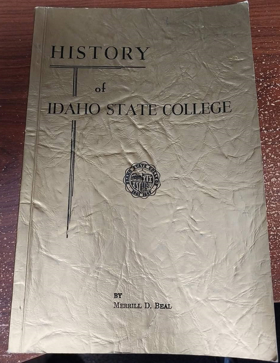
Merrill D. Beal’s History of Idaho State College chronicles the arduous institutional colonization and civic subjugation of a rugged, mechanized rail-junction enclave carved directly into the arid, wind-scoured expanse of the Snake River Plain. The narrative maps how the severe environmental realities of this unforgiving inland topography—defined by vast, sun-baked sagebrush steppes, plunging winter extremes, and the sheer geological barricades isolating the eastern Idaho frontier—initially paralyzed the establishment of permanent cultural infrastructure, forcing early settlers to prioritize raw industrial survival and mineral extraction over civic development. By detailing the grueling transition from a remote, utilitarian railroad outpost servicing heavy transcontinental freight to the aggressive engineering and expansion of a centralized academic academy, the text illustrates how the intellectual anchoring of the region was strictly dictated by the necessity of domesticating this harsh, transient frontier. Ultimately, the account demonstrates that systematically erecting robust educational architecture and deploying organized civic institutions to conquer the profound cultural and geographical isolation of the high desert were the absolute prerequisites for transforming a raw, transcontinental transit corridor into a permanent, sophisticated anchor of the inland empire.
v, 216 pages : illustrations ; 23 cm
Desiderata
Related Online Resources
Idaho State University Special Collections
Special Collections and Archives at the Eli M. Oboler Library, Idaho State University acquires, preserves, and makes accessible research materials that document the historical, cultural, and folk life experience of Southeast Idaho, the Intermountain West, and the history of Idaho State University.
WEB LINKDigital Atlas of Idaho
Idaho's natural history online. One Digital Location for Geography, History, and the natural history of Idaho. Project funded by the Idaho State Board of Education Technology Initiative Grants.
WEB LINK
Bannock County
- City of Arimo
- Blackrock
- Cambridge
- City of Chubbuck
- Dempsey (historical)
- Downata Hot Springs
- City of Downey
- Hawkins
- City of Inkom
- City of Lava Hot Springs
- Marsh Valley
- City of McCammon
- City of Pocatello
- Portneuf
- Red Rock Junction
- Robin
- Swan Lake
- Swanlake
- Topaz (historical)
- Tyhee
- Virginia
- Zenda
Political Boundaries
Last updated: 2023-10-16