City of Pasco Franklin County, Washington
Mapped Location
City of Pasco: The mapped location is an approximation and should not be used for navigation or wayfinding.
Information
General information on City of Pasco
- Feature Type: Incorporated
Official, historical, colloquial and alternative toponyms for City of Pasco
A brief list of names that this geographic feature has been named
| Name | Description |
|---|---|
| City of Pasco | Official |
| Pasco | Official |
Origin Notes and History of City of Pasco
References to City of Pasco that document the origin of its place name

PASCO, a town near the junction of the Snake and Columbia Rivers, and the county seat of Franklin County. The name was bestowed by Virgil Gay Bogue, Location Engineer of the Northern Pacific Railroad. At that time the place was dusty, hot and disagreeable. He had read of a disagreeable town in Mexico by that name and gave it to the new station with no suspicion that it would become an important county seat and railroad center. (F. W. Dewart, Spokane, in Names MSS. Letter 599.) Another version is that Harry McCartney, associated with Mr. Bogue as locating engineers, named it by way of contrast. Pasco was the flattest and hottest place he had found while Cerro de Pasco, Peru, was the highest and coldest place he han ever been in. (Lewis A. MsArthur, in Names MSS. Letter 606.)
A Selected Bibliography of City of Pasco, Franklin County, Washington
A compilation of essential readings detailing the history, geography, and culture of the region.
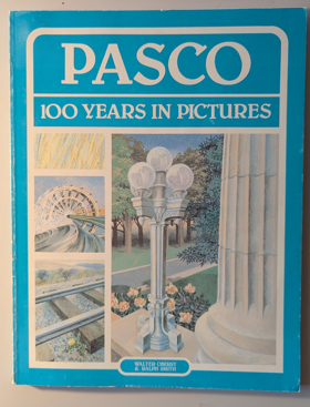
Pasco, 100 years in pictures by Walter Oberst, Ralph Smith
Railroads, reclamation and the river a history of Pasco by Walter A. Oberst

Railroads, Reclamation, and the River chronicles the transformation of Pasco from a desolate, wind-swept desert outpost into a vital regional hub strategically situated at the confluence of the Columbia, Snake, and Yakima rivers in southeastern Washington. Oberst details how the sprawling, relatively flat topography of this arid inland basin made it a natural geographic juncture for early transcontinental railways, breaking the area's profound isolation by linking the interior shrub-steppe to distant coastal markets. The narrative heavily emphasizes the monumental engineering efforts required to harness the immense volume of these converging waterways, mapping out the large-scale irrigation projects that finally allowed settlers to conquer the severe, dry climate and cultivate the sun-baked soil. Ultimately, the book serves as a localized environmental and industrial history, demonstrating how the precise hydrological positioning of this settlement fundamentally dictated its survival and economic evolution within the harsh extremes of the Pacific Northwest interior.
224 pages : illustrations, maps, portraits ; 23 cm
Non-circulating [ 1 ]
Franklin County
- Ainsworth Junction
- Basin City
- Cactus
- City of Connell
- Curry
- Davin
- Edwards
- Eltopia
- Estes
- Farrington
- Five Corners
- Glade
- Harder
- Joso
- City of Kahlotus
- Levey
- Martindale
- Mathews Corner
- McAdam
- City of Mesa
- Myers
- City of Pasco
- Pasco West
- Perry
- Redd
- Riverview
- Riverview
- Sagemoor
- Schlomer
- Sperry
- Sulphur
- Wacota
- West Pasco
- Windust
Political Boundaries
Last updated: 2017-07-03