City of Port Townsend Jefferson County, Washington
Mapped Location
City of Port Townsend: The mapped location is an approximation and should not be used for navigation or wayfinding.
Information
General information on City of Port Townsend
- Feature Type: Incorporated
Official, historical, colloquial and alternative toponyms for City of Port Townsend
A brief list of names that this geographic feature has been named
| Name | Description |
|---|---|
| City of Port Townsend | Official |
| Port Townsend | Official |
A Selected Bibliography of City of Port Townsend, Jefferson County, Washington
A compilation of essential readings detailing the history, geography, and culture of the region.
Tracing footsteps Jefferson County, Washington by Pam McCollum Clise
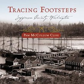
From rich natural resources to free land to hard work and imaginative solutions. This is the story of one small county and what it took to make it strong. Stories of the hopeful, adventurous, opportunistic, and salt of the earth people that have made Jefferson County, Washington what it is today. By following footsteps from the past, starting with the tribes that inhabited this area for thousands of years, to Capt. George Vancouver's exploration in 1792, and on to the early European and east coast settlers, we are able to find the conditions under which decisions were made and actions taken. By unfolding the lives of the people that made it happen, it is possible to see more clearly how the richness of today's community was been handed down from those who came before us.
475 pages : illustrations ; 22 cm
Non-circulating [ 1 ]
City of dreams a guide to Port Townsend by Peter Simpson, Robin Biffle

City of Dreams: A Guide to Port Townsend, edited by Peter Simpson in collaboration with Robin Biffle and other local writers, is a 1986 regional history and cultural guide published by Bay Press. The book explores the vibrant heritage of this prominent Olympic Peninsula seaport, famously nicknamed the "City of Dreams" due to early pioneer speculation that it would become the largest harbor on the West Coast. Blending local history, architectural appreciation, and community lore, the volume chronicles Port Townsend's boom-and-bust economic cycles, its preservation of late 19th-century Victorian architecture, and its enduring maritime traditions. Ultimately, it serves as an engaging and comprehensive resource for understanding the historical forces and distinct cultural identity that shaped one of Washington's most picturesque and architecturally significant coastal cities.
330 pages : illustrations, maps ; 24 cm
Non-circulating [ 1 ]
Port Townsend--years that are gone an illustrated history by Peter Simpson, James Hermanson
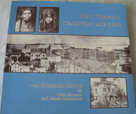
Port Townsend—Years That Are Gone provides a visual and historical chronicle of a maritime boomtown strategically situated at the extreme northeastern tip of Washington’s Olympic Peninsula. The authors detail how the city's exposed location at the turbulent junction of the Strait of Juan de Fuca and Admiralty Inlet dictated its early development, physically dividing the settlement between a bustling deepwater commercial waterfront and a residential district built atop steep coastal bluffs. By examining the ornate Victorian architecture constructed during its prosperous peak, the narrative demonstrates how the town's ultimate geographic isolation—surrounded by marine waterways and backed by rugged mountains—thwarted vital railroad connections and abruptly halted its expansion. Ultimately, the book captures the physical legacy of this unique seaport, mapping its rapid late-nineteenth-century boom and sudden bust directly onto the dramatic coastal topography of the Pacific Northwest.
iii, 192 pages : illustrations ; 21 x 22 cm
Non-circulating [ 1 ]
A brief historical sketch of Port Townsend, Washington by William D. Welsh, Port Townsend Chamber of Commerce, Crown Zellerbach Corporation

William D. Welsh’s A brief historical sketch of Port Townsend, Washington chronicles the dramatic economic arc of a Victorian seaport whose destiny was absolutely dictated by its strategic but isolated marine geography. The narrative maps how the settlement's commanding position on the precipitous northeastern tip of the Olympic Peninsula initially guaranteed immense prosperity, allowing it to monopolize early pioneer commerce as the vital deep-water customs gateway bridging the Strait of Juan de Fuca and the inland sea. However, the text illustrates that the very same rugged, heavily timbered topography that framed the harbor ultimately proved fatal to its metropolitan ambitions, as the impenetrable coastal mountains effectively blocked any viable overland connection to the transcontinental railroad. Ultimately, the account demonstrates how this inescapable geographic isolation forced the bypassed maritime hub to adapt to severe continental detachment, permanently tethering its survival to localized timber and paper extraction industries that could leverage the remaining oceanic highway.
24 pages : illustrations (some color), map ; 21 cm
Non-circulating [ 1 ]
Jefferson County
- Adelma Beach
- Beaver Valley
- Bees Mill
- Bridgehaven
- Brinnon
- Camp Discovery
- Chimacum
- Clearwater
- Coyle
- Dabob
- Discovery Bay
- Discovery Junction
- Duckabush
- Eaglemount
- East Quilcene
- Fairmont
- Fort Flagler
- Four Corners
- Gardiner
- Glen Cove
- Hoh
- Irondale
- Kalaloch
- Lackawanna Beach
- Leland
- Marrowstone
- Mats Mats
- Maynard
- McGees (historical)
- Nordland
- Oil City
- Port Discovery
- Port Hadlock
- Port Ludlow
- City of Port Townsend
- Queets
- Quilcene
- Seal Rock
- Shine-Gri-La
- Smith Place
- Swansonville
- Tukey
- Uncas
- Woodmans
Political Boundaries
Last updated: 2025-09-23