City of The Dalles Wasco County, Oregon
Mapped Location
City of The Dalles: The mapped location is an approximation and should not be used for navigation or wayfinding.
Information
General information on City of The Dalles
- Feature Type: Incorporated
Official, historical, colloquial and alternative toponyms for City of The Dalles
A brief list of names that this geographic feature has been named
| Name | Description |
|---|---|
| City of The Dalles | Official |
| The Dalles | Official |
A Selected Bibliography of City of The Dalles, Wasco County, Oregon
A compilation of essential readings detailing the history, geography, and culture of the region.
"Picturesque" frontier the Army's Fort Dalles by Priscilla Knuth
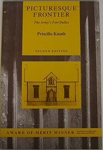
"Picturesque" Frontier: The Army's Fort Dalles by Priscilla Knuth is a detailed 1967 historical monograph, published by the Oregon Historical Society, that examines the mid-19th-century military presence in the Columbia River Gorge. The book chronicles the establishment, architectural evolution, and strategic importance of the Oregon fort during the pioneer era and the region's indigenous conflicts from the late 1840s through the 1860s. Ultimately, it serves as a well-documented look at garrison life and the crucial role this frontier outpost played in the early American settlement of the Pacific Northwest.
ix, 114 pages : illustrations, maps ; 23 cm
Non-circulating [ 1 ]
The name was Olney by Roscoe Sheller

Roscoe Sheller’s The Name Was Olney chronicles the arduous pioneer journey and settlement of Nathan Olney, who established the first permanent non-indigenous trading post at The Dalles in the mid-nineteenth century. The narrative maps the treacherous aquatic geography of the Columbia River Gorge, detailing Olney's perilous descent past the roaring cascades of Celilo Falls on a crude log raft. By focusing on this strategic inland chokepoint—originally the indigenous village of Winquat, meaning "a-place-encircled-by-a-rock"—the book illustrates how the area's formidable basalt topography functioned as the ultimate geographical crossroads for early Pacific Northwest commerce. Ultimately, the text captures the severe physical realities of the Columbia basin, demonstrating how the transition from grueling overland wagon trails to the turbulent, unforgiving currents of the lower Columbia River shaped the region's earliest frontier outposts and indigenous relations.
viii, 171 pages : illustrations, portraits ; 23 cm
Non-circulating [ 1 ]
History of the Columbia River Valley from the Dalles to the sea by Fred Lockley
Authored in 1928 by prominent Oregon journalist and historian Fred Lockley, History of the Columbia River Valley from the Dalles to the Sea is an exhaustive, multi-volume subscription history detailing the commercial and civic maturation of the region's most vital geographic artery. Tracing the lower Columbia corridor's evolution from the era of maritime exploration and the fur trade to the booming industrialization of Portland and Astoria, Lockley leverages his extensive career interviewing early settlers to weave personal pioneer reminiscences into a broader narrative of regional development. Like many commercial histories of its era, the primary historical account is heavily subsidized by subsequent volumes of flattering biographical sketches profiling local merchants, industrialists, and pioneer descendants, serving as a sprawling civic monument to the capitalist triumph of the local elite.
A keen insight drawn from the work is how Lockley’s narrative structurally redefines the Columbia River itself, conceptually transforming it from an ancient, highly complex network of Indigenous civilization and sustenance into a mere logistical conduit for Anglo-American capitalism. By framing the "history" of the river valley almost exclusively around the establishment of trading posts, the advent of steamboat navigation, and the extraction of timber and salmon for global markets, the text actively erases millennia of Chinookan and other Native sovereignties. This historiographical maneuver successfully commodifies the landscape, validating the colonial project by teaching readers that the true destiny of the great river was not to sustain the Indigenous societies that had managed it for centuries, but to serve as a passive, exploitable highway for modern industrial empire.
3 volumes : frontispiece, illustrations, plates, portraits ; 27 cm
ONLINE Circulation [ 1 ]
Wasco County
- City of Antelope
- Bakeoven
- Boyd
- Celilo Village
- Chenoweth
- Cherry Heights
- Clarno
- Criterion (historical)
- Dant
- City of Dufur
- East Maupin
- Emerson
- Endersby
- English (historical)
- Fairbanks
- Friend
- Kingsley
- City of Maupin
- City of Mosier
- Nansene
- Ortley
- Petersburg
- Pine Grove
- Pine Hollow
- Rowena
- City of Shaniko
- Simnasho
- City of The Dalles
- Tygh Valley
- Wamic
- Wapinitia
Political Boundaries
Last updated: 2017-01-18