Wasco County County
When the Territorial Legislature created Wasco County in 1854 from parts of Clackamas, Lane, Linn and Marion Counties, it embraced all of Oregon east of the Cascade Range, most of Idaho and parts of Montana and Wyoming. It was named for the Wasco (or Wascopam) Tribe.
Mapped Location
Wasco County: The mapped location is an approximation and should not be used for navigation or wayfinding.
Information
General information on Wasco County
- Feature Type: County
- County Seat: City of The Dalles
- Established: Wednesday, January 11, 1854
Official, historical, colloquial and alternative toponyms for Wasco County
A brief list of names that this geographic feature has been named
| Name | Description |
|---|---|
| Wasco County | Official |
Related Catalog Titles
A Bibliography for Wasco County, County
Barlow Road by Wasco County Historical Society, Clackamas County Historical Society
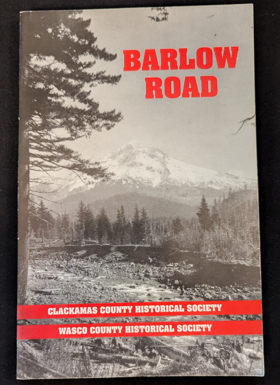
Authored collaboratively by the Wasco County Historical Society and the Clackamas County Historical Society, Barlow Road chronicles the construction and historical legacy of the final, grueling overland leg of the historic Oregon Trail. The book traces how Sam Barlow’s 1845 toll road carved a hazardous wagon route around the treacherous southern flank of Mount Hood, offering exhausted pioneers a perilous alternative to navigating the dangerous rapids of the Columbia River. Through archival maps, journals, and photographs, the text details the monumental physical labor required to hack a wagon track through dense old-growth forests and volcanic terrain. A keen insight drawn from the work is how the creation of the Barlow Road transformed a humanitarian struggle into a capitalist enterprise; by privatizing the final mountain obstacle of the migration route, the toll road proved that the westward movement was driven as much by entrepreneurial toll-gate economics as it was by Manifest Destiny.
vii, 97 pages : illustrations, maps ; 21 cm
CIRC [ 1 ]
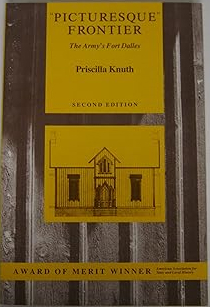
"Picturesque" frontier the Army's Fort Dalles by Priscilla Knuth
Shaniko people by Helen Guyton Rees
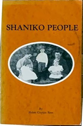
Here you will recapture the Shaniko of pioneer days through the eyes of old-timers who have shared with the author their memories, records and photographs. There are interviews with more than fifty long-time residents, with colorful, firsthand accounts of living at the close of the pioneer period. It is written with folksy insights into the daily lives of the people whose town, for a few years, became a wool empire in the wilderness. Nearly one hundred fifty previously unpublished photos; map and chart locating homes and buildings; comprehensive index. 256 pages.
ix, 245 pages : illustrations ; 23 cm
CIRC [ 1 ]
An illustrated history of central Oregon, embracing Wasco, Sherman, Gilliam, Wheeler, Crook, Lake and Klamath counties, state of Oregon by F. A. Shaver, Arthur P. Rose,Richard F. Steele,A. E. Adams, Western historical publishing company

Published in 1905 by the Western Historical Publishing Company, this extensive volume chronicles the early pioneer settlement and economic development of central and south-central Oregon. A keen insight drawn from the text is how the region's severe geographic isolation—cut off from the coast by the Cascade Mountains and defined by an expansive, arid high desert—forced early settlers to build an exceptionally self-reliant culture that depended heavily on massive livestock operations and fierce competition for scarce water rights. The authors provide comprehensive local histories for Wasco, Sherman, Gilliam, Wheeler, Crook, Lake, and Klamath counties, documenting their gradual transition from rugged frontier outposts into established civic and agricultural centers. Like other regional histories of its era, the narrative ultimately serves as a vital genealogical archive by preserving hundreds of detailed biographical sketches of the resilient ranchers, merchants, and civic leaders who built these foundational communities.
xxx, 1097 pages : plates, portraits ; 31 cm
ONLINE CIRC [ 1 ]
Wasco County
- City of Antelope
- Bakeoven
- Boyd
- Celilo Village
- Chenoweth
- Cherry Heights
- Clarno
- Criterion (historical)
- Dant
- City of Dufur
- East Maupin
- Emerson
- Endersby
- English (historical)
- Fairbanks
- Friend
- Kingsley
- City of Maupin
- City of Mosier
- Nansene
- Ortley
- Petersburg
- Pine Grove
- Pine Hollow
- Rowena
- City of Shaniko
- Simnasho
- City of The Dalles
- Tygh Valley
- Wamic
- Wapinitia
Political Boundaries
Last updated: 2013-01-08