City of Cle Elum Kittitas County, Washington
Mapped Location
City of Cle Elum: The mapped location is an approximation and should not be used for navigation or wayfinding.
Information
General information on City of Cle Elum
- Feature Type: Incorporated
Official, historical, colloquial and alternative toponyms for City of Cle Elum
A brief list of names that this geographic feature has been named
| Name | Description |
|---|---|
| City of Cle Elum | Official |
| Cle Elum | Official |
Origin Notes and History of City of Cle Elum
References to City of Cle Elum that document the origin of its place name

CLE ELUM, a town in Kittitas County. The United States Postal Guide, Geographic Board and Land office maps give the name in two words. Many other maps, however, show the name as Clealum. The lake and river of the same name have been called "Kleallum" Lake and "Samahma" River. (Pacific Railroad Reports, Volume I., pages 210 and 882.) James Tilton's Map of Part of Washington Territory, 1859, shows "Kleattam" Lake. (United States Public Documents, Serial Number 1026.) The several forms of the Indian word are said to mean "swift waters."
Related Catalog Titles
A Bibliography for City of Cle Elum, Kittitas County, Washington
Coal towns in the Cascades a centennial history of Roslyn and Cle Elum, Washington by John C. Shideler
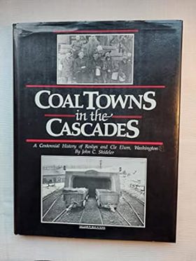
From Coal Mine to Recreational In the early 1880s, the Northern Pacific Railroad discovered coal in Roslyn, Washington. By 1886, mining coal in Roslyn became the company's top priority. The coal mines attracted a diverse workforce from across America and Europe. Each group, along with their hopes and dreams for a better life, brought their own culture, cuisine and customs, many of which are still in evidence today.Coal mining operations ceased in 1963. After more than 63 million tons of coal had been mind from the Roslyn coal field, Roslyn became a town with no industry. Over time, Seattlites, seeking sunny skies and fresh mountain air stimulated an increased demand for recreational property. As people began to discover the great natural beauty of the areas close to Seattle, tourism began to grow. People became enchanted with the area's history and its four-season recreational opportunities.The resort community of Suncadia was created on a 6,300-acre piece of property, southwest of Roslyn, which includes Mines No. 9 and No. 10. Suncadia is owned by subsidiaries of JELD-WEN, PacTrust and Lowe Enterprises. The goal of Suncadia LLC was to develop a four-season destination resort, while preserving the beauty and history of the land. An important component of the resort is the Rope Rider golf course, so named as a tribute to the coal miners, who precariously balanced themselves on the coal cars that maneuvered the steep slopes of the mine shafts. The enduring legacy of the Rope Riders is woven into the design, architecture and personality of the Roper Rider Clubhouse.
[8], 151 pages : illustrations, chart, portraits; 29 cm
CIRC [ 1 ]
Kittitas County
- Beverly Junction
- Boylston
- Bristol
- Cabin Creek
- Cheviot
- City of Cle Elum
- Doris
- Driftwood Acres
- Dutch Settlement
- East Kittitas
- Easton
- Edgemont
- City of Ellensburg
- Hillside Siding
- Holmes
- Horlick
- Hyak
- Kachess Resort
- City of Kittitas
- Lakedale
- Lauderdale Junction
- Lavender
- Levering
- Liberty
- Martin
- Nelson
- Pine Glen
- Regal
- Renslow
- Ronald
- City of Roslyn
- Roza
- Rye
- Scammon Landing
- Snoqualmie Pass
- Town of South Cle Elum
- Teanaway
- Thorp
- Thrall
- Umtanum
- Vantage
- Whittier
- Wymer
Political Boundaries
Last updated: 2017-07-02