Kittitas County County
The county was created on November 24, 1883 when it separated from Yakima County. There are numerous interpretations of the name, which is from the language of the Yakama Nation. According to one source, it "has been said to mean everything from 'white chalk' to 'shale rock' to 'shoal people' to 'land of plenty'. Most anthropologists and historians concede that each interpretation has some validity depending upon the particular dialect spoken."
Mapped Location
Kittitas County: The mapped location is an approximation and should not be used for navigation or wayfinding.
Information
General information on Kittitas County
- Feature Type: County
- County Seat: City of Ellensburg
- Established: Saturday, November 24, 1883
Official, historical, colloquial and alternative toponyms for Kittitas County
A brief list of names that this geographic feature has been named
| Name | Description |
|---|---|
| Kittitas County | Official |
Origin Notes and History of Kittitas County
References to Kittitas County that document the origin of its place name

KITTITAS, the name of a county and town in the central part of the State. The county was established by the Legislature of Washington Territory on November 24, 1883. The name is an Indian word to which have been assigned various meanings. James Mooney is authority for the statement that a small tribe called themselves "K'tatas" and the Yakima name for them was "Pshwanapum." Lewis and Clark had alluded to them as "Shanwappoms." The words meant "shoal" and "shoal people," referring to a shoal in the Yakima River at Ellensburg. (Fourteenth Annual Report of the Bureau of Ethnology, Part II., page 736.) That origin and meaning are repeated in the Handbook of American Indians, (Volume II., page 527.) By another the meaning is said to be "white rock." (M. T. Simmons, Thrall, in Names MSS., Letter 468.) Students in the State Normal School at Ellensburg, in a brief history of the valley, say it was called Kittitas by the Indians because it was their "land of bread," being a favorite region for collecting camas. Wilbur Spencer, an educated son of Chief Spencer, in a letter dated April 28, 1904, says:
"In the summet of 1856 my father was sent from the upper Cascades on the Columbia into the country where Owhi and Kamiken lived. He found several lodges on the south side of the river near where Ellensburg now is. The place was called in the Indian language 'Kittatas' meaning 'clay gravel valley.'"
Related Catalog Titles
A Bibliography for Kittitas County, County
Kittitas County historic photo album by Pediment Publishing
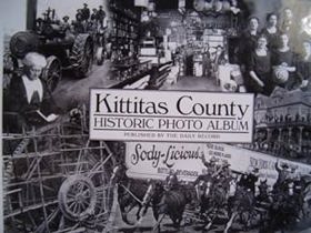
Published by Pediment Publishing in cooperation with regional archives, Kittitas County Historic Photo Album compiles a rich visual chronicle of central Washington's transition from an indigenous homeland and rugged frontier corridor into an organized agricultural and mining hub. The volume showcases rare vintage photographs documenting the rise of towns like Ellensburg, the punishing construction of railroads through mountain passes, and the daily lives of ranchers, homesteaders, and coal miners. Through its expansive visual catalog, the text captures the stark beauty of the high desert and river valleys alongside the relentless human labor required to harness the arid landscape. A keen insight drawn from the work is how photographic collections of inland Washington reveal the profound visual tension between monumental geography and fragile human enterprise; the stark, towering backdrops of the Cascade foothills dwarf the modest wooden storefronts and rail lines, underscoring how precarious early settlement truly was against the vast scale of the high desert.
128 pages : chiefly illustrations ; 20 x 27 cm
CIRC [ 1 ]
Coal towns in the Cascades a centennial history of Roslyn and Cle Elum, Washington by John C. Shideler
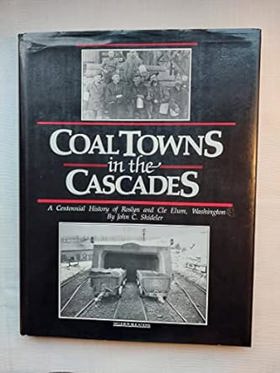
From Coal Mine to Recreational In the early 1880s, the Northern Pacific Railroad discovered coal in Roslyn, Washington. By 1886, mining coal in Roslyn became the company's top priority. The coal mines attracted a diverse workforce from across America and Europe. Each group, along with their hopes and dreams for a better life, brought their own culture, cuisine and customs, many of which are still in evidence today.Coal mining operations ceased in 1963. After more than 63 million tons of coal had been mind from the Roslyn coal field, Roslyn became a town with no industry. Over time, Seattlites, seeking sunny skies and fresh mountain air stimulated an increased demand for recreational property. As people began to discover the great natural beauty of the areas close to Seattle, tourism began to grow. People became enchanted with the area's history and its four-season recreational opportunities.The resort community of Suncadia was created on a 6,300-acre piece of property, southwest of Roslyn, which includes Mines No. 9 and No. 10. Suncadia is owned by subsidiaries of JELD-WEN, PacTrust and Lowe Enterprises. The goal of Suncadia LLC was to develop a four-season destination resort, while preserving the beauty and history of the land. An important component of the resort is the Rope Rider golf course, so named as a tribute to the coal miners, who precariously balanced themselves on the coal cars that maneuvered the steep slopes of the mine shafts. The enduring legacy of the Rope Riders is woven into the design, architecture and personality of the Roper Rider Clubhouse.
[8], 151 pages : illustrations, chart, portraits; 29 cm
CIRC [ 1 ]
Snoqualmie Pass from Indian trail to interstate by Yvonne Prater
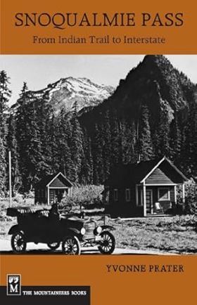
Colorful history of the Washington Cascades pass. Published in conjunction with the Mountains to Sound Greenway Trust.
[8], 167, [1] pages : illustrations, maps, portraits ; 22 cm
CIRC [ 1 ]
Kittitas frontiersmen by Earl T. Glauert , Merle H. Kunze
Passes to the North history of Wenatchee Mountains by Edson Dow
History of the Yakima Valley, Washington; comprising Yakima, Kittitas, and Benton Counties by W. D. Lyman

Authored in 1919 by Whitman College professor William Denison Lyman, History of the Yakima Valley, Washington is an expansive, subscription-based chronicle detailing the rapid agricultural and industrial transformation of the region's arid interior. The multi-volume text traces the development of Yakima, Kittitas, and Benton counties, emphasizing the shift from the violent frontier conflicts of the Yakima War to the systematic implementation of massive irrigation projects that turned sagebrush plains into highly profitable orchards. Heavily subsidized by the inclusion of flattering biographical sketches of prominent local ranchers, politicians, and businessmen, the work serves as a triumphant civic monument celebrating Anglo-American engineering and agrarian capitalism. A keen insight drawn from the work is how the narrative weaponizes the rhetoric of ecological transformation to justify colonial occupation; by framing the irrigation and agricultural cultivation of the valley as the heroic redemption of a "useless" desert, Lyman’s text morally validates the dispossession of the Yakama Nation by equating legitimate land ownership exclusively with capitalist, industrial-scale agricultural productivity.
2 volumes : illustrations, portraits ; 27 cm
ONLINE CIRC [ 2 ]
Kittitas County
- Beverly Junction
- Boylston
- Bristol
- Cabin Creek
- Cheviot
- City of Cle Elum
- Doris
- Driftwood Acres
- Dutch Settlement
- East Kittitas
- Easton
- Edgemont
- City of Ellensburg
- Hillside Siding
- Holmes
- Horlick
- Hyak
- Kachess Resort
- City of Kittitas
- Lakedale
- Lauderdale Junction
- Lavender
- Levering
- Liberty
- Martin
- Nelson
- Pine Glen
- Regal
- Renslow
- Ronald
- City of Roslyn
- Roza
- Rye
- Scammon Landing
- Snoqualmie Pass
- Town of South Cle Elum
- Teanaway
- Thorp
- Thrall
- Umtanum
- Vantage
- Whittier
- Wymer
Political Boundaries
Last updated: 2017-06-29