Clackamas County County
Clackamas County was named for the resident Clackamas Tribe and was one of the four original Oregon counties created in 1843. Oregon City, the county seat, was the first incorporated city west of the Rocky Mountains, the first capital of the Oregon Territory, and the site of the first legislative session.
Mapped Location
Clackamas County: The mapped location is an approximation and should not be used for navigation or wayfinding.
Information
General information on Clackamas County
- Feature Type: County
- County Seat: City of Oregon City
- Established: Wednesday, July 5, 1843
Official, historical, colloquial and alternative toponyms for Clackamas County
A brief list of names that this geographic feature has been named
| Name | Description |
|---|---|
| Clackamas County | Official |
Related Catalog Titles
A Bibliography for Clackamas County, County
Barlow Road by Wasco County Historical Society, Clackamas County Historical Society
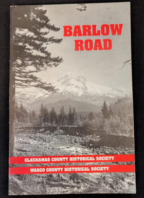
Authored collaboratively by the Wasco County Historical Society and the Clackamas County Historical Society, Barlow Road chronicles the construction and historical legacy of the final, grueling overland leg of the historic Oregon Trail. The book traces how Sam Barlow’s 1845 toll road carved a hazardous wagon route around the treacherous southern flank of Mount Hood, offering exhausted pioneers a perilous alternative to navigating the dangerous rapids of the Columbia River. Through archival maps, journals, and photographs, the text details the monumental physical labor required to hack a wagon track through dense old-growth forests and volcanic terrain. A keen insight drawn from the work is how the creation of the Barlow Road transformed a humanitarian struggle into a capitalist enterprise; by privatizing the final mountain obstacle of the migration route, the toll road proved that the westward movement was driven as much by entrepreneurial toll-gate economics as it was by Manifest Destiny.
vii, 97 pages : illustrations, maps ; 21 cm
CIRC [ 1 ]
Willamette landings, ghost towns of the river by Howard McKinley Corning, Federal Writers' Project (Or)
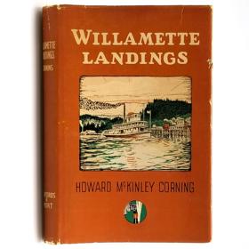
A history of the towns and landings on the Willamette River that were serviced by steamboats prior to the advent of railroads. Includes an index of almost 200 landings, as compiled by Capt. Arthur Riggs in 1940. Howard McKinley Corning (1896-1977) was a poet and historian. During the 1930s he served as an editor and supervisor for the Oregon Writers' Project of the Works Progress Administration, the work for which led to his writing of both this book (1947) and A Dictionary of Oregon History (1956).
vi, 224 pages illustrations 23 cm
CIRC [ 2 ]
Clackamas County historical, 1966-1967 history of Willamette Falls by Clackamas County Historical Society

Clackamas County
- Aims
- Alder Creek
- Ardenwald
- Barton
- Battin
- Beaver Creek
- Bissell
- Boring
- Briarwood
- Brightwood
- Bull Run
- Butte Creek (historical)
- City of Canby
- Carus
- Carver
- Cedardale
- Cedarhurst Park
- Central Point
- Charbonneau
- Cherryville
- Christie (historical)
- Clackamas
- Clackamas Heights
- Clarkes
- Colton
- Concord
- Cottrell
- Currinsville
- City of Damascus
- Damascus Heights
- Deep Creek (historical)
- Dodge
- Dover
- Eagle Creek
- Echo Dell
- Elliott Prairie
- Elwood
- City of Estacada
- Fair Oaks
- Faubion
- Fernwood
- Firwood
- Fishers Corner
- Garfield (historical)
- George
- City of Gladstone
- Glen Avon
- Glen Echo
- Government Camp
- Hamricks Corner
- City of Happy Valley
- Harmony
- Harmony Point
- Henrici
- Highland
- Hillsview
- Holcomb
- Hoodview
- Jean
- Jennings Lodge
- City of Johnson City
- Kelso
- Ladd Hill
- Lake Grove (historical)
- City of Lake Oswego
- Lakewood
- Liberal
- Logan
- Lone Elder
- Macksburg
- Marmot
- Marquam
- Marylhurst
- City of Milwaukie
- Milwaukie Heights
- City of Molalla
- Mount Hood Village
- Mount Pleasant
- Mountain Air Park
- Mulino
- Needy
- New Era
- North Highland
- O'Neil Corners
- Oak Grove
- Oaklawn
- Oatfield
- Old Colton
- City of Oregon City
- Paradise Park
- Park Place
- Redland
- Rhododendron
- Ripplebrook
- City of Rivergrove
- Rosemont
- Rosewood
- Rural Dell
- City of Sandy
- Shadowood
- Shady Dell
- South Lake Oswego
- Springwater
- Stafford
- Stringtown (historical)
- Sunnyside
- Three Lynx
- Timber Grove
- Tracy
- Union Mills
- Upper Highland
- Viola
- Waverly Heights
- Welches
- Wemme
- City of West Linn
- Wildwood
- Wilhoit
- City of Wilsonville
- Yoder
- Zigzag
Political Boundaries
Last updated: 2025-09-23