Cowlitz County County
Cowlitz County was one of the first seven counties established when the Washington Territory was formed on April 21, 1854. Its name derives from the anglicized version of the Cowlitz Indian term, Cow-e-liske, meaning either “river of shifting sands” or “capturing the medicine spirit.”
Mapped Location
Cowlitz County: The mapped location is an approximation and should not be used for navigation or wayfinding.
Information
General information on Cowlitz County
- Feature Type: County
- County Seat: City of Kelso
- Established: Friday, April 21, 1854
Official, historical, colloquial and alternative toponyms for Cowlitz County
A brief list of names that this geographic feature has been named
| Name | Description |
|---|---|
| Cowlitz County | Official |
Origin Notes and History of Cowlitz County
References to Cowlitz County that document the origin of its place name

COWLITZ COUNTY, created by the Territorial Legislature on April 21, 1854. The name was taken from the tribe of Indians or the river of the same name.
COWLITZ RIVER. Of all the geographic uses of the word Cowlitz, the name of the river is oldest and most important. Lewis and Clark, 1803-1806, say the Indians called the river "Coweliske." (Journal, Coues Edition, Volume II., page 698.) Subsequent writers made various attempts at spelling. Dr. W. Fraser Tolmie, 1833, wrote it "Tawallitch." (Washington Historical Quarterly, Volume III., page 233.) The word is said to mean "capturing the medicine spirit," from the fact that the young Indians of the tribe were sent to a small prairie to commune with the spirits to get "medicine" or "power." (Henry C. Sicade to John L. Harris, in Names MSS., Letter 483.) The River's early importance was its use as a highway between the Columbia River and Puget Sound.
Related Catalog Titles
A Bibliography for Cowlitz County, County
An early history of Spirit Lake & the Toutle River Valley by Leland G. Jackson, Trudy Howarth
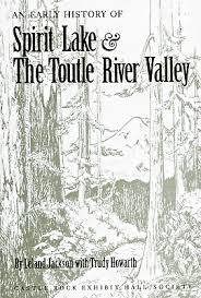
Authored by Leland G. Jackson and Trudy Howarth, An Early History of Spirit Lake & the Toutle River Valley chronicles the pioneer settlement, timber extraction, and rugged recreation that defined the remote wilderness surrounding Mount St. Helens before the 1980 cataclysmic eruption. The book draws on historical photographs, diaries, and local records to document the daring homesteaders, early cabin builders, and resilient loggers who carved out a living in the shadow of the active volcano. Through these preserved vignettes, the text captures the idyllic, rustic era of lakeside resorts and mountain trails that existed prior to the mountain's dramatic reconfiguration. A keen insight drawn from the work is how human history in volcanic zones is defined by a collective, deliberate amnesia regarding natural hazards; by building permanent communities and thriving tourist hubs directly beneath a dormant geological giant, early settlers demonstrated an irrepressible human tendency to mistake temporary mountain stability for a permanent guarantee.
v, 113 pages : illustrations, maps ; 23 cm
CIRC [ 1 ]
Postmarked Washington Lewis and Cowlitz counties by Guy Reed Ramsey, Lewis County Historical Society
Longview, the first fifty years 1923-1973 by Longview Golden Jubilee Committee
Cowlitz corridor by John M. McClelland, Albert Gustav Kletsch

I. First came explorers -- II. Canoe and bateau -- III. Came religion and government -- IV. Terrible road but beautiful -- V. Commerce comes to Cowlitz -- VI. N.P. lays its first rails -- VII. Monticello steamboat enterprise -- VIII. Opening of Kellogg era -- IX. Steamboating in its heyday -- X. Close of steamboat era -- XI. Good roads at last
64 pages : illustrations, map ; 23 cm
ONLINE CIRC [ 1 ]
Longview, the remarkable beginnings of modern western city by John M. McClelland
Cowlitz County, Washington, 1854-1947 by Hattie Barlow Olson
Cowlitz County
- Ariel
- Beacon Hill
- Bunker Hill
- Caples
- Caples Landing
- Carrolls
- City of Castle Rock
- Coal Creek
- Columbia Heights
- Columbia Valley Gardens
- Cougar
- Davis Terrace
- Eufaula
- Eufaula Heights
- Evergreen Terrace
- Harrington Place
- Headquarters
- City of Kalama
- City of Kelso
- Kid Valley
- Lexington
- City of Longview
- Longview Heights
- Longview Junction
- Monticello (historical)
- Oak Point
- Olequa
- Ostrander
- Pigeon Springs
- Pleasant Hill
- Rose Valley
- Ryderwood
- Saint Helens
- Sandy Bend
- Sightly
- Silver Lake
- Stella
- Toutle
- Valley View Tracts
- Vision Acres
- West Kelso
- West Longview
- City of Woodland
- Woodland Park
- Yale
Political Boundaries
Last updated: 2017-06-28