Lewis County County
The county was created on December 19, 1845, by the Provisional Government of Oregon, and originally named after George Vancouver. In 1849 the county was renamed after Meriwether Lewis.
Mapped Location
Lewis County: The mapped location is an approximation and should not be used for navigation or wayfinding.
Information
General information on Lewis County
- Feature Type: County
- County Seat: City of Chehalis
- Established: Friday, December 19, 1845
Official, historical, colloquial and alternative toponyms for Lewis County
A brief list of names that this geographic feature has been named
| Name | Description |
|---|---|
| Lewis County | Official |
Origin Notes and History of Lewis County
References to Lewis County that document the origin of its place name

The naming of counties within the limits of the present state began under the Provisional Government of Oregon with an attempt to name two counties north of the Columbia River in honor of the explorers, Lewis and Clark. The bill for organizing these counties was introduced by Mr. McClure of the committee on districts on the 12th of August, 1845. The bill passed the legislative assembly, but with a rider attached substituting the name Vancouver in place of Lewis and Clark, and defining one district instead of two counties. In this form, it was approved on the 20th and provided that
“All that portion of the Territory of Oregon lying north of the middle of the main channel of the Columbia River, shall be and the same is hereby declared a separate district under the name and style of Vancouver district.”
At the next session of the assembly, attempt was made to eliminate the name Vancouver. On the 18th of December, 1845, Mr. Hill presented a petition praying that the name of Vancouver district be changed to that of Clark and that said district be divided. Later in the day, he presented also two bills; the one to change Vancouver district to that of Clark, the other providing for the creation of a Lewis county. Immediate action was taken upon these bills with the result that upon the following day the bill creating Lewis county was passed, as was also the bill substituting in all cases the word “county” in place of the word “district”; but the bill to change the name of Vancouver district was indefinitely postponed. There were now north of the Columbia River two counties named Lewis and Vancouver. The name Vancouver, however did not grow in favor and on September 3, 1849, it was definitely enacted, “That the name of the county of Vancouver be and hereby changed to Clark.”

LEWIS COUNTY, the second unit of government established north of the Columbia River by the Provisional Government of Oregon, December 21, 1845. It embraced the land west of the Cowlitz River and northward to "fifty-four forty" until the treaty of 1846 limited it to the forty-ninth parallel. The name was an honor for Captain Meriwether Lewis. See Clarke County for further information. (Edmond S. Meany, History of the State of Washington, Appendix I.)
Related Catalog Titles
A Bibliography for Lewis County, County
The land called Lewis a history of Lewis County, Washington by Sandra A. Crowell
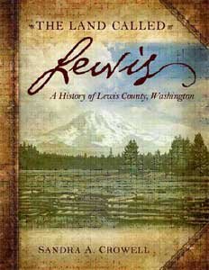
An excellent and comprehensive historical account of Lewis County history, from the first tribes to the closing of the Trans Alta coal mine in 2006. Wonderful historical photographs and fantastic research. A true Lewis County treasure.
204 pages : illustrations, maps ; 29 cm
CIRC [ 1 ]
From homestead to lakebed Kosmos, The Town That Drowned by LaVonne M. Sparkman
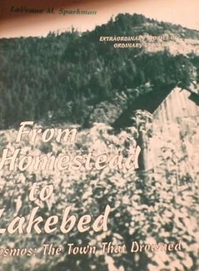
Authored by LaVonne M. Sparkman, From Homestead to Lakebed: Kosmos—The Town that Drowned chronicles the rise and deliberate inundation of Kosmos, a small logging and milling community in Washington State that was wiped off the map to make way for the Mayfield Dam. The book utilizes historical records, photographs, and accounts from former residents to trace how a thriving early-twentieth-century industrial settlement was systematically dismantled, evacuated, and submerged beneath the Cowlitz River. Through these local archives, the text preserves the poignant human cost of hydroelectric progress on rural Pacific Northwest ecosystems and neighborhoods. A keen insight drawn from the work is how corporate and state infrastructure projects treat localized working-class history as entirely disposable collateral; by documenting how a self-sustaining town was erased by utility planning, the narrative underscores how modern energy demands have repeatedly required the literal burial of regional heritage.
viii, 242 pages : illustrations, maps, portraits ; 28 cm
CIRC [ 1 ]
Postmarked Washington Lewis and Cowlitz counties by Guy Reed Ramsey, Lewis County Historical Society
Centralia, the first fifty years, 1845-1900 by Herndon Smith (Compiler), Centralia High School (Wash)
Lewis County
- Adna
- Ajlune
- Alpha
- Alta Vista
- Berry Patch
- Blakeslee Junction
- Boistfort
- Bremer
- Bunker
- Carlson
- City of Centralia
- Ceres
- City of Chehalis
- Cinebar
- Cispus
- Claquato
- Cora
- Cowlitz
- Crego (historical)
- Curtis
- Doty
- Dryad
- Ethel
- Evaline
- Fayette
- Fords Prairie
- Forest
- Galvin
- Glenoma
- Harmony
- Klaber
- Klaus
- Kopiah
- Kosmos (historical)
- Lacamas
- Lindberg (historical)
- Littell
- Marys Corner
- Mayfield
- Mays (historical)
- McCormick
- Meskill
- Millburn
- Mineral
- City of Morton
- City of Mossyrock
- Murnen
- City of Napavine
- Nesika
- Newaukum
- Nulls Crossing
- Onalaska
- Oxley
- Packwood
- Town of Pe Ell
- Phillips
- Randle
- Reynolds (historical)
- Riffe (historical)
- Ruth
- Saint Urban
- Salkum
- Siler
- Silver Brook
- Silver Creek
- Swofford
- City of Toledo
- City of Vader
- Vance (not official)
- Wabash
- Walville
- Wildwood
- Wilson
- City of Winlock
- Winston
Political Boundaries
Last updated: 2017-06-30