Suquamish Kitsap County, Washington
Mapped Location
Suquamish: The mapped location is an approximation and should not be used for navigation or wayfinding.
Information
General information on Suquamish
- Feature Type: Place
Official, historical, colloquial and alternative toponyms for Suquamish
A brief list of names that this geographic feature has been named
| Name | Description |
|---|---|
| Suquamish | Official |
A Selected Bibliography of Suquamish, Kitsap County, Washington
A compilation of essential readings detailing the history, geography, and culture of the region.
Chief Seattle, man of vision by Florence Westover Bond
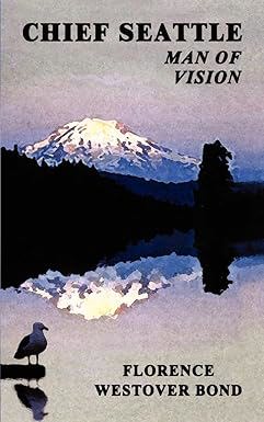
Published in regional biographical editions by Florence Westover Bond, Chief Seattle, Man of Vision explores the life, diplomacy, and complex legacy of the mid-19th-century Duwamish and Suquamish leader whose name became synonymous with the city of Seattle. The book details his strategic efforts to navigate the turbulent arrival of European-American settlers, maintain peace during the devastating conflicts of the 1850s, and protect the sovereign interests of his people amidst aggressive territorial displacement. Drawing on historical records and regional oral traditions, the text contrasts the popular, romanticized myth of the tragic vanishing Indian with the reality of a pragmatic political strategist. A keen insight drawn from the work is how Chief Seattle’s famous, oft-romanticized speech was not a surrender to inevitability, but a brilliant act of long-term rhetorical positioning; by binding the spiritual destiny of the white settlers to the sacred ancestral land of the tribes, he sought to morally obligate the colonizers to respect native memory even as their physical presence was being dismantled.
xiv, 139 pages ; 21 cm
Desiderata
Kitsap County
- Agate Point
- Bainbridge
- Bainbridge Grange
- City of Bainbridge Island
- Bangor
- Banner
- Battle Point
- Bethel
- Breidablick
- City of Bremerton
- Bremerton Junction
- Brownsville
- Burley
- Central Valley
- Charleston
- Chico
- Colby
- Colchester
- Conifer Park
- Country Lane
- Creosote
- Crosby
- Crystal Springs
- Eagledale
- East Bremerton
- East Port Orchard
- Eastwood
- Eglon
- Eldorado Hills
- Enetai
- Erlands Point
- Fairview
- Ferncliff
- Fernwood
- Fletcher Bay
- Fort Ward
- Four Corners
- Fragaria
- Gilberton
- Glenwood
- Gorst
- Hansville
- Harper
- Hawley
- Hintzville
- Hite Center
- Holly
- Huckle Ridge
- Illahee
- Indianola
- Jackson Park
- Johansons Corner
- Kariotis
- Keyport
- Kingston
- Kitsap Lake
- Lawters Beach
- Lemolo
- Lincoln
- Little Boston
- Lofall
- Lynwood Center
- Madrona Heights
- Madrona Point
- Manchester
- Manette
- Manitou Beach
- Manzanita
- Meadowdale
- Naval Depot Junction
- Navy Yard City
- Nellita
- Olalla
- Olympic View
- Orchard Heights
- Parkwood
- Parkwood East
- Pearson
- Point White
- Port Blakely
- Port Gamble
- Port Madison
- City of Port Orchard
- City of Poulsbo
- Retsil
- Rocky Point
- Rollingbay
- Rose Point
- Scandia
- Seabeck
- Seabold
- Sheridan
- Sherman Heights
- Silverdale
- South Beach
- South Colby
- Southworth
- Striebels Corner
- Sunnyslope
- Sunset Farm
- Suquamish
- Tolo
- Tracyton
- Treemont
- Trikkala
- Twin Spits
- Venice
- Vinland
- Virginia
- Warrenville
- Waterman
- Waterman Point
- Wautauga Beach
- West Blakely
- West Port Madison
- Westwood
- Wildcat Lake
- Wildwood
- Yeomalt
Political Boundaries
Last updated: 2015-08-20