Bainbridge Kitsap County, Washington
Mapped Location
Bainbridge: The mapped location is an approximation and should not be used for navigation or wayfinding.
Information
General information on Bainbridge
- Feature Type: Place
Official, historical, colloquial and alternative toponyms for Bainbridge
A brief list of names that this geographic feature has been named
| Name | Description |
|---|---|
| Bainbridge | Official |
A Selected Bibliography of Bainbridge, Kitsap County, Washington
A compilation of essential readings detailing the history, geography, and culture of the region.
Bainbridge landings by Allen Beach
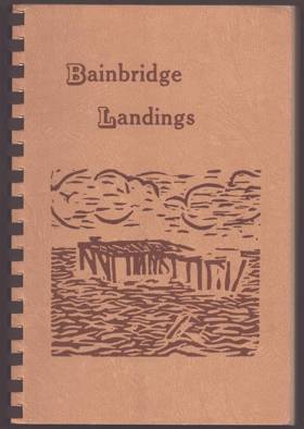
Allen Beach’s Bainbridge Landings chronicles the intimate maritime and pioneer history of Bainbridge Island, an isolated, heavily forested landmass strategically situated in the heart of Washington's Puget Sound. The narrative meticulously maps the island's convoluted, deeply indented shoreline, illustrating how the dense, impassable interior timber forced early settlement to cluster entirely around sheltered estuarine inlets like Eagle Harbor and the deep-water anchorage of Port Blakely. By detailing the massive coastal lumber mills, sprawling shipyards, and the vital daily operations of the "Mosquito Fleet" steamboats that serviced dozens of scattered wooden piers, the book demonstrates how the surrounding tidal waters served as the absolute economic and social lifeline for these disconnected enclaves. Ultimately, the text captures the defining marine geography of this inland island community, highlighting how its physical isolation from the mainland and total reliance on aquatic transit dictated the industrial development and cultural rhythm of the region long before the advent of the modern automobile ferry system.
unpaged.
Non-circulating [ 1 ]
Kitsap County
- Agate Point
- Bainbridge
- Bainbridge Grange
- City of Bainbridge Island
- Bangor
- Banner
- Battle Point
- Bethel
- Breidablick
- City of Bremerton
- Bremerton Junction
- Brownsville
- Burley
- Central Valley
- Charleston
- Chico
- Colby
- Colchester
- Conifer Park
- Country Lane
- Creosote
- Crosby
- Crystal Springs
- Eagledale
- East Bremerton
- East Port Orchard
- Eastwood
- Eglon
- Eldorado Hills
- Enetai
- Erlands Point
- Fairview
- Ferncliff
- Fernwood
- Fletcher Bay
- Fort Ward
- Four Corners
- Fragaria
- Gilberton
- Glenwood
- Gorst
- Hansville
- Harper
- Hawley
- Hintzville
- Hite Center
- Holly
- Huckle Ridge
- Illahee
- Indianola
- Jackson Park
- Johansons Corner
- Kariotis
- Keyport
- Kingston
- Kitsap Lake
- Lawters Beach
- Lemolo
- Lincoln
- Little Boston
- Lofall
- Lynwood Center
- Madrona Heights
- Madrona Point
- Manchester
- Manette
- Manitou Beach
- Manzanita
- Meadowdale
- Naval Depot Junction
- Navy Yard City
- Nellita
- Olalla
- Olympic View
- Orchard Heights
- Parkwood
- Parkwood East
- Pearson
- Point White
- Port Blakely
- Port Gamble
- Port Madison
- City of Port Orchard
- City of Poulsbo
- Retsil
- Rocky Point
- Rollingbay
- Rose Point
- Scandia
- Seabeck
- Seabold
- Sheridan
- Sherman Heights
- Silverdale
- South Beach
- South Colby
- Southworth
- Striebels Corner
- Sunnyslope
- Sunset Farm
- Suquamish
- Tolo
- Tracyton
- Treemont
- Trikkala
- Twin Spits
- Venice
- Vinland
- Virginia
- Warrenville
- Waterman
- Waterman Point
- Wautauga Beach
- West Blakely
- West Port Madison
- Westwood
- Wildcat Lake
- Wildwood
- Yeomalt
Political Boundaries
Last updated: 2016-10-01