Deer Harbor San Juan County, Washington
A group of four Hudson Bay Company hunters, Louis Cayou, Jim Bradshaw, William Moore and Ed Guard, arrived in Deer Harbor one autumn to hunt deer for the winter meat supply. They camped on the Deer Harbor spit where the bridge now crosses the slough. Between 60 to 70 deer were killed during each hunt. The meat was taken back to the post in Victoria in large canoes. They remained on Orcas Island, establishing a small encampment on the inner bay in Deer Harbor where there was plenty of fresh water and grass for grazing animals. In 1858 the name Deer Harbor first officially appeared on British Admiralty charts of the San Juan Islands. By the 1880s, a small community had formed in Deer Harbor, with regular mail service, a school was started, and the first government-installed navigational light appeared at Pole Pass. A kerosene lantern was lit and hung on a post each night.
Mapped Location
Deer Harbor: The mapped location is an approximation and should not be used for navigation or wayfinding.
Information
General information on Deer Harbor
- Feature Type: Place
Official, historical, colloquial and alternative toponyms for Deer Harbor
A brief list of names that this geographic feature has been named
| Name | Description |
|---|---|
| Deer Harbor | Official |
Origin Notes and History of Deer Harbor
References to Deer Harbor that document the origin of its place name

DEER HARBOR, on southwestern shore of Orcas Island, in San Juan County. A town there bears the same name. The name of the harbor first appears on the British Admiralty Chart 2689, Richards, 1858-1859.
Related Catalog Titles
A Bibliography for Deer Harbor, San Juan County, Washington
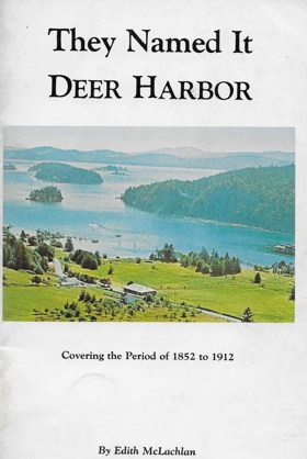
They named it Deer Harbor covering the period of 1852 to 1912 by Edith McLachlan, Washington State Library Rare Publications Collection
San Juan County
- Argyle
- Beach Haven
- Buckhorn
- Camp Orkila
- Decatur
- Deer Harbor
- Doe Bay
- Dolphin
- Eastsound
- Town of Friday Harbor
- Islandale
- Lakedale
- Lopez
- Olga
- Orcas
- Port Stanley
- Prevost
- Richardson
- Roche Harbor
- Rosario
- Sea Acre
- Shaw Island
- Thatcher
- Waldron
- West Beach
- West Sound
- Yacht Haven
Political Boundaries
Last updated: 2025-09-23