San Juan Island Feature
Mapped Location
San Juan Island: The mapped location is an approximation and should not be used for navigation or wayfinding.
Information
General information on San Juan Island
- Feature Type: Feature
Official, historical, colloquial and alternative toponyms for San Juan Island
A brief list of names that this geographic feature has been named
| Name | Description |
|---|---|
| San Juan Island | Official |
Origin Notes and History of San Juan Island
References to San Juan Island that document the origin of its place name

BELLEVUE ISLAND, one of the former names of San Juan Island.
SAN JUAN COUNTY, named for one of the largest islands in Washington Sound, which should be known as San Juan Archipelago. Following the boundary treaty of 1846, a dispute arose between the British and American Governments for the possession of this group of islands, which dispute was settled by Emperor William I., of Germany, as arbitrator on October 21, 1872. On receiving information of that award the Territorial Legislature of Washington organized the archipelago into San Juan County on October 31, 1873.
SAN JUAN ISLAND, the western part of San Juan County, received its name in 1791 from the Spanish explorer Eliza, who realized that there were several islands in the group and wrote on his chart "Isla y Archiepelago de San Juan." (United States Public Documents, Serial No. 1557, chart K.) The Spanish map remained only in manuscript for many years. The Wilkes Expedition, 1841, respected the names given by Vancouver in 1792 but apparently knew nothing of the "San Juan" name. The large island was named "Rodgers" in honor of Commodore John Rodgers who commanded the President in the combat with the Little Belt, which was also commemorated in the attempted naming of the adjacent waterways. See President Channel and Little Belt Passage. The whole group was called "Navy Archipelago," the report saying: "Navy Archipelago is a collection of 25 islands, having the Straits of Fuca on, the south, the Gulf of Georgia on the north, the Canal de Arro on the west and Ringgold's Channel on the east. They have been named from distinguished officers late of the U.S. naval service, viz., Rodgers, Chauncey, Hull, Shaw, Decatur, Jones, Blakeley, Perry, Sinclair, Lawrence, Gordon, Percival, and others." (Hydrography, Volume XXIII., page 306, and Atlas, chart 77,) Captain Henry Kellett, of the Royal Navy, in 1847, restored the Spanish name of San Juan for the island but gave no name for the archipelago. (British Admiralty Chart 1911.) The Hudson's Bay Company gave a local name of "Bellevue" to the island. (Pacific Coast Pilot page 556.) When the United States Coast Survey began work among the islands in 1853, the archipelago was named Washington Sound. (Pacific Coast Pilot, page 556.) The confusion of names for the island is shown by the official charting of "Bellevue or San Juan Island." (United States Coast Survey Report for 1854, chart 51.) The maps by the Surveyor General of Washington Territory for 1857 and 1859 show the same dual names. (United States Public Documents, Serial Nos. 877 and 1026.) Later the American geographers dropped the name "Bellevue" and accepted the Spanish name as restored on the British charts.
Related Catalog Titles
A Bibliography for San Juan Island, Feature
Is it a house? archaeological excavations at English Camp, San Juan Island, Washington by Amanda K. Taylor, Julie K. Stein, Burke Museum of Natural History and Culture
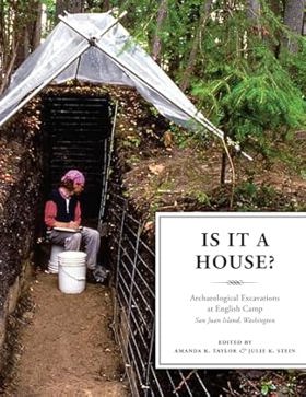
Prehistoric houses on the Northwest Coast were built from wood, often within piles of discarded shells, leaving little archaeological evidence from which to confirm their presence. Is It a House? uses multiple lines of evidence to investigate whether the U-shaped depression surrounded by shells at the English Camp site on San Juan Island was originally a house constructed by native peoples. Each chapter addresses a different kind of evidence, including artifacts, sediment, faunal remains, and stratigraphy. The quantitative and qualitative analyses used to examine the evidence reveal new directions and insights for identifying houses in similar contexts. The editors introduce the research in the context of current and past Gulf of Georgia (Coast Salish) archaeology, and end by synthesizing the research evidence.
x, 170 pages : illustrations, maps ; 28 cm.
CIRC [ 1 ]
The Pig War and other experiences of William Peck soldier 1858-1862, U.S. Army Corps of Engineers : the journal of William A. Peck, Jr. by William A. Peck, C. Brewster Coulter, Bert Webber

Edited by C. Brewster Coulter and Bert Webber, The Pig War and Other Experiences of William Peck, Soldier 1858-1862 presents the remarkable personal journal of a U.S. Army engineer stationed in the Pacific Northwest during a tense geopolitical standoff. The book chronicles Private William A. Peck's daily life, military duties, and keen observations surrounding the infamous 1859 San Juan Island boundary dispute between the United States and Great Britain. Through these rare primary documents, the text captures the stark isolation, raw camp conditions, and quiet diplomacy that characterized an uneasy international borderlands garrison. A keen insight drawn from the work is how military journals humanize imperial brinkmanship; by filtering an international crisis through the mundane daily chores and reflective musings of an ordinary soldier, the narrative reveals that historical flashpoints are often lived not as grand historical dramas, but as tedious, freezing waits in remote wilderness outposts.
x, 236 pages : illustrations, maps ; 21 cm
CIRC [ 1 ]
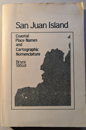
San Juan Island coastal place names and cartographic nomenclature by Bryce Wood, Washington State Historical Society
Last updated: 2025-09-23