Haida Gwaii Feature
Islands - Land area surrounded by water or marsh. Plural of Island. Off NW coast of British Columbia, separated from mainland BC by Hecate Strait, Queen Charlotte Land District
Mapped Location
Haida Gwaii: The mapped location is an approximation and should not be used for navigation or wayfinding.
Information
General information on Haida Gwaii
- Feature Type: Feature
Official, historical, colloquial and alternative toponyms for Haida Gwaii
A brief list of names that this geographic feature has been named
| Name | Description |
|---|---|
| Haida Gwaii | Official |
Origin Notes and History of Haida Gwaii
References to Haida Gwaii that document the origin of its place name
"Queen Charlotte Islands" adopted 15 October 1920 on Ottawa file OBF 0557, as identified on charts from 1790 onward. "Queen Charlotte Islands" and the approved French form "Îles de la Reine-Charlotte" identified as names of pan-Canadian significance per Treasury Board Circular 1983-58, 23 November 1983. Re-named Haida Gwaii per Bill 18: Haida Gwaii Reconciliation Act, which legislation received Royal Assent 3 June 2010.
Xhaaidlagha Gwaayaai is the oldest name, pronounced hy-dah-gah gWHY-eye. The name means "Islands at the Boundary of the World" The spelling is presented as X̱AAYDAG̱A GWAAY.YAAY on the First Peoples Language Map of British Columbia. In the early 1970's the name was restyled as Haida Gwaii ("Islands of the People") by the Haida people.
"The natives of the Queen Charlotte Islands were known as Haidas, which means in their language 'people' - this word is pronounced hada-i by the natives of Masset, and by the Skidegates haidai-gai."
This offshore archipelago, the traditional home of the Haida First Nation, is the largest on the BC coast – 9,596 sq km in area. It consists of hundreds of islands, including Graham and Moresby, the largest in BC after Vancouver Island. Spanish naval officer Juan Perez was the first European to sight the QCI, in 1774 but did not land. The name was applied in 1878 by early British fur trader George Dixon after his vessel, the ‘Queen Charlotte,’ which, in turn, commemorated the wife of England’s King George III. Dixon and Nathaniel Portlock, of the ‘King George,’ spent 1786-87 in the PNW (Pacific Northwest), sponsored by the King George’s Sd Co of London. Dixon was the first European to trade extensively with the Haida. He sailed the length of the west coast of the QCI in 1787, then rounded Cape St James and cruised partway up the east side of the archipelago. The French explorer Lapérouse, in the area in 1786, had suspected the insularity of the QCI; Dixon was sure of it, Neither made a circumnavigation, however, nor did Charles Duncan, in the ‘Princess Royal,’ following year, though he sailed father north in Hecate Straight. The US fur trader Robert Gray, in 1789, called the archipelago Washington’s Island. The Haida people know their homeland as Haida Gwaii ("islands of the people"), and this name is becoming increasingly popular. As BC premier Gordon Campbell said in 2007, “I hear people talk far more about Haida Gwaii today than the Queen Charlotte Islands.” An older Haida name is Xaadala Gwayee (Xhaaydla Gwaayaay), meaning “islands on the boundary between worlds” – the worlds being those of forest, sea, and sky. Another name in popular usage is “Galapagos on the North,” referring to the unique ecology on the QCI, which partly escaped recent glaciation. The village of Queen Charlotte, which if often referred to locally as Queen Charlotte City, takes its name from the QCI, as do the Queen Charlotte Mountains.
The Queen Charlotte Islands have been known by many names – from the old Haida reference of ‘Islands of the People’ to the modern day Misty Isles often affectionately bestowed upon them. The first European name given to them as a group was probably that of James Hanna’s Nova Hibernia in 1786. Hanna had sailed from Macoa that year in the Sea Otter, a brig of barely 60 tons, and traded briefly around the southern shores of the Charlottes. Twelve years previously, in 1774, Juan Perez had named two features, Cape Santa Margarita and the San Christoval Mountains but, since he believed the Islands were part of the mainland continent, he did not give the archipelago a separate designation. On August 3, 1787, Captain George Dixon reported, “This is not one continued land, but rather a group of islands.” In true seafaring tradition he named them for his ship, Queen Charlotte, a British snow of some 200 tons. She was one of two ships sent by The King George Sound Company of British trade in the New World. The other, King George, a larger vessel commanded by Nathaniel Portlock, had accompanied the Queen Charlotte to the west coast of the Islands the autumn before. Find no signs of life during this first visit they left to winter in the Hawaiian Islands. When they returned to the northwest coast the following summer the two ships separated in Prince William Sound, with Dixon sailing his vessel again to the Charlottes and subsequently naming them. Entrepreneur John Meares of Nootka, an ex-British Navy man, head of the fur bonanza Dixon discovered on the Charlottes, but unaware, or uncaring, that Dixon had given the islands a name, Meares called them The Great Island. He despatched one of his ships, ‘Iphigenia’ under Captain Douglas to trade along the shores of The Great Island in August 1788. The following year the Islands received another name when, in June 1789, Captain Robert Gray of the American sloop Lady Washington called them Washington’s Isle. And about this time a map drawn under the direction of Esteban Jose Martinez showed still another name, Isla Infante Don Fernando, a name corrupted to “Elefante” by the man who drew the map. As an omen of the future, perhaps, it was Dixon’s British name Queen Charlotte Islands which became the accepted name.
A Selected Bibliography of Haida Gwaii, Feature
A compilation of essential readings detailing the history, geography, and culture of the region.
Plants of Haida Gwaii = X̲aadaa gwaay gud gina k̲'aws (Skidegate) = X̲aadaa gwaayee guu ginn k̲'aws (Massett) by Nancy J. Turner , Florence Edenshaw Davidson , John Enrico
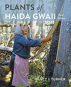
"For many thousands of years the lands and waters of Haida Gwaii have been home to the Haida. Plants of Haida Gwaii, written with the cooperation and collaboration of Haida knowledge holders and botanical experts, is a detailed and insightful record of the traditional uses of over 150 species of native plants. Moreover, it explains the systems of knowledge and understanding that enabled the Haida to use the resources of their islands sustainably from one generation to the next over millennia. The Haida names of these plants indicate their importance, as do the many narratives featuring them. From the ts'uu--massive western red-cedars--of the forests which provide wood used for canoes, house posts, poles and boxes, and bark carefully harvested for weaving mats, baskets and hats, to the ngaal--tough, resilient fronds of giant kelp--used to harvest herring eggs, the botanical species used by the Haida are found from the ocean to the mountain tops, and are as important today as ever before. With over 250 photographs and illustrations, this book is both beautiful and informative."-- Provided by publisher
262 pages : illustrations (some colour), colour maps, portraits (some colour) ; 24 cm
Desiderata
Haida Gwaii journeys through the Queen Charlotte Islands by Ian Gill, David Nunuk

Native artist Bill Reid once called Haida Gwaii, home to the Haida people, the "Shining Islands." This revised edition in Raincoast's popular Journeys series shows why. Known also as "Canada’s Galápagos," these islands are a natural marvel, featuring awesome vistas and a rich ecosystem. The islands also offer more than 400 cultural sites, including the UNESCO World Heritage village of Ninstints. Ian Gill's lively text and David Nunuk's dramatic photographs celebrate this unique, still relatively unspoiled place.
vii, 149 pages : illustrations (chiefly color), map ; 26 cm
Non-circulating [ 1 ]
Haida monumental art villages of the Queen Charlotte Islands by George F. MacDonald, Richard J. Huyda
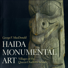
"The Haida of the Queen Charlotte Islands in British Columbia constructed some of the most magnificent houses and erected some of the most beautifully carved totem poles on the Northwest Coast. During the last quarter of the nineteenth century, images of the Haida's immense cedar houses and soaring totem poles were captured, first on glass plates and later on film, by photographers who travelled to then-remote villages such as Masset and Skidegate to marvel at, and record, what they saw there." "Haida Monumental Art ... includes a large number of these remarkable photographs, selected from a collection of over 10,000 original prints and photographic plates. They depict the Haida villages at the height of their glory and record their tragic deterioration only a few decades later. ... By combining archaeology and ethnohistory, George MacDonald presents an integrated framework for understanding the physical structure of a Haida village. He explains how the houses and poles are part of a fascinating web of myth, family history, and Haida cosmology, which provides a unique insight into Haida culture."--Back cover
218 pages : illustrations (some color), maps ; 31 cm
Desiderata
The Queen Charlotte Islands volume 1 ; 1774-1966 by Kathleen E. Dalzell
Kathleen E. Dalzell’s The Queen Charlotte Islands, Volume 1: 1774–1966 serves as a foundational spatial and documentary chronicle of Haida Gwaii, tracing the archipelago’s turbulent transition from an autonomous Indigenous maritime stronghold into a resource-extraction frontier. Drawing heavily on archival logs, pioneer journals, and oral testimonies, Dalzell details how European maritime fur traders, gold seekers, and homesteaders entered a densely organized geography long governed by the Haida nation, whose village sites, cedar reserves, and open-ocean canoe routes spanned the treacherous waters of Hecate Strait and Dixon Entrance. The text documents the systematic superimposition of colonial infrastructure—ranging from early mineral outposts and Anglican mission stations to commercial fish canneries, timber leases, and coastal steamer docks—directly over ancestral Haida town sites such as Masset (Kayung/Atewaas) and Skidegate (Hlgagilda). Dalzell underscores the profound physical isolation of the archipelago, illustrating how early non-Indigenous survival was wholly contingent on interdependent alliances, wage labor, and critical logistical aid from Haida mariners, who provided essential open-water canoe transport, coastal piloting, and food provisions. Ultimately, the history captures the enduring tension between expanding industrial enterprises and an unceded Indigenous marine domain, revealing how twentieth-century logging camps and civic settlements remained physically grounded upon the ancient geographic networks of the islands.
340 pages : illustrations, maps ; 24 cm.
Non-circulating [ 1 ]
The Queen Charlotte Islands volume 2 ; places and names by Kathleen E. Dalzell
Kathleen E. Dalzell’s The Queen Charlotte Islands, Volume 2: Places and Names serves as an exhaustive toponymic gazetteer and spatial record, documenting the linguistic and cartographic superimposition of Euro-American settlement across Haida Gwaii. Functioning as a granular geographical ledger, the volume systematically traces how eighteenth-century naval charts, colonial surveys, and pioneer mining and timber claims assigned British, Spanish, and settler monikers over ancient Haida village sites, hereditary fishing stations, and ancestral canoe passages. Dalzell details the logistics of frontier navigation, illustrating how remote infrastructure—such as isolated lighthouses, steamship landings, copper prospects, and coastal canneries—was anchored to specific sheltered inlets and treacherous tidal passages long mastered by Haida mariners. By cataloging the origins of every inlet, reef, and headland, the work reveals the geographic friction between an imposed imperial cartography and an enduring Indigenous maritime domain, demonstrating that the archipelago’s modern civic map remains an indelible palimpsest built directly upon ancestral Haida geography.
472 pages : illustrations, maps, portraits ; 23 cm
Non-circulating [ 1 ]
Last updated: 2026-10-14