Masset North Coast Regional District, British Columbia
Mapped Location
Masset: The mapped location is an approximation and should not be used for navigation or wayfinding.
Information
General information on Masset
- Feature Type: Place
Official, historical, colloquial and alternative toponyms for Masset
A brief list of names that this geographic feature has been named
| Name | Description |
|---|---|
| Masset | Official |
A Selected Bibliography of Masset, North Coast Regional District, British Columbia
A compilation of essential readings detailing the history, geography, and culture of the region.
Plants of Haida Gwaii = X̲aadaa gwaay gud gina k̲'aws (Skidegate) = X̲aadaa gwaayee guu ginn k̲'aws (Massett) by Nancy J. Turner , Florence Edenshaw Davidson , John Enrico
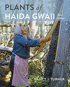
"For many thousands of years the lands and waters of Haida Gwaii have been home to the Haida. Plants of Haida Gwaii, written with the cooperation and collaboration of Haida knowledge holders and botanical experts, is a detailed and insightful record of the traditional uses of over 150 species of native plants. Moreover, it explains the systems of knowledge and understanding that enabled the Haida to use the resources of their islands sustainably from one generation to the next over millennia. The Haida names of these plants indicate their importance, as do the many narratives featuring them. From the ts'uu--massive western red-cedars--of the forests which provide wood used for canoes, house posts, poles and boxes, and bark carefully harvested for weaving mats, baskets and hats, to the ngaal--tough, resilient fronds of giant kelp--used to harvest herring eggs, the botanical species used by the Haida are found from the ocean to the mountain tops, and are as important today as ever before. With over 250 photographs and illustrations, this book is both beautiful and informative."-- Provided by publisher
262 pages : illustrations (some colour), colour maps, portraits (some colour) ; 24 cm
Desiderata
North Coast Regional District
- Alliford Bay
- Chaatl
- Cumshewa
- Dadens
- Delkatla
- Digby Island
- Dodge Cove
- Georgetown Mills
- Haina
- Hartley Bay
- Hippa
- Hunts Inlet
- Jedway
- Juskatla
- Kaisun
- Kitkatla
- Kiusta
- Kung
- Lawnhill
- Lax Kw'alaams
- Lockeport
- Village of Masset
- Masset
- Metlakatla
- Moresby Camp
- New Clew
- Ninstints
- Old Massett
- Oona River
- Osland
- Porcher Island
- Village of Port Clements
- District of Port Edward
- Port Essington
- City of Prince Rupert
- Queen Charlotte
- Village of Queen Charlotte
- Rose Harbour
- Sandspit
- Sewall
- Sewell Inlet
- Shannon Bay
- Skedans
- Skidegate
- Skidegate Landing
- Tanu
- Tasu
- Thurston Harbour
- Tlell
- Yaku
Political Boundaries
Last updated: 2016-08-28