Clark County County
Clark County was the first county to be established in Washington, named after William Clark of the Lewis and Clark Expedition. It was created by the provisional government of Oregon Territory on August 20, 1845, and at that time covered the entire present-day state.
Mapped Location
Clark County: The mapped location is an approximation and should not be used for navigation or wayfinding.
Information
General information on Clark County
- Feature Type: County
- County Seat: City of Vancouver
- Established: Wednesday, August 20, 1845
Official, historical, colloquial and alternative toponyms for Clark County
A brief list of names that this geographic feature has been named
| Name | Description |
|---|---|
| Clark County | Official |
| Vancouver district | Historical · Original name of county from August 20, 1845 to December 18, 1845 |
| Vancouver County | Historical · Official name from December 19, 1845 to September 3, 1849 |
Origin Notes and History of Clark County
References to Clark County that document the origin of its place name
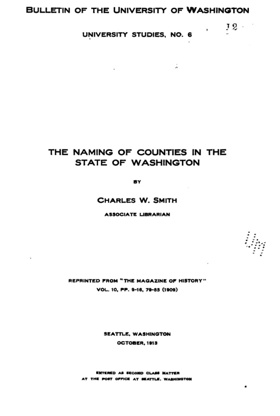
The naming of counties within the limits of the present state began under the Provisional Government of Oregon with an attempt to name two counties north of the Columbia River in honor of the explorers, Lewis and Clark. The bill for organizing these counties was introduced by Mr. McClure of the committee on districts on the 12th of August, 1845. The bill passed the legislative assembly, but with a rider attached substituting the name Vancouver in place of Lewis and Clark, and defining one district instead of two counties. In this form, it was approved on the 20th and provided that
“All that portion of the Territory of Oregon lying north of the middle of the main channel of the Columbia River, shall be and the same is hereby declared a separate district under the name and style of Vancouver district.”
At the next session of the assembly, attempt was made to eliminate the name Vancouver. On the 18th of December, 1845, Mr. Hill presented a petition praying that the name of Vancouver district be changed to that of Clark and that said district be divided. Later in the day, he presented also two bills; the one to change Vancouver district to that of Clark, the other providing for the creation of a Lewis county. Immediate action was taken upon these bills with the result that upon the following day the bill creating Lewis county was passed, as was also the bill substituting in all cases the word “county” in place of the word “district”; but the bill to change the name of Vancouver district was indefinitely postponed. There were now north of the Columbia River two counties named Lewis and Vancouver. The name Vancouver, however did not grow in favor and on September 3, 1849, it was definitely enacted, “That the name of the county of Vancouver be and hereby changed to Clark.”

CLARK COUNTY, oldest county in the State of Washington. It was named in honor of Captain Clark of the Lewis and Clark Expedition of 1803 to 1806. The addition of the letter 'e' to the name has given rise to much inquiry and discussion. The blunder is one of ignorance, but is probably now too deeply embedded in law, literature and custom to be completely corrected. The question was ably discussed by Frederick V. Holman in his presidential address before the Oregon Historical Society, December 18, 1909. (Oregon Historical Quarterly, Volume XI., pages 8-6.) On August 20, 1845, Governor George Abernethy approved a law by the Provisional Legislature of the Territory of Oregon creating Vancouver District out of that part of Oregon lying north of the Columbia River. The same authority, on December 21, 1845, subdivided the vast area by creating the western portion into Lewis County. Vancouver District was then changed to Vancouver County. On September 8, 1849, the Oregon Territorial Legislature passed a law, Section 1 of which briefly enacted "That the name of the county of Vancouver be, and hereby is, changed to Clark." In the law as printed the name is in italics and is without the final e. Washington Territory was created by Act of Congress, dated March 2, 1858. The Oregon Territorial Legislature on January 3, 1854, passed an act to release Clark County from the payment of certain taxes due to the Territory of Oregon. This legal farewell used the name without the final e. The new Territory of Washington began the blunder at once. No law was passed changing the name, but the journals of the first legislative session, 1854, always referred to Clarke County. The first newspapers, such as the Columbian, Pioneer, and Pioneer and Democrat, all used the final e in Clarke County. Territorial laws on mentioning the name of this county used the final e. While attention has often been called to the blunder in late years no effort at legal correction has apparently been made.
A Selected Bibliography of Clark County, County
A compilation of essential readings detailing the history, geography, and culture of the region.
Exploring Fort Vancouver by Douglas Calvin Wilson, Theresa E. Langford
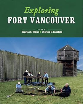
To explore the sweep of human history at Fort Vancouver is to grasp some of the essentials of the North American experience. The fort has been part of the major historical trends of the Pacific Northwest for over 150 years, from the effects of colonialism native peoples to the role of the U.S. Army. Native Americans, traders, homesteaders, and soldiers lived and worked at the fort, their lives interwoven and their stories imbedded in the objects they left behind. Exploring Fort Vancouver uses some of the most intriguing objects from the fort's extensive archaeological and archival collections to tell the history of technology, material culture, globalization, health and diet, and the National Park Service at this significant place.
xii, 116 pages : illustrations (some color), color maps ; 26 cm
Desiderata
Northwest bastion the U.S. Army barracks at Vancouver, 1849-1916 by Ted Van Arsdol, Heritage Trust of Clark County (Wash)
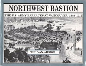
The U.S. Army, obeying the command, arrived May 13, 1849, to establish a military presence north of the Columbia River. The Hudson's Bay Co. moved from the Bastion to Victoria on Vancouver Island and slowly sold or abandoned its holding below the 49th parallel. A new chapter began in American history that year, as the bugle call was heard up and down the Columbia River. The United States extended from "sea to shining sea" and the country began to develop fully its economic, social, and cultural identity. Ch. 1 speaks of the Ninth Regiment stationed at Fort Vancouver and the famous Shanghai drill that was performed daily. The Indian Frontier (1849-1860) is the title of the first chapter. Ch. 2 talks of Volunteers Take Over (1861-1866) because the Civil War was beginning, and an early effect of that war was the removal of most regular Army units. Trained soldiers were required in the East. Some officers resigned and joined the Confede rates. This era at the fort was called the volunteer era. They had to let go of men like Sheridan, Augur, an Ingalls, and a Grant. Ch. 3 is about Pacifying The Natives (1867-1882) and the worry for Indian Tribes in the area. The troops at Vancouver were called out to curb tribes in the surrounding area. By 1882 the last Indian war of the Pacific NW was fought, and transition was under way into a different era. Ch. 4 speaks of Marking Time (1883-1898) because during this time the life of the fort was a round of dinner parties, dances, and theatricals. Ch. 5 is all about preparing troops for overseas duty, hence, Troops For Overseas (1898-1906). They were going "to the front" - artillery troops were leaving for Cuba from Vancouver. And later for the Philippines. Ch. 6 is called, Heading to Armageddon (1907-1916). Germany was exercising an expanding role in Europe at this time. Initially there were no big concerns about building up armed forces. 7 yrs. later this all changed.
xii, 110 pages : illustrations, facsimiles, map ; 22 x 28 cm
Non-circulating [ 1 ]
Vancouver on the Columbia an illustrated history by Ted Van Arsdol, Sheila Guenther, Greater Vancouver Chamber of Commerce (Wash)

Vancouver on the Columbia: An Illustrated History by Ted Van Arsdol, featuring photo research by Sheila Guenther and produced in cooperation with the Greater Vancouver Chamber of Commerce, is a comprehensive 1986 civic history of Washington state's oldest continuously inhabited non-Native settlement. The book chronicles the city's rich evolution from its origins as a prominent Hudson's Bay Company fur-trading outpost and U.S. military garrison (Fort Vancouver) into a modern industrial, shipping, and commercial hub along the Columbia River. Ultimately, enriched by an extensive collection of archival photographs and business profiles, it serves as a highly visual and engaging tribute to the pioneer heritage, economic milestones, and enduring community identity of Vancouver, Washington.
160 pages : illustrations (some color) ; 28 cm
Non-circulating [ 1 ]
Clark County
- Alpine
- Amboy
- Baker
- Barberton
- City of Battle Ground
- Battle Ground West
- Blurock Landing
- Brush Prairie
- Burton
- Burton Homes
- City of Camas
- Cathlapotle (historical)
- Cedarville
- Charter Oak
- Chelatchie
- Cherry Grove
- Crawford
- Creswell Heights
- Dayton
- Dole
- Dollar Corner
- Etna
- Fargher Lake
- Felida
- Fern Prairie
- Fisher
- Five Corners
- Good Hope
- Hall
- Hayes
- Hazel Dell
- Heisson
- Hidden
- Highland
- Hockinson
- Homan
- Image
- Ireland
- King Corner
- Knapp
- Kumtux
- City of La Center
- Lake Shore
- Lakeshore
- Lambert
- Lewisville
- Little Elkhorn
- Livingston
- Lucia
- Manor
- McLoughlin
- Meadow Glade
- Mill Plain
- Minnehaha
- Moulton
- Mount Pleasant
- Mount Vista
- Officers Row
- Orchards
- Parker Landing Light
- Parkersville
- Pine Grove
- Pioneer
- Proebstel
- City of Ridgefield
- Russell Landing
- Rye
- Saint John
- Salmon Creek
- Sara
- Scotton Corner
- Sifton
- Sunnyside
- Union
- City of Vancouver
- Vancouver Junction
- Venersborg
- View
- Walnut Grove
- City of Washougal
- West Pioneer
- Town of Yacolt
Political Boundaries
Last updated: 2017-06-30