Catalog of British Columbiana and Pacific Northwest Americana
Encyclopedia Cascadia Catalog contains book titles of mostly non-fiction Pacific Northwest Coast of North America Titles (primarially British Columbia, Idaho, Oregon and Washington State) in an easy-to-understand title catalog. If you see a link with this badge ONLINE CIRC it means that there is an online institution that provides free access to that title. In some cases there may be more than one institution hosting the title digitally.
| Catalog Title | Published |
|---|---|
|
The Nez Perce Indians and the opening of the Northwest by Alvin M. Josephy 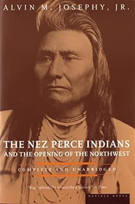
This is the story of the so-called Inland Empire of teh Northwest, that rugged and majestic region bounded east and west by the Cascades and the Rockies, from the time of the great exploration of Lewis and Clark to the tragic defeat of Chief Joseph in 1877. Explorers, fur traders, miner, settlers, missionaries, ranchers and above all a unique succession of Indian chiefs and their tribespeople bring into focus one of the permanently instructive chapters in the history of the American West xx, 705 pages : illustrations, maps ; 23 cm CIRC [ 1 ]
|
1997 |
|
The next tsunami living on a restless coast by Bonnie Henderson 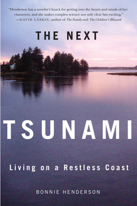
On a March evening in 1964, ten-year-old Tom Horning awoke near midnight to find his yard transformed. A tsunami triggered by Alaska’s momentous Good Friday earthquake had wreaked havoc in his Seaside, Oregon, neighborhood. It was, as far as anyone knew, the Pacific Northwest coast’s first-ever tsunami. More than twenty years passed before geologists discovered that it was neither Seaside’s first nor worst tsunami. In fact, massive tsunamis strike the Pacific coast every few hundred years, triggered not by distant temblors but by huge quakes less than one hundred miles off the Northwest coast. Not until the late 1990s would scientists use evidence like tree rings and centuries-old warehouse records from Japan to fix the date, hour, and magnitude of the Pacific Northwest coast’s last megathrust earthquake: 9 p.m., January 26, 1700, magnitude 9.0—one of the largest quakes the world has known. When the next one strikes—this year or hundreds of years from now—the tsunami it generates is likely to be the most devastating natural disaster in the history of the United States. In The Next Tsunami, Bonnie Henderson shares the stories of scientists like meteorologist Alfred Wegener, who formulated his theory of continental drift while gazing at ice floes calving from Greenland glaciers, and geologist Brian Atwater, who paddled his dented aluminum canoe up muddy coastal streams looking for layers of peat sandwiched among sand and silt. The story begins and ends with Tom Horning, who grew up to be a geologist and return to his family home at the mouth of the river in Seaside—arguably the Northwest community with the most to lose from what scientist Atwater predicts will be an “apocalyptic” disaster. No one in Seaside understands earthquake and tsunami science—and the politics and complicated psychology of living in a tsunami zone—better than Horning. Henderson’s compelling story of how scientists came to understand the Cascadia Subduction Zone and how ordinary people cope with that knowledge is essential reading for anyone interested in the charged intersection of science, human nature, and public policy. 322 pages : illustrations ; 23 cm CIRC [ 0 ]
|
2014 |
|
The New Washington a guide to the Evergreen State by Sperlin, Howard McKinley Corning , Writers' Program (Wash) (Compiler), Washington State Historical Society 
Numerous Reference to Indians in the Index xxx, 687 pages, 64 unnumbered pages of plates : illustrations, maps ; 21 cm CIRC [ 1 ]
|
1950 |
|
The new El Dorado, or, British Columbia by Kinahan Cornwallis, Great Britain Colonial Office Library (Former owner)
A glowing description of British Columbia and its settlement possibilities, written by an Englishman who arrived in Victoria from San Francisco in June 1858 to prospect for Fraser River gold xxviii, 405 pages, 2 unnumbered leaves of plates (1 folded) : illustrations, map ; 20 cm ONLINE CIRC [ 2 ]
|
1858 |
|
The new beachcomber's guide to the Pacific Northwest by J. Duane Sept 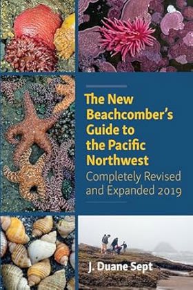
"The Pacific Northwest coast is home to one of the most diverse displays of intertidal marine life in the world. Featuring sponges, clams, snails, crabs, sea stars, sea anemones, jellies, fishes, seaweeds and more, The New Beachcomber's Guide to the Pacific Northwest is a portable and easy-to-use reference for searching out and identifying any of the hundreds of species of seashore life found on the beaches of British Columbia, Washington and Oregon. Covering the Pacific Northwest's most common shoreline-dwelling flora and fauna, each entry contains a detailed description of appearance and habitat accompanied by colour photos for easy identification of any creature you might encounter as you explore your local beach. This guide also provides simple but essential information on tides and the various habitats within the intertidal zones, to assist beachcombers in exploring safely with minimal ecological impact. The Beachcomber's Guide even contains up-to-date descriptions of the best beachcombing sites and when to visit them--you may even find your new favourite exploration grounds! Thoroughly updated and packed with handy and accessible information, this guide belongs in the beach bag or backpack of any avid naturalist, amateur beachcomber or adventurous family."-- Provided by publisher 410 pages : color illustrations ; 23 cm CIRC [ 0 ]
|
2019 |
|
The Nehalem Tillamook an ethnography by Elizabeth Derr Jacobs, William R. Seaburg 
The first book-length ethnography of any Western Oregon native group, The Nehalem Tillamook fills an important gap in what was previously known about southern Northwest Coast native cultures. In 1933 and 1934, Elizabeth Jacobs, advised by her husband, the noted anthropologist Melville Jacobs, conducted fieldwork on the Nehalem Tillamook culture of northwestern Oregon. Working with her extraordinarily able Nehalem Tillamook consultant Clara Pearson, Jacobs recorded extensive ethnographic and folkloric materials that far surpass in quality and quantity the Tillamook research of previous investigators. Jacobs's collaboration with Pearson eventually resulted in the publication of Nehalem Tillamook Tales, an exceptional collection of myths and tales recorded in English. But the companion ethnography was never finished. The Nehalem Tillamook grew from that unfinished manuscript. In consultation with Elizabeth Jacobs, the manuscript was expanded and extensively edited by William Seaburg. After Elizabeth Jacobs's death in 1983, Seaburg added careful annotations and a detailed historical introduction. The result is a remarkable book that makes a major contribution to our understanding of Nehalem Tillamook culture and will be invaluable for drawing comparisons with other Northwest native cultures. xii, 260 pages : illustrations, maps ; 23 cm CIRC [ 0 ]
|
2003 |
|
The Nehalem River valley settling the big timberland by Stella Bellingham Satern 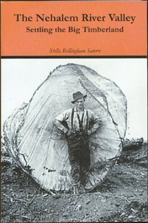
Stories about the pioneers who settled the Oregon wilderness of the Nehalem River valley, from the 1860s through the twentieth century 488 pages : illustrations ; 23 cm CIRC [ 1 ]
|
2005 |
|
The nature of borders salmon, boundaries, and bandits on the Salish Sea by Lissa K. Wadewitz, Center for the Study of the Pacific Northwest 
For centuries, borders have been central to salmon management customs on the Salish Sea, but how those borders were drawn has had very different effects on the Northwest salmon fishery. Native peoples who fished the Salish Sea--which includes Puget Sound in Washington State, the Strait of Georgia in British Columbia, and the Strait of Juan de Fuca--drew social and cultural borders around salmon fishing locations and found ways to administer the resource in a sustainable way. Nineteenth-century Euro-Americans, who drew the Anglo-American border along the forty-ninth parallel, took a very different approach and ignored the salmon's patterns and life cycle. As the canned salmon industry grew and more people moved into the region, class and ethnic relations changed. Soon illegal fishing, broken contracts, and fish piracy were endemic--conditions that contributed to rampant overfishing, social tensions, and international mistrust. The Nature of Borders is about the ecological effects of imposing cultural and political borders on this critical West Coast salmon fishery. This transnational history provides an understanding of the modern Pacific salmon crisis and is particularly instructive as salmon conservation practices increasingly approximate those of the pre-contact Native past. The Nature of Borders reorients borderlands studies toward the Canada-U.S. border and also provides a new view of how borders influenced fishing practices and related management efforts over time. xi, 271 pages, 27 unnumbered pages of plates : illustrations, maps ; 23 cm. CIRC [ 0 ]
|
2012 |
|
The natural history of Washington Territory and Oregon with much relating to Minnesota, Nebraska, Kansas, Utah, and California between the thirty-sixth and forty-ninth parallels of latitude by George Suckley, J. G. Cooper, United States War Department 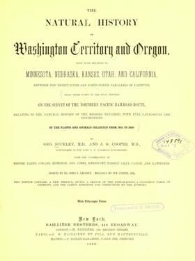
The final reports on the survey of the Northern Pacific Railroad route, relating to the natural history of the regions explored, with full catalogues and descriptions of the plants and animals collected from 1853 to 1860 xvii, 72, 399 pages, 58 unnumbered leaves of plates : illustrations (some color) ; 31 cm ONLINE CIRC [ 1 ]
|
1860 |
|
The natural history of Puget Sound country by Arthur R. Kruckeberg 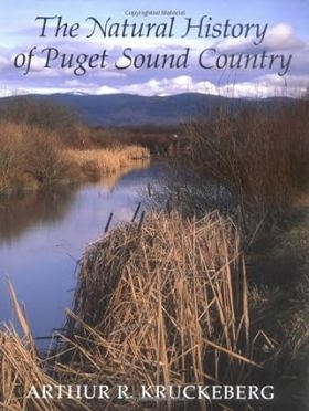
Reveals the natural history of the Puget Sound region. This book begins with a discussion of how the ice ages and vulcanism shaped the land and examines the natural attributes of the region - flora and fauna, climate, special habitats, life histories of key organisms - as they pertain to the ecosystem. It contains over three hundred photographs. Winner of the Pacific Northwest Booksellers Award. Bounded on the east by the crest of the Cascade Range and on the west by the lofty east flank of the Olympic Mountains, Puget Sound terrain includes every imaginable topograhic variety. This thoughtful and eloquent natural history of the Puget Sound region begins with a discussion of how the ice ages and vulcanism shaped the land and then examines the natural attributes of the region―flora and fauna, climate, special habitats, life histories of key organisms―as they pertain to the functioning ecosystem. Mankind's effects upon the natural environment are a pervasive theme of the book. Kruckeberg looks at both positive and negative aspects of human interaction with nature in the Puget basin. By probing the interconnectedness of all natural aspects of one region, Kruckeberg illustrates ecological principles at work and gives us a basis for wise decision-making. The Natural History of Puget Sound Country is a comprehensive reference, invaluable for all citizens of the Northwest, as well as for conservationists, biologists, foresters, fisheries and wildlife personnel, urban planners, and environmental consultants everywhere. Lavishly illustrated with over three hundred photographs and drawings, it is much more than a beautiful book. It is a guide to our future. xxiv, 468 pages : illustrations, maps ; 25 cm CIRC [ 1 ]
|
1998 |
|
The Naming of Counties in the State of Washington by Charles W. Smith
Authored by prominent Pacific Northwest librarian and historian Charles W. Smith, The Naming of Counties in the State of Washington offers a precise etymological and legislative record charting the geopolitical organization of the region. The monograph traces the administrative debates and territorial acts that carved up the regional map, documenting the linguistic origins of each boundary, from early districts retaining Anglicized Indigenous names to those explicitly honoring military generals, presidents, and pioneer politicians. A keen insight drawn from the work is how the seemingly mundane bureaucratic act of naming local geography served as a subtle but permanent mechanism of frontier assimilation; by chronicling how early lawmakers increasingly favored the names of distant federal authorities over local indigenous terminology, the text exposes how achieving statehood required actively overwriting the native landscape with the linguistic markers of American imperial control. 15 pages ; 23 cm. ONLINE CIRC [ 1 ]
|
1913 |
|
The name was Olney by Roscoe Sheller
|
1965 |
|
The Mount Adams country forgotten corner of the Columbia River Gorge by Keith McCoy, David A. James
|
1987 |
|
The most difficult of our camps Vernon Internment Camp, 1914-1920 by Don McNair , Lawrna Myers , Carol Brown , Vivian Elgie , Jerry Thompson , Vernon & District Family History Society (Publisher) 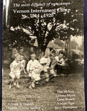
Authored by researchers from the Vernon & District Family History Society, The Most Difficult of Our Camps: Vernon Internment Camp, 1914–1920 presents a comprehensive examination of Canada's First World War internment operations. The volume meticulously documents the experiences of over one thousand "enemy aliens"—including men, women, and children of Austro-Hungarian, German, and Ottoman descent—detained in British Columbia's interior. Utilizing archival photographs, official correspondence, and detailed biographical sketches, the authors illuminate daily life within the camp and its associated regional work projects. Ultimately, the text contributes a vital socio-historical perspective to the broader discourse on state-sponsored detention, civil liberties, and wartime governance in Canada 389 pages : illustrations (some colour), colour maps ; 23 cm CIRC [ 0 ]
|
2022 |
|
The Modoc people by Odie B. Faulk , Henry F. Dobyns , John I. Griffin
|
1976 |
|
The Milwaukee Road revisited by Stanley W. Johnson 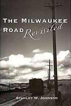
Stanley W. Johnson traces the ways that the Milwaukee Railroad shaped the lives of its employees and their families on its route from Three Forks, Montana, to Spokane, Washington 239 pages : illustrations, map ; 24 cm CIRC [ 0 ]
|
1997 |
|
The mills that built Coos Bay, Oregon and the men who made it happen by William A. Lansing 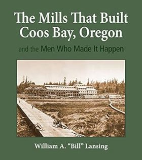
The author states that the purpose of this book is to "identify and describe the scores of mills that populated the shores of Coos Bay from the 1850s to the 1960s; to record how these mills came into existence, then drifted into history; and to tell the stories of the entrepreneurs who made it all happen."--Dust jacket xviii, 574 pages : illustrations (some color), facsimiles, maps (some color) ; 29 cm + 2 maps (color ; 77 x 61 cm and 81 x 61 cm) CIRC [ 0 ]
|
2020 |
|
The mightiest of them all memories of Grand Coulee Dam by Leonhard Vaughn Downs
|
1986 |
|
The Methow Valley between home and heaven by Laura Hurwitz 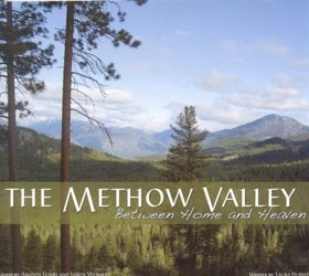
Washington's remote Methow Valley is a wild and extravagantly beautiful place that cradles an amazing diversity of wildlife, topography and people. Residents refer to this land of sparkling rivers, rugged mountains and dramatic seasons as home, while visitors, who flock to the area's unparalleled hiking, skiing, camping and biking, call it heaven. Professional, stunning photography and fluid, informative text highlight this gorgeous photo essay. For the discriminating adventurer and nature lover in everyone. vii, 88 pages : color illustrations ; 20 x 24 cm CIRC [ 1 ]
|
2007 |
|
The Meek Cutoff tracing the Oregon trail's lost wagon train of 1845 by Brooks Geer Ragen 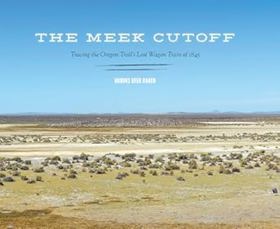
In 1845, an estimated 2,500 emigrants left Independence and St. Joseph, Missouri, for the Willamette Valley in what was soon to become the Oregon Territory. It was general knowledge that the route of the Oregon Trail through the Blue Mountains and down the Columbia River to The Dalles was grueling and dangerous. About 1,200 men, women, and children in over two hundred wagons accepted fur trapper and guide Stephen Meek's offer to lead them on a shortcut across the trackless high desert of eastern Oregon. Those who followed Meek experienced a terrible ordeal when his memory of the terrain apparently failed. Lost for weeks with little or no water and a shortage of food, the Overlanders encountered deep dust, alkali lakes, and steep, rocky terrain. Many became ill and some died in the forty days it took to travel from the Snake River in present-day Idaho to the Deschutes River near Bend, Oregon. Stories persist that children in the group found gold nuggets in a small, dry creek bed along the way. Fom 2006 to 2011, Brooks Ragan and a team of specialists in history, geology, global positioning, metal detecting, and aerial photography spent weeks every spring and summer tracing the Meek Cutoff. They located wagon ruts, gravesites, and other physical evidence from the most difficult part of the trail, from Vale, Oregon, to the upper reaches of the Crooked River and to a location near Redmond where a section of the train reached the Deschutes. The Meek Cutoff moves readers back and forth in time, using surviving journals from members of the 1845 party, detailed day-to-day maps, aerial photographs, and descriptions of the modern-day exploration to document an extraordinary story of the Oregon Trail. xi, 156 pages : illustrations (chiefly color), color maps ; 24 x 29 cm CIRC [ 0 ]
|
2013 |
|
"The McLoughlin Empire and Its Rulers reveals an amazing record of a lower Canada family of Scotch Protestant and Irish Catholic descent, which produced three remarkably astute and successful persons to guide the family destiny to a high point. Dr. John McLoughlin, trained as a physician, became the Chief Factor in the Columbia District of the Hudson's Bay Company, where he ruled a vast empire in the Northwest. Dr. David McLoughlin, his brother, also educated for a medical career, became a highly successful doctor in Paris, and personal physician to King Louis Philippe. Their sister, Marie Louise, as Sister St. Henry, found her success as the leading teacher and Mother Superior of the great Ursuline Monastery in Quebec, where she remained alert to the affairs of her family, educated her nieces, and aided in solving family problems. The story comes to light for the first time, through the discovery of a fascinating file of family correspondence, preserved by the Fraser family, relatives of the McLoughlins on their maternal side. It discloses a hitherto unknown side of the John McLoughlin saga - his personal finances, his children, his land holdings in the lower St. Lawrence River valley, and his prominent kin, both McLoughlin and Fraser. A carefully researched and well documented account is presented by Dr. Barker."--Publisher's description 370 pages illustrations, color coats of arms, facsimiles, genealogical table, 2 maps (1 folded) portraits 25 cm CIRC [ 1 ]
|
1959 |
|
The master love, latitude, longitude & laughter by Jan Ferris Koltun, Ferris family 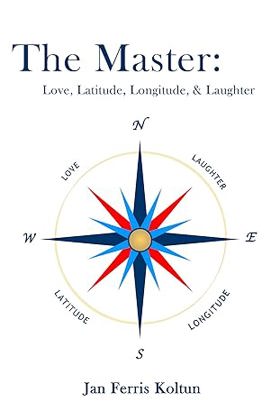
This is about my father's mastery of everything that makes life worthwhile: ships, boats, airplanes, families, oceans, pets, and alcohol. Some of these he managed better than others. A master mariner whose unlimited licenses covered all oceans and any ship's tonnage, he learned to fly airplanes in order to land on docks next to his ship, tamed a kangaroo by playing the organ aboard his vessels, threw good parties and disastrous ones, sailed a 50-foot ketch from Fiji to Juneau, and made "good times" during most of his life, along with a notable failure. He was a Sunset Magazine Chef of the West. He also was a water witch, discovering that he could use dowsing sticks to discover water resources for his community on tiny Orcas Island, off the West Coast, where he treated his friends to cases of Scotch that he dumped overboard in the Strait of Georgia. vi, 131 pages : illustrations, maps ; 23 cm CIRC [ 0 ]
|
2013 |
|
The March of the mounted riflemen first United States military expedition to travel the full length of the Oregon Trail from Fort Leavenworth to Fort Vancouver, May to October, 1849 : as recorded in the journals of Major Osborne Cross and George Gibbs and the official report of Colonel Loring by Osborne Cross, George Gibbs, William Wing Loring, Raymond W. Settle 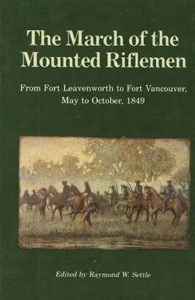
The March Of The Mounted Riflemen, First published in 1940, is important as the only complete record of one of the longest marches ever made 378 pages : illustrations ; 21 cm CIRC [ 1 ]
|
1989 |
|
The mapmaker's eye David Thompson on the Columbia Plateau by Jack Nisbet 
"David Thompson is a hero in Canada, yet has remained largely unknown in the United States. Between 1801 and 1812, this fur trader, explorer, and cartographer established two viable trade routes across the Rocky Mountains in Canada and systematically surveyed the entire 1,250-mile course of the Columbia River. In succeeding years he distilled his mathematical notations from dozens of journal notebooks into the first accurate maps of the northwest quadrant of North America. Information from some of his earlier mapwork was even used by the Lewis and Clark Expedition." xii, 180 pages : illustrations (some color), facsimiles, maps (some color), portraits ; 27 cm CIRC [ 1 ]
|
2005 |
|
The management of small history museums by Carl E. Guthe, American Association for State and Local History
|
1977 |