Catalog of British Columbiana and Pacific Northwest Americana
The Encyclopedia Cascadia Catalog indexes mostly non-fiction literature covering the Pacific Northwest coast of North America, with an emphasis on British Columbia, Idaho, Oregon, and Washington State.
| Catalog Title | Published |
|---|---|
|
Paths to the Northwest a Jesuit history of the Oregon Province by Wilfred P. Schoenberg 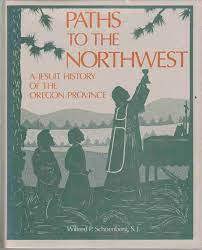
A detailed history of the Oregon Province of the Jesuits from 1831 to 1982. The Oregon Province includes St. Ignatius Mission. Illustrates how the Pacific Northwest Indian missions became a very small part of the Province's business as it grew. The Alaskan Mission and Jesuit educational work occupied most of the Province's resources xiii, 647 pages, 2 unnumbered leaves of plates : illustrations ; 26 cm Non-circulating [ 1 ]
|
1982 |
|
Past the end of the road a North Island boyhood by Michel Drouin 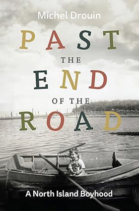
"Past the End of the Road recounts a free-range adolescence in mid-century Port Hardy on northern Vancouver Island, at a time when, with no roads south, the town was only connected to the rest of the island by air and sea and the Union steamship was the main mode of travel to and from the sleepy logging village. Michel Drouin's frank and humorous memoir recounts the freedom of his childhood in midcentury Port Hardy. When he was twelve, Drouin and his friend rowed a small boat from town ten kilometres across the Goletas Channel for a day trip to the Gordon Group of islands, without even bringing water to drink, as neither he or his friend owned a canteen and "plastic water bottles hadn't been invented yet." Drouin's adolescence encompassed hunting, fishing, firewood cutting, and more activities that although common at the time are probably foreign to most Canadian children. Although he ultimately prospered, the wildness of Drouin's youth led to some close calls, such as when the young man accidentally lit himself on fire and he was only able to extinguish himself by running to the beach--"fortunately, the tide was in"--and flinging himself into the ocean."-- Provided by publisher x, 230 pages : illustrations, map ; 22 cm Desiderata
|
2024 |
|
Passes to the North history of Wenatchee Mountains by Edson Dow 
Edson Dow’s Passes to the North provides a detailed pioneer and transit history of the Wenatchee Mountains, a rugged, eastward-reaching spur of the Cascade Range in central Washington. The narrative meticulously maps this formidable alpine topography, which historically formed a massive physical barrier isolating the Kittitas Valley to the south from the fertile Columbia River basin to the north. By detailing the grueling efforts to carve viable overland routes through steep, heavily timbered defiles and treacherous, snow-choked saddles like Colockum and Blewett passes, the book illustrates how early miners, freighters, and cattlemen battled extreme elevations and volatile weather to access the region's remote gold strikes along Swauk Creek. The text highlights how these precarious mountain corridors slowly transitioned from ancient indigenous pathways to crude pioneer toll roads, serving as the essential, if highly dangerous, economic arteries for isolated mining camps and early logging operations. Ultimately, the account captures the defining geographic severity of Washington’s high-elevation interior, demonstrating how mastering these restrictive topographical chokepoints was the absolute prerequisite for resource extraction and the cultural integration of the state's divided inland valleys. 255 pages illustrations 22 cm Non-circulating [ 1 ]
|
1963 |
|
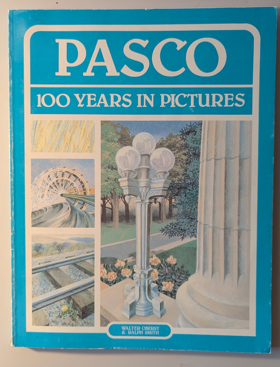
Pasco, 100 years in pictures by Walter Oberst, Ralph Smith
|
1983 |
|
Parallel destinies Canadian-American relations west of the Rockies by John M. Findlay, Kenneth Coates 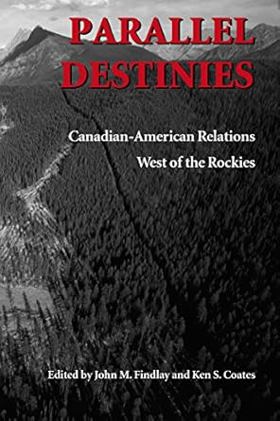
The Canadian West and the American Northwest offer a valuable setting for considering issues of borders and borderlands. The regions contain certain similarities, and during the first half of the nineteenth century they were even grouped together as a distinct political and economic unit, called the "Oregon Country" by Americans and the "Columbia Department" of the Hudson's Bay Company by the British. The essays in this volume -- which grew out of a conference commemorating the Oregon Treaty of 1846 -- view the boundary between Canada and the United States as a dividing line and also as a regional backbone, with people on each side of the border having key experiences and attitudes in common. In their eloquence and scope, they illustrate how historical study of Canadian-American relations in the West calls into question the parameters of the nation-state. The border has not had a single constant meaning; rather, its significance has changed over time and varied from group to group. The essays in Part One concern the movement of peoples and capital across a relatively permeable boundary during the nineteenth century. Many people in this era--especially Natives, miners, immigrants, and capitalists--did not regard the international boundary as particularly important. Part Two considers how the United States and Canada took pains to strengthen and enforce the international boundary during the twentieth century. In this era, the nation-state became more assertive about defining and defending the borderline. Part Three offers considerations of the distinctions, both real and imagined, that emerged during the nineteenth and twentieth centuries between Canada and the United States. Its essays examine different schools of history, divergent ideas toward wilderness, and the influence of anti-Americanism on Canadians' view of national development in North America. xxii, 302 pages : maps ; 24 cm Desiderata
|
2002 |
|
Paradise won the struggle to create Gwaii Haanas National Park Reserve by Elizabeth May 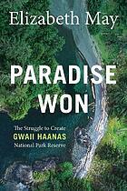
Originally published in 1990, Paradise Won has been updated and details the epic 12-year struggle to stop logging in the unique global ecosystem referred to as “Canada’s Galapagos.” Gwaii Haanas National Park Reserve is located in the southernmost part of Haida Gwaii (formerly known as the Queen Charlotte Islands), 130 kilometres off the mainland of British Columbia, Canada. Gwaii Haanas protects an archipelago of 138 islands in the territory of the Haida people, who have lived in Haida Gwaii for well over 14,000 years. From the 1970s through the early 1980s, plans to expand logging in the area led to the first concerted efforts to protect Gwaii Haanas and – in 1985 – the Haida Nation created the “Haida Heritage Site.” In spite of efforts to protect the landscape, logging continued and resulted in a prolonged legal and political battle. In 1987, logging finally ended when the governments of Canada and British Columbia signed the South Moresby Memorandum of Understanding, which safeguarded the area and permitted shared stewardship, treating the unique marine and terrestrial environments as though they were a national park, though many land claims were still outstanding. This updated edition of Paradise Won includes a new foreword by the author and will bring back into focus this remarkable story of the power and importance of Indigenous rights and how activism can spur average citizens to action in order to fight climate change and protect fragile ecosystems everywhere. 326 pages : color illustrations, map ; 23 cm Desiderata
|
2020 |
|
Panoramas of promise Pacific Northwest cities and towns on nineteenth-century lithographs by John William Reps, David H. Stratton 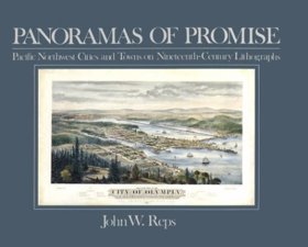
"Beginning with Henry James Warre's view of Oregon City in 1846 and concluding with highly technical panoramas of Seattle and Portland by artists like E. S. Glover and Augustus Koch, John Reps demonstrates what lithographs of Pacific Northwest communities can tell us about the past. The text is illustrated by 44 beautiful, detailed drawings, eight in color. Source: Publisher." -- Google Books viewed August 7, 2020 11 unnumbered preliminary pages, 93 pages : illustrations (some color) ; 21 x 26 cm Non-circulating [ 1 ]
|
1984 |
|
Palouse rails Granger railroads of the inland Northwest by Thomas Hillebrant 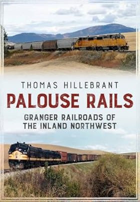
The Palouse region of Eastern Washington and North Idaho produces the highest yields of any wheat-growing district in North America, followed closely by farmlands in the adjoining Walla Walla and Camas Prairie regions. Early farmers clamored for railroads to carry their harvests to world markets, and soon a veritable spider's web of competing rail routes left few corners of the Inland Northwest untouched. Some lines also reached into nearby forests to haul timber to local sawmills and ship out finished lumber. As the principal transporter of people and goods prior to World War II, railroads served an integral role in the communities they served. Despite traffic losses to competing trucks and river barges, railroads still haul considerable grain and wood products tonnage on these lines today. Palouse Rails tells the stories of seven major railroads serving these regions, from their origins to the present day, through the eyes of contemporary railroad photographers. These images capture the railroad equipment, locations, personnel, and operations that, for generations, have connected Inland Northwest's agricultural regions with each other and with the world. 180 pages, 12 unnumbered pages of plates : illustrations (some color) ; 25 cm Desiderata
|
2018 |
|
Painters of the Northwest Impressionism to Modernism, 1900-1930 by John E. Impert 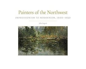
From its sweeping coastlines to its soaring inland mountains, verdant valleys, and volcanoes standing in splendid isolation, the Pacific Northwest has long inspired artists to capture the unique spirit of its varied landscape. Yet the early years of twentieth-century Pacific Northwest painting remain shrouded in mystery. In this groundbreaking work, John Impert introduces readers to the rich and varied array of artists and works of art that defined the region's artistic transition from a nature-bound impressionism to the arrival of modernism. Focusing on nine artists--Paul Morgan Gustin, C. C. McKim, Clyde Keller, J. Edgar Forkner, Clara Jane Stephens, Dorothy Dolph Jensen, Eustace Paul Ziegler, Mark Tobey, and C. S. Price--art historian John Impert organizes his work around the landscapes, people, and city scenes they painted. He identifies the influence of impressionism, in particular the singular way in which each artist's biography, style, and iconography contribute to a distinctive northwestern sensibility. Painters of the Northwest shows us for the first time how a spectacular natural environment, one that conformed aesthetically to nineteenth-century ideals of romanticism and transcendental reverence, combined with an emphasis on subject over style to create a body of work far more concerned with the natural environment than with the socioeconomic issues that occupied city-bound artists of the day. Establishing a chronology, history, and art historical canon for this little-studied place and time, this book is a long-overdue foundational history of early twentieth-century painting in the Pacific Northwest.--Google Books xi, 208 pages : illustrations (chiefly color) ; 23 x 28 cm Desiderata
|
2018 |
|
Painted journeys the art of John Mix Stanley by Peter H. Hassrick , Mindy N. Besaw
"Insightful, deeply informed, and elegantly written, these essays convey the full scope of John Mix Stanley's artistic accomplishment and document the unfolding of that uniquely American vision throughout the artist's colorful life. Together they restore Stanley to his rightful place in the panorama of nineteenth-century American life and art." Provided by Publisher xv, 292 pages : illustrations (chiefly color), color map ; 29 cm. Non-circulating [ 1 ]
|
2015 |
|
Pageant of B.C. glimpses into the romantic development of Canada's far western province by B. A. McKelvie 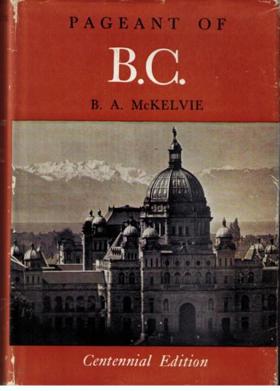
McKelvie's title is too modest: this is in essence a very well researched short history of British Columbia to the end of the nineteenth century, written for the general reader. Its more than 100 short chapters "first appeared in serial form in The Vancouver Daily Province, between February 1953 and March 1955". 263 pages plates (some color), portraits 23 cm Desiderata
|
1955 |
|
Paddlewheels on the frontier the story of B.C.-Yukon sternwheel steamers, volume two by Art Downs
Paddlewheels on the frontier the story of B.C.-Yukon sternwheel steamers, volume two examines the precarious inland maritime transit and remote resource extraction situated across the vast, roadless river systems of northern British Columbia and the Yukon Territory. Downs details how the region's formidable hydro-geography—specifically the shallow, fast-flowing northern river arteries, the treacherous, whitewater rock canyons, and the sprawling, frozen subarctic wilderness—strictly dictated the margins of pioneer logistics, gold rush supply lines, and the highly specialized shallow-draft engineering of the sternwheelers. By mapping the grueling navigation of these formidable inland waterways to sustain deeply isolated mining camps during the brief, ice-free summer months, the narrative highlights how this specific riverine geography anchored the northern frontier's absolute reliance on seasonal steamboat connectivity. Ultimately, this maritime and transportation record serves as a macro-level spatial history, demonstrating how the immense overland isolation, extreme seasonal ice constraints, and vital navigable waterways of this Pacific Northwest and subarctic landscape fundamentally shaped the highly precarious, river-bound character of the B.C.-Yukon frontier. 80p illus Non-circulating [ 1 ]
|
1971 |
|
Pacific voyages the story of sail in the great ocean by Gordon Miller 
"In Western myths and imagination, the Pacific is the home of soft, warm, gentle trade winds, idyllic island lagoons and waving palms--the exotic earthly paradise of escapists, adventurers and romantics. Until James Cook showed otherwise, eighteenth-century Europeans also believed this ocean to contain a great southern continent of untold riches and beauty. The islands of the South Pacific can indeed be enchanting, their charm often exceeding expectations, but as European mariners realized when they first arrived here in the sixteenth century, the Pacific Ocean is also a region of ferocious tropical cyclones, treacherous, reef-littered atolls, wearying doldrums and mind-numbing distances. This book is maritime artist and historian Gordon Miller's tribute to the humble little ships that first ventured across the great Pacific, and the brave sailors that manned them. It is a brief, selective and condensed story of the charting, exploitation and occupation of the Pacific Ocean, mostly in small, wooden ships, with only wind and human muscle for power. These maritime pioneers united North and South America, Australia, New Zealand, the entire Pacific Ocean, all the coasts that surround it, and all the islands within. Even confined to the last four centuries of oceangoing sail, this is a large and complex story--a story brought to life by Miller's carefully researched text and masterfully rendered maritime paintings."-- Provided by publisher xi, 252 pages : illustrations (chiefly color), color maps ; 27 x 30 cm Desiderata
|
2023 |
|
Pacific tugboats by Gordon R. Newell
Gordon R. Newell’s Pacific Tugboats chronicles the grueling industrial mastery of the Pacific seaboard, where a violent and geographically complex marine topography mandated the development of a highly specialized, heavy-duty towing fleet. The narrative maps how the severe environmental realities of the coastal Northwest—characterized by labyrinthine deep-water fjords, treacherous estuarine river bars, and unpredictable, storm-battered straits—frequently paralyzed conventional sail-driven commerce and completely obstructed the aquatic transit of massive inland timber harvests. By detailing the technological evolution from early, vulnerable steam-powered vessels to robust, high-powered diesel tugs, the text illustrates how the expansion of regional industry was strictly dictated by the necessity of deploying these mechanized workhorses to muscle colossal log rafts and guide vulnerable deep-draft freighters through dangerous, tide-ripped marine highways. Ultimately, the account demonstrates that engineering the raw mechanical power necessary to conquer these formidable navigational hazards was the absolute prerequisite for breaching the region's coastal isolation and linking the heavily forested western frontier to the broader global maritime economy. 191 pages illustrations 28 cm Non-circulating [ 1 ]
|
1957 |
|
Pacific steamers by Will Lawson
Detailed history and listing of steam ships in the Pacific, changes in technology, with ships mainly from Australia, New Zealand, United States, and Canada xx, 244 pages, 72 unnumbered leaves of plates : illustrations ; 22 cm Non-circulating [ 1 ]
|
1927 |
|
Pacific seaweeds a guide to common seaweeds of the West Coast by Louis D. Druehl , Bridgette E. Clarkston , Shirarose Wilensky 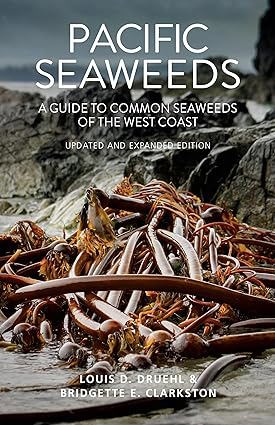
This updated and expanded guide thoroughly documents every aspect of seaweed life, from species identification and seaweed biology to the essential--and often surprising--roles seaweed plays in the marine ecosystem and our everyday lives. Seaweeds are used in everything from cosmetics to sustainable biofuels, and some species, like kelp, contribute to the remediation of coastal ecosystems. Featuring an attractive new full-colour design, the expanded Pacific Seaweeds includes updated species descriptions, dozens of additional colour photos, new species discovered since the original edition, and brand-new sections on common shore plants and the use of DNA techniques to discover, catalog and identify seaweeds. It also features several new recipes and an essay on umami--because in addition to all its other uses, some species of seaweed make delectable food. Packed with illustrations, vivid colour photographs, comprehensive scientific information and further readings, this easy-to-use guidebook will appeal to marine biologists, amateur beachcombers, gourmet foragers and everyone in between. 320 pages : illustrations (some color), map, portrait ; 22 cm Desiderata
|
2016 |
|
Pacific Northwest themes historical essays, in honor of Keith A. Murray by Keith A. Murray, James William Scott , Western Washington University Center for Pacific Northwest Studies (Publisher) 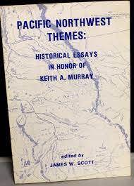
For "Official uses of violence against Northwest Coast Indians in Colonial British Columbia": author undertakes a justification for the use of violence against North West Coast Indians. The use of force to expand the British frontier on the Northwest Coast is noted as a product of British policy, a policy that was put into action when the circumstances warranted. The author referes to this policy as "diplomacy by other means." viii, 138 pages : map, portraits ; 23 cm Non-circulating [ 1 ]
|
1978 |
|
Pacific Northwest lighthouses Oregon to the Aleutians by Bruce Roberts, Ray Jones 
Pacific Northwest Lighthouses pays tribute to the forty-five lifesaving beacons From Coos Bay, Oregon, to Unimark Island in the Aleutians. The lighthouses on the harrowing northwestern coastline of the United States and Canada are memorialized in dramatic tales and glorious photos that evoke the continuing battle between men and sea. Profiles include complete details on directions and visiting hours 88 pages : illustrations (some color) ; 28 cm. Non-circulating [ 1 ]
|
1997 |
|
Pacific Northwest letters of George Gibbs by George Gibbs, Vernon Carstensen
Vernon Carstensen’s edition of the Pacific Northwest Letters of George Gibbs chronicles the rigorous cartographic and scientific subjugation of an aggressively fractured, unmapped territorial expanse spanning from the towering alpine barricades of the northern Rockies to the remote, heavily timbered enclaves of Puget Sound. The narrative maps how the severe environmental realities of this untamed frontier—defined by impenetrable coastal rainforests, volatile riverine valleys, and formidable, snow-choked mountain passes—initially paralyzed large-scale overland migration, forcing early military surveyors and naturalists to endure grueling physical hardships merely to measure and document the sheer scale of the landscape. By detailing Gibbs's arduous deployment alongside the pioneering transcontinental railroad surveys of the 1850s, the text illustrates how the systematic intellectual and scientific cataloging of the region's immense physical obstacles was strictly dictated by the urgent imperial necessity to engineer viable terrestrial transit corridors. Ultimately, the account demonstrates that methodically mapping this forbidding wilderness and calculating the exact topographical vectors required to eventually force mechanized rail networks through sheer granite valleys were the absolute prerequisites for shattering the region's profound continental detachment and incorporating the raw Pacific edge into an expanding industrial state. 52 pages ; 24 cm Non-circulating [ 1 ]
|
1954 |
|
Pacific Northwest cheese a history by Tami J. Parr 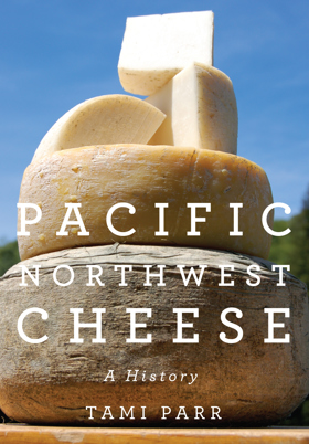
In this rich and engaging history, Tami Parr shows how regional cheesemaking found its way back to the farm. It?s a lively story that begins with the first fur traders in the Pacific Northwest and ends with modern-day small farmers in Oregon, Washington, and Idaho. For years, farmers in the Pacific Northwest made and sold cheese to support themselves, but over time the craft of cheesemaking became a profitable industry and production was consolidated into larger companies and cooperatives. Eventually, few individual cheesemakers were left in the region. In the late sixties and early seventies, influenced by the counterculture and back-to-the-land movements, the number of small farms and cheesemakers began to grow, initiating an artisan cheese renaissance that continues today 208 pages : illustrations ; 26 cm Desiderata
|
2013 |
|
Pacific Northwest Americana, 1949-1974 a supplement to Charles W. Smith's third edition 1950 by Richard E. Moore, Nadine H. Purcell, Charles W. Smith, Pacific Northwest Library Association Committee on the Smith Bibliography Supplement
|
1981 |
|
Pacific Northwest Americana a checklist of books and pamphlets relating to the history of the Pacific Northwest by Charles W. Smith
Compiled in 1921 by University of Washington librarian Charles W. Smith (expanding upon a 1909 preliminary edition), Pacific Northwest Americana: A Checklist of Books and Pamphlets Relating to the History of the Pacific Northwest serves as a foundational bibliography designed to definitively catalog the region's historical literature. Acting as a master inventory for subscribing libraries, historical societies, and private collectors, the extensive checklist standardized the historical canon of Washington, Oregon, Idaho, and British Columbia by organizing thousands of pioneer memoirs, government surveys, and missionary tracts into a cohesive, searchable archive. By establishing the institutional parameters of what constituted legitimate scholarly material, the work effectively built the academic infrastructure for studying the region. A keen insight drawn from the work is how the seemingly neutral, bureaucratic act of archival cataloging functioned as a powerful tool of colonial gatekeeping; by strictly defining regional history as a collection of published, settler-produced texts and government pamphlets, Smith's bibliography institutionalized an academic canon that elevated pioneer narratives to the realm of empirical fact while structurally erasing Indigenous oral histories from the official scholarly record. xi, [1], 329 pages 27 cm ONLINE Circulation [ 2 ] Non-circulating [ 1 ]
|
1921 |
|
Pacific Northwest a brief descriptive list of books with suggested outline of study by Katharine Berry Judson
Katharine Berry Judson’s Pacific Northwest: a brief descriptive list of books with suggested outline of study functions as an early, curated pedagogical guide designed to structure the historical and civic understanding of the region's rapid frontier development. Rather than merely listing titles, her study outline categorizes the chronological waves of maritime exploration, overland migration, and early resource extraction, illustrating how early pioneer infrastructure was systematically mapped over the ancient, established territories and trail networks of indigenous nations. The bibliography highlights essential pioneer memoirs, federal documents, and early civic records that document the profound physical labor, interdependent alliances, and deep community bonds required by isolated homesteaders to establish agricultural and industrial footholds in a formidable landscape. Ultimately, this foundational academic framework served to institutionalize the narrative of Pacific Northwest settlement, providing early scholars and local readers with a comprehensive blueprint for understanding the complex geographic and cooperative social history that built the modern region. 12 pages Desiderata
|
1910 |
|
Pacific graveyard a narrative of shipwrecks where the Columbia River meets the Pacific Ocean by Jim Gibbs 
Man's age-old struggle with the sea comes historically alive in these true stories of shipwrecks off the Oregon and Washington coasts -- all near the mouth of the Columbia River. Dramatic photos of disaster and rescue at sea are placed with the stories they illustrate. Narrative appendix lists all wrecks; pictorial map gives locations. Fourth edition. 5 1/2 x 8 1/2. Highlighted by over 100 superb photos. Index. 304 pages. Companion to "Pacific Graveyard Shipwrecks Chart." 302 pages : illustrations, maps ; 22 cm Non-circulating [ 1 ]
|
1993 |
|
Pacific coast. Coast pilot of California, Oregon, and Washington Territory by United States Coast Survey, George Davidson
Published in 1869 by the United States Coast Survey under the direction of George Davidson, this exhaustive maritime manual provided the first rigorous, scientific hydrographic documentation of the American Pacific seaboard. The guide meticulously details the treacherous coastal geography, hazardous river bars, and nascent lighthouse infrastructure of Oregon and Washington, offering critical navigational instructions for surviving the notoriously deadly Columbia River entrance. A keen insight drawn from the text is how Davidson's exhaustive scientific cartography functioned as essential state-building infrastructure; by mathematically mapping and demystifying the hazardous "Graveyard of the Pacific," the survey directly catalyzed the Pacific Northwest's economic integration into the broader global maritime trade network. 262 pages plates 27 cm ONLINE Circulation [ 1 ]
|
1869 |