Catalog of British Columbiana and Pacific Northwest Americana
Encyclopedia Cascadia Catalog contains book titles of mostly non-fiction Pacific Northwest Coast of North America Titles (primarially British Columbia, Idaho, Oregon and Washington State) in an easy-to-understand title catalog. If you see a link with this badge ONLINE CIRC it means that there is an online institution that provides free access to that title. In some cases there may be more than one institution hosting the title digitally.
| Catalog Title | Published |
|---|---|
|
A history of Oregon, 1792-1849 : drawn from personal observation and authentic information by William Henry Gray 
This work grew out of a series of articles published in the Astoria Marine Gazette, 1865-1866, ref. Pref. "Mr. Gray, a missionary, reached Oregon in 1838. His history has been mercilessly criticized by Hubert Howe Bancroft [no.25] who declares that it would take a work equally as large to correct the mistakes in it" Published in 1870, William Henry Gray’s A History of Oregon, 1792-1849 provides a highly subjective, firsthand account of the territory's early pioneer era, the establishment of Protestant missions, and the contentious formation of the 1843 Provisional Government. Drawing upon his own experiences as a member of the 1836 Whitman missionary party, Gray chronicles the region's development while aggressively championing the American Protestant settlers as the sole heroic founders of the state. A keen insight drawn from the text is how its notorious lack of objectivity transforms the book from a reliable historical record into a fascinating psychological artifact of frontier sectarian paranoia. By conspiratorially blaming the British Hudson’s Bay Company and Catholic missionaries for instigating the tragic 1847 Whitman Massacre, Gray's narrative vividly exposes the intense, deeply ingrained religious and nationalist hostilities that fundamentally shaped early American colonization efforts in the Pacific Northwest. pages 624. frontispiece 8vo ONLINE CIRC [ 1 ]
|
1870 |
|
Washington territory west of the Cascade mountains by Ezra Meeker
Containing a description of Puget Sound, and rivers emptying into it, the Lower Columbia, Shoalwater Bay, Gray's Harbor, Timber, Lands, Climate, Fisheries, Ship Building, Coal Mines, Market Reports, Trade, Labor, Poupluation, Wealth and Resources. 52 pages : tables ; 21 cm ONLINE CIRC [ 1 ]
|
1870 |
|
Pacific coast. Coast pilot of California, Oregon, and Washington Territory by United States Coast Survey, George Davidson
Published in 1869 by the United States Coast Survey under the direction of George Davidson, this exhaustive maritime manual provided the first rigorous, scientific hydrographic documentation of the American Pacific seaboard. The guide meticulously details the treacherous coastal geography, hazardous river bars, and nascent lighthouse infrastructure of Oregon and Washington, offering critical navigational instructions for surviving the notoriously deadly Columbia River entrance. A keen insight drawn from the text is how Davidson's exhaustive scientific cartography functioned as essential state-building infrastructure; by mathematically mapping and demystifying the hazardous "Graveyard of the Pacific," the survey directly catalyzed the Pacific Northwest's economic integration into the broader global maritime trade network. 262 pages plates 27 cm ONLINE CIRC [ 1 ]
|
1869 |
|
A history of the San Juan water boundary question, as affecting the division of territory between Great Britain and the United States by William Fitzwilliam Milton 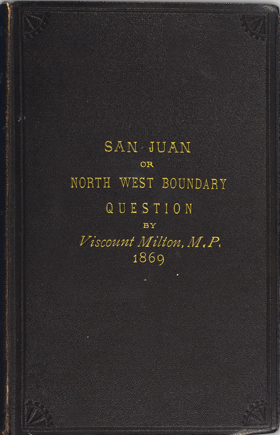
Published in 1869, Viscount William Fitzwilliam Milton’s treatise provides a detailed, staunchly British perspective on the diplomatic stalemate over the San Juan archipelago, a territorial dispute famously ignited by the 1859 "Pig War." The text meticulously dissects the geographic and legal ambiguities of the 1846 Oregon Treaty, which vaguely established the international water boundary through the "middle of the channel" separating Vancouver Island from the mainland. Milton forcefully argues that the boundary must follow the Rosario Strait rather than the Haro Strait, a cartographic interpretation that would have permanently placed San Juan, Lopez, and Orcas islands under the British Crown. A keen insight drawn from the volume is how Milton's exhaustive legal arguments inadvertently reveal the profound anxieties driving British imperial strategy in the Pacific Northwest. By framing the retention of the archipelago not merely as a matter of territorial pride but as an absolute naval necessity to protect the sea lanes to Victoria, the book illustrates how these local island channels and ferry routes briefly became the high-stakes geopolitical linchpin for controlling the entire Puget Sound. 446 pages : 2 folded maps ; 23 cm ONLINE CIRC [ 1 ]
|
1869 |
|
Vancouver Island and British Columbia their history, resources and prospects by Matthew Macfie
Published in London in 1865 after the author's five-year residency in Victoria, Matthew Macfie’s Vancouver Island and British Columbia offers a comprehensive geographical, historical, and economic assessment of the twin Pacific colonies during the transformative Cariboo Gold Rush. A keen insight drawn from the text is how Macfie strategically weaponizes his critique of the monopolistic Hudson's Bay Company, arguing that true imperial prosperity and a robust defense against American expansionism required both the immediate political union of the two colonies and the construction of a transcontinental railway. Functioning as sophisticated promotional literature for prospective British emigrants, the volume meticulously catalogs the region's agricultural, mining, and timber potential while actively minimizing the complex realities of the existing Indigenous and growing Chinese populations. Consequently, the book stands as a quintessential artifact of Victorian colonial boosterism that accurately forecasted the infrastructural and political integration that would ultimately define western Canada. xxi, 574 pages, 2 unnumbered pages, 3 leaves of plates (2 folded) : illustrations, frontispiece, 2 color maps ; 23 cm ONLINE CIRC [ 1 ]
|
1865 |
|
A glance at British Columbia and Vancouver's Island in 1861 by Alfred J. Langley
Published in London in 1862, Alfred J. Langley’s pamphlet A Glance at British Columbia and Vancouver's Island in 1861 serves as a classic piece of colonial booster literature explicitly designed to attract British emigrants and investment to the Pacific Northwest. The text outlines the region's physical geography, favorable climate, and abundant natural resources, with a particular emphasis on the explosive wealth generated by the Cariboo Gold Rush and the availability of agricultural land. It captures a pivotal moment of transition as the British administration actively sought to shift the region away from the monopolistic fur-trade economy of the Hudson's Bay Company toward a permanent, settler-driven society. A keen insight drawn from the publication is how Langley’s promotional rhetoric conceptually maps the rugged frontier strictly through the lens of capitalist extraction, systematically minimizing the existing Indigenous presence in order to aggressively market the region as an "empty" wilderness ripe for immediate white settlement and industrial exploitation. 44 pages ; 19 cm ONLINE CIRC [ 1 ]
|
1862 |
|
Grammar and dictionary of the Yakama language by Charles Marie Pandosy, John Gilmary Shea, George Gibbs
Published in 1862, Grammar and Dictionary of the Yakama Language originated from the field notes of Catholic Oblate missionary Charles Marie Pandosy, whose French manuscript was subsequently translated and edited by federal ethnologist George Gibbs and historian John Gilmary Shea. The volume stands as the first formal linguistic documentation of the Sahaptin language spoken by the Yakama people of eastern Washington, detailing its intricate grammatical syntax alongside a comprehensive bilingual lexicon. A keen insight drawn from the publication is how the collaboration between a proselytizing missionary and a government ethnologist illustrates the profound entanglement of religion and colonial statecraft, demonstrating how linguistic reference materials originally designed to facilitate spiritual assimilation were systematically repurposed by officials like Gibbs to execute federal treaty negotiations and accelerate indigenous displacement. 59 pages ; 26 cm. ONLINE CIRC [ 1 ]
|
1862 |
|
Four years in British Columbia and Vancouver Island an account of their forests, rivers, coasts, gold fields and resources for colonisation by Richard C. Mayne, John Murray (Firm) (Publisher), William Clowes and Sons (Printer), Northern Pacific Railroad Company (Former owner), Northern Transcontinental Survey (Associated name) 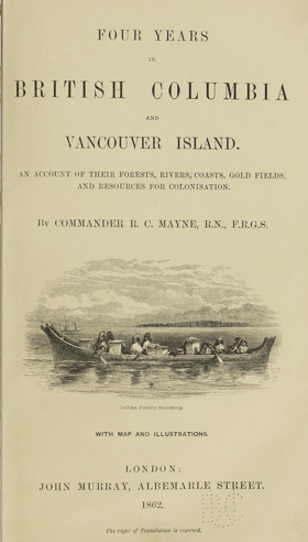
Published in 1862, Royal Navy Commander Richard C. Mayne’s Four Years in British Columbia and Vancouver Island provides a detailed firsthand account of the region's geography, indigenous populations, and natural resources during the height of the Fraser River Gold Rush. Based on his extensive coastal and inland surveying expeditions aboard the HMS Plumper and Hecate, the narrative captures the rapid transformation of the territory from a remote fur-trade outpost into an actively managed British colony. A keen insight drawn from the text is how Mayne's meticulous cartographic and resource-focused observations demonstrate the Royal Navy's crucial role as agents of colonial statecraft, systematically converting a rugged, Indigenous-inhabited landscape into a legible, commodified space designed specifically for imperial investment. Furthermore, the volume's historical provenance as property of the Northern Pacific Railroad Company perfectly illustrates how these early military surveys ultimately functioned as direct strategic blueprints for subsequent corporate and infrastructural expansion across the Pacific Northwest. xi, 468 pages, 20 unnumbered pages of plates + 32 pages publisher's ads : illustrations, maps (1 folded) ; 23 cm ONLINE CIRC [ 1 ]
|
1862 |
|
The natural history of Washington Territory and Oregon with much relating to Minnesota, Nebraska, Kansas, Utah, and California between the thirty-sixth and forty-ninth parallels of latitude by George Suckley, J. G. Cooper, United States War Department 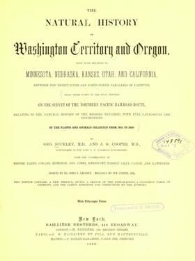
The final reports on the survey of the Northern Pacific Railroad route, relating to the natural history of the regions explored, with full catalogues and descriptions of the plants and animals collected from 1853 to 1860 xvii, 72, 399 pages, 58 unnumbered leaves of plates : illustrations (some color) ; 31 cm ONLINE CIRC [ 1 ]
|
1860 |
|
The new El Dorado, or, British Columbia by Kinahan Cornwallis, Great Britain Colonial Office Library (Former owner)
A glowing description of British Columbia and its settlement possibilities, written by an Englishman who arrived in Victoria from San Francisco in June 1858 to prospect for Fraser River gold xxviii, 405 pages, 2 unnumbered leaves of plates (1 folded) : illustrations, map ; 20 cm ONLINE CIRC [ 2 ]
|
1858 |
|
The Northwest coast, or, Three years' residence in Washington Territory by James Gilchrist Swan
Published in 1857, James Gilchrist Swan's The Northwest Coast provides a vivid, firsthand account of early pioneer life and indigenous culture during his three-year residence around Shoalwater Bay in the Washington Territory. The narrative details the grueling yet lucrative early oyster trade that connected the isolated coastal settlements to San Francisco, while simultaneously offering meticulous records of the daily customs, language, and social structures of the local Chinook and Chehalis tribes. A keen insight drawn from the text is how Swan's approach profoundly contrasted with the era's prevailing settler hostility; rather than viewing Indigenous peoples merely as obstacles to Manifest Destiny, he actively integrated into their communities and learned the Chinook Jargon, rendering his account an exceptionally rare and empathetic ethnographic record of pre-reservation coastal life. Ultimately, the book stands as an indispensable primary source that captures the complex, interdependent, and multicultural reality of the Pacific Northwest frontier before large-scale American colonization fundamentally altered the region. xxiii, 435 pages : illustrations ; 21 cm ONLINE CIRC [ 1 ]
|
1857 |
|
Narrative of a Voyage to the Northwest Coast of America in the Years 1811, 1812, 1813, and 1814 The First American Settlement on the Pacific by Gabriel Franchère, translated by J.V. Huntington
The author, a Canadian, was one of the party sent out by John Jacob Astor to establish his colony at Astoria and he describes the voyage up the Columbia 376 pages, 4 unnumbered leaves of plates + 8 unnumbered pages of publisher's advertisements : frontispiece, illustrations (plates) ; 19 cm ONLINE CIRC [ 1 ]
|
1854 |
|
A narrative of events and difficulties in the colonization of Oregon, and the settlement of California by Hall J Kelley
Published as a bitter retrospective by early American expansionist Hall J. Kelley, this narrative details his obsessive, decades-long crusade to promote the American colonization of the Oregon Country during the 1820s and 1830s. The text chronicles his arduous journey to the Pacific Northwest, his near-fatal experiences in California, and his intense clashes with the British Hudson's Bay Company, whom he accused of actively thwarting his utopian settlement plans. Throughout the volume, Kelley airs his profound grievances against both the British monopoly and the United States government, demanding recognition and financial compensation for his role in sparking the mass migration that eventually secured the territory. A keen insight drawn from the text regarding Oregon is how Kelley's fanaticism highlights the paradoxical nature of early frontier boosterism; while his relentless printed propaganda successfully catalyzed the "Oregon Fever" that ultimately flooded the Willamette Valley with American pioneers, his own lack of pragmatic leadership and profound paranoia rendered him a tragic, marginalized figure in the very colonization movement he helped create. 92 pages ONLINE CIRC [ 1 ]
|
1852 |
|
Oregon and California in 1848 by J. Quinn Thorton
The first book account of the Donner Party. Thornton’s journal of his crossing with the Russell party in 1846 provides details of the Trail and the Donners and Reeds up to the parting of the ways at the Little Sandy. Thornton describes the difficulties he faced taking the Applegate Cutoff to Oregon and excoriated Applegate as a liar for promoting the route. Two years later he traveled to California where he interviewed Donner Party survivors and rescuers including William Eddy and researched accounts previously published in the California newspapers. Thornton’s description of the events set the tone for most of the Donner Party histories to this day. Thornton’s chapters about the Donner Party were excerpted and published as The California Tragedy, Biobooks, 1945, and Camp of Death, Outback Books, 1986 2 volumes : frontispiece, plates, folded map ; 20 cm. ONLINE CIRC [ 2 ]
|
1849 |
|
Colonization of Vancouver's Island by Hudson's Bay Company Ltd. 
"Written to encourage emigrants to obtain land from the Hudson's Bay Company for settlement, the work outlines conditions of land purchase and quotes published sources as to the suitability of Vancouver Island for colonization." -- Lowther, B. J., & Laing, M. (1968). A bibliography of British Columbia: Laying the foundations, 1849-1899. Victoria, BC: University of Victoria, p. 2. 28 pages map 22 cm ONLINE CIRC [ 1 ]
|
1849 |
Four years after Lewis and Clark stimulated American interest in the far western reaches of the continent, John Jacob Astor, a New York businessman, dispatched an overland expedition to establish a fur-trading post on the Columbia River. A second group traveled by sea aboard the Tonquin, among them Alexander Ross, a clerk in Astor's Pacific Fur Company. Adventures of the First Settlers is a vivid account of the expedition and its struggles to establish a successful trading venture. Ross details the Tonquin's dangerous voyage and documents the Astorians' painstaking struggles to clear the land and build a new trading post. Their settlement, Astoria, became the first American outpost on the Pacific Slope. Although the Astorians were aggressive in expanding their presence in the Columbia River country, their enterprise was short-lived. Ross chronicles their competition with the rival North West Company for furs and empire, the colorful and hazardous exploits of the fur trappers, and the eventual transfer of Astoria to the north West Company in the midst of the War of 1812. His detailed descriptions of the Columbia River Indians reveal Ross to be an astute and informed observer. In a new introduction to a book he calls "one of the charter literary documents for the Pacific Northwest," historian William Robbins considers the relationship between exploration, commerce, and empire in the Astorians' experience. An appendix containing a Chinook vocabulary and a table of weather conditions at Astoria in 1811. xv, 352 pages, 1 unnumbered folded leaf of plates + 16 pages advertisements : 1 map ; 19 cm ONLINE CIRC [ 1 ]
|
1849 |
|
Journal of Travels: Over the Oregon Trail in 1845 by Joel Palmer
Provides equipment guidance and comprehensive route information for those crossing the Oregon Trail. The publication also has a general description of the Oregon Country, a detailed description of the Willamette Valley, and includes a copy of the Organic Laws of Oregon adopted by settlers at the Champoeg Meetings [4], iv, 9-189, [3] pages ; 21 cm. ONLINE CIRC [ 1 ] CIRC [ 1 ]
|
1847 |
|
The book covers the period from the early exploration of the region by European explorers to the signing of the Convention of the Escurial in 1846, which settled the territorial dispute between the United States and Great Britain. The book begins by providing an overview of the geography and natural resources of the region, including the Columbia River and its tributaries, the Cascade Mountains, and the fertile Willamette Valley. It then delves into the early exploration and settlement of the territory by Spanish, Russian, and British explorers and traders, as well as the interactions between these groups and the native tribes of the region.The book also covers the territorial dispute between the United States and Great Britain, which began in the early 19th century and was finally resolved by the Convention of the Escurial in 1846. The convention established the 49th parallel as the border between the United States and British North America, and granted the United States control over the Oregon Territory. 264, iv pages + 24 pages publisher's catalogue ; 21 cm ONLINE CIRC [ 1 ]
|
1846 |
|
Narrative of the exploring expedition to the Rocky Mountains in the year 1842 And to Oregon and North California in the years 1843-44 by John C. Fremont
Published together in 1846 for a British readership, these reports of two westward expeditions shed light on the challenges of exploration in nineteenth-century North America. Led by the army officer and future presidential candidate John Charles Frémont (1813-90), who became known as 'the Pathfinder', the first expedition ranged west of the Missouri River, while the second pushed beyond the Rocky Mountains, north to Fort Vancouver and then south into Mexican-held California. Frémont's detailed accounts are accessible to the non-specialist: this edition omits 'only the portions which are altogether astronomical, scientific, and philosophical, and, therefore, not adapted for general utility'. When originally published separately in 1843 and 1845, the narratives enthused a great many Americans, encouraging them to migrate west by providing stirring inspiration, valuable maps and practical information. Frémont's words and deeds remain of interest in the debate surrounding the 'manifest destiny' of the United States. 186 pages ; 24 cm ONLINE CIRC [ 1 ]
|
1846 |
|
The Oregon question by Albert Gallatin
Published in 1846 at the height of the border crisis, Albert Gallatin’s The Oregon Question is a masterful diplomatic treatise advocating for a peaceful resolution to the fierce territorial dispute between the United States and Great Britain. Writing in direct opposition to the aggressive "Fifty-four Forty or Fight" expansionists, the elderly statesman systematically reviewed decades of treaties, geographic surveys, and international law to argue for a pragmatic partition of the Pacific Northwest. A keen insight drawn from the text is how Gallatin effectively weaponized his own unparalleled institutional memory—having personally negotiated the original 1818 joint occupation agreement—to expose the legal frailty of America's maximum territorial claims and demonstrate that a compromise at the 49th parallel was the only sound outcome. Ultimately, this rigorous pamphlet served as a crucial voice of reason that helped defuse jingoistic war fever and provided the exact diplomatic blueprint later adopted in the 1846 Oregon Treaty. 75 pages ; 23 cm ONLINE CIRC [ 1 ]
|
1846 |
|
The Emigrants' guide to Oregon and California by Lansford Warren Hastings
A notorious bit of historical esoterica, this 1845 handbook for travelers heading westward from the civilized United States for the freedom of the wild, unsettled frontier is remembered today mainly for its small role in one of the most horrific stories of the American West: it suggested the untried "shortcut," now known as the Hastings Cutoff, through Utah that led the Donner Party to its dreadful end. Absent the book's footnote position in the history of the West, this would still be a remarkable document of mid-19th-century America and the machinations and politicking that went into the American expansion across the continent. Written and published by Ohio-born lawyer Lansford Warren Hastings (1819-1870), it sets out glowing, idyllic descriptions of the bountiful landscapes of California and Oregon, offering almost irresistible enticements to settlers looking to make a new start. Hastings' motives were less than noble, however: he hoped to establish an independent Republic of California ... with himself as its ruler. He failed in his efforts, but the evidence of his ambition, in the form of this fascinating work, remains must reading for anyone looking for a deeper understanding of what drove the settling of the frontier ONLINE CIRC [ 1 ]
|
1845 |
|
The text is divided into 2 parts, the first presents a concise history of the Oregon territory and an impassioned argument for the United States to lay claim to the region. Part II of the text contains the first person narrative account of Peter H. Burnett (unnamed) of the 1843 emigration. Burnett later became the first civil governor of California. An Appendix on pp. 114-127 contains the diplomatic correspondence, letters, and treaties between Russia, Spain, Great Britain and the United States relevant to Part I. 127 pages, [1] folded leaf : map ; 22 cm ONLINE CIRC [ 1 ]
|
1845 |
|
The following pages are devoted, principally, to the description and history of the portion of North America bordering on the Pacific Ocean, between the 40th and the 54th parallels of latitude, wisich is traversed and in a great iueasure drained, by the River Columbia, and to which the name of OREGON is now usually applied. xviii, 492, 7 pages ONLINE CIRC [ 1 ]
|
1844 |
|
Ten years in Oregon by Daniel Lee, Joseph Frost 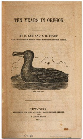
Containing also a brief history of the missions and settlement of the country, origin of the provisional government, number and customs of the Indians, incidents witnessed while traversing and residing in the territory, description of the soil, production and climate of the country. This work details the travels and adventures of Doctor E. White and his wife to the Oregon Territory and the incidents witnessed during their residence, with a brief history of the missions and settlement of the country, origin of the provisional government, number and customs of the Indians, and a description of the soil, production and climate. Excerpts from John Charles Frémont's Narrative Sabin are included. 399 pages : 1 portrait ; 20 cm ONLINE CIRC [ 1 ]
|
1844 |
|
Having been articled to the Hudson's Bay Company, I left my father's home in London, in their ship, the Ganymede, for their settlements on the Pacific. It is needless for me to give any account of our outward voyage (though I met with some strange adventures) to the Sandwich Islands — at which we stopped for a short time ; and thence to the Columbia river. Having arrived at the western head-quarters of the Company — Fort Vancouver ; on the northern shore of the river, ninety miles from its mouth— I was placed in the fort, in the situation of assistant store-keeper. After remaining in the fort nearly a year, I was commissioned to proceed northward, in the company's ships, on trading and exploring expeditions ; threading, in our various courses, the whole of the vast labyrinth of gulphs, sounds, straits, bays, and inlets, that interlace the whole of the Pacific fiuore, for many hundred miles inland, and along many degrees of latitude Viii, 359 P. : Ill., Map ONLINE CIRC [ 1 ]
|
1844 |