Yakima County County
The county was formed out of Ferguson County on January 21, 1865 and is named for Yakama tribe of Native Americans. Ferguson County, no longer in existence, had been created from Walla Walla County on January 23, 1863. Ferguson County, named for Washington legislator James L. Ferguson, was established on January 23, 1863 from Walla Walla County and dissolved on January 18, 1865. Yakima County was established in its place.
Mapped Location
Yakima County: The mapped location is an approximation and should not be used for navigation or wayfinding.
Information
General information on Yakima County
- Feature Type: County
- County Seat: City of Yakima
- Established: Saturday, January 21, 1865
Official, historical, colloquial and alternative toponyms for Yakima County
A brief list of names that this geographic feature has been named
| Name | Description |
|---|---|
| Yakima County | Official |
Origin Notes and History of Yakima County
References to Yakima County that document the origin of its place name

YAKIMA, one of the most extensively used geographic terms in the State of Washington, is applied to a county, city, river, valley, pass in the Cascade Range, Indian tribe and Indian reservation. As in many other cases the name was first applied to the river and the natives who occupied the land drained by the river. Lewis and Clark, 1805-1806, give the name as "Tapteal," which they spell in several ways. Elliott Coues, the scholarly editor of their journals, gives a number of synonyms, such as "Eyakama." (History of Lewis and Clark Expedition, Volume II., page 641 and Volume III., page 973.) John H. Lynch, of Yakima, quotes the pioneer Jack Splawn as authority for "lake water" as the meaning of Yakima. (In Names MSS. Letter 302.) Henry Gannett says the word means "blackbear." (Origin of Certain Place Names in the United States, page 332.) The Bureau of American Ethnology says the word means "runaway" and that the native name for the tribe was "Waptailmim" meaning "people of the narrow river." (Handbook of American Indians, Volume II, pages 983-984.) David Thompson, of the North West Company of Montreal referred to the Indians on July 8, 1811, as "Skaemena." ("Journal," edited by T. C. Elliott, in Oregon Historical Society Quarterly, Volume XV., page 56.) Alexander Ross was with the Astorians, 1811, though his book Adventures of the First Settlers on the Oregon or Columbia River was not published until 1849, in which he uses the name "Eyakema." ("Early Western Travels" edition, Volume VII., page 141.) The Wilkes Expedition, 1841, refers to the river by the name as now spelled. (Narrative, Volume IV., page 428.) The same is true of the railroad explorers in 1853, though they call the upper portion of the river "Yahinse." (Pacific Railroad Reports, Volume I., pages 377-389.) In framing the treaty of June 9, 1855, Governor Isaac I. Stevens referred to the river and tribe as "Yakama." (Charles J. Kappler, Indian Affairs, Volume II., "Treaties," pages 698-702.)
Yakima County was established by an act of the Territorial Legislature approved January 21, 1865. Hubert Howe Bancroft describes an interesting epoch as follows: "Yakima City was incorporated December 1, 1883. Twelve months later, when it had 400 inhabitants, the surveyors of the Northern Pacific railroad laid out the town of North Yakima, four miles distant from the old town, upon a broad and liberal scale, and proposed to the people of the latter that if they would consent to be removed to the new town they should he given as many lots there as they possessed in the old, and have besides their buildings moved upon them without cost to the owners. Such an agreement in writing was signed by a majority of the citizens, and in the winter and spring of 1884-1885 over 100 buildings were moved on trucks and rollers, hotels, a bank, and other business houses doing their usual business en route. This was a good stroke of policy on the part of the railroad, general land commissioner, and the company, as it definitely settled opposition, both to the new town and the corporation, which also received a year's growth for North Yakima in ninety days' time." (Works, Volume XXXI., pages 298-300.) By act of the State Legislature approved January 30, 1917, and to go into effect on January 1, 1918, the city was permitted to drop the word "North" from its name. The same Legislature also changed the name of the older town of Yakima to Union Gap.
Related Catalog Titles
A Bibliography for Yakima County, County
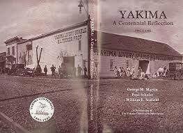
Yakima, a centennial reflection, 1885-1985 by George M. Martin, Paul Schäfer, William E. Scofield, Yakima Centennial Commission
Old Town the story of Union Gap by Maurice Helland
Bugles in the valley Garnett's Fort Simcoe by Heister Dean Guie

Through such rolling hills and prairies, over rocks and across valleys with views of cascade peaks, army troops and indians evaded and confrtoned each other during the Yakima War that brought Fort Simcoe's begining
viii, 196 pages : illustrations ; 23 cm
CIRC [ 1 ]
Magic Valley the story of St. Joseph Academy and the blossoming of Yakima by Ellis Lucia, Sisters of Charity of Providence
Published in 1976, Ellis Lucia’s Magic Valley chronicles the founding of St. Joseph Academy by the Sisters of Providence and its profound influence on the early development of Yakima, Washington. The narrative intertwines the institutional history of this pioneer Catholic school with the broader agricultural and civic expansion of the region. The book offers the keen insight that these frontier nuns functioned as critical civic architects, establishing the essential educational and social infrastructure that allowed a rugged agrarian settlement to successfully "blossom" into a cohesive, enduring community.
48 pages : illustrations, facsimiles ; 21 x 23 cm
CIRC [ 0 ]
History of the Yakima Valley, Washington; comprising Yakima, Kittitas, and Benton Counties by W. D. Lyman
Authored in 1919 by Whitman College professor William Denison Lyman, History of the Yakima Valley, Washington is an expansive, subscription-based chronicle detailing the rapid agricultural and industrial transformation of the region's arid interior. The multi-volume text traces the development of Yakima, Kittitas, and Benton counties, emphasizing the shift from the violent frontier conflicts of the Yakima War to the systematic implementation of massive irrigation projects that turned sagebrush plains into highly profitable orchards. Heavily subsidized by the inclusion of flattering biographical sketches of prominent local ranchers, politicians, and businessmen, the work serves as a triumphant civic monument celebrating Anglo-American engineering and agrarian capitalism. A keen insight drawn from the work is how the narrative weaponizes the rhetoric of ecological transformation to justify colonial occupation; by framing the irrigation and agricultural cultivation of the valley as the heroic redemption of a "useless" desert, Lyman’s text morally validates the dispossession of the Yakama Nation by equating legitimate land ownership exclusively with capitalist, industrial-scale agricultural productivity.
2 volumes : illustrations, portraits ; 27 cm
ONLINE CIRC [ 2 ]
Yakima County
- Ahtanum
- Alfalfa
- American River
- Artesian
- Ashue
- Birchfield
- Blackrock (historical)
- Blacks Corner
- Brace
- Brownstown
- Buena
- Byron
- Cliffdell
- Cougar Valley
- Cowiche
- Donald
- East Selah
- Elliott Ave
- Emerald
- Eschbach
- Farron
- Flint
- Givens Corner
- Gleed
- Goose Prairie
- City of Grandview
- City of Granger
- Gromore
- Town of Harrah
- Harwood
- Holtzinger
- Liberty
- Lichty
- City of Mabton
- Midvale
- City of Moxee
- Town of Naches
- Nass
- Nile
- Outlook
- Parker
- Parrott Crossing
- Pinecliff
- Pomona
- Pomona Heights
- Rimrock
- Rupple
- Satus
- Sawyer
- City of Selah
- Silver Beach
- Summitview
- City of Sunnyside
- Tampico
- Tasker
- Terrace Heights
- City of Tieton
- Tietonview Grange
- City of Toppenish
- City of Union Gap
- Venner
- City of Wapato
- Washington Park
- Weikel
- Wenas
- Wesley Junction
- White Swan
- Wiley City
- Willy Dick Crossing
- City of Yakima
- Yethonat
- City of Zillah
Political Boundaries
Last updated: 2017-06-26