Wahkiakum County County
Wahkiakum County (wuh-Ki-uh-kuhm), the 2nd smallest county in Washington based on population, was created by the territorial legislature out of Cowlitz County on April 25, 1854. The name comes from a Kathlamet Indian village located on the north bank of the Columbia River near the present town of Cathlamet. Chief Wakaiyakam, whose name the village took, is buried in Pioneer Cemetery in Cathlamet. Wahkiakum means "tall timber" in Chinook.
Mapped Location
Wahkiakum County: The mapped location is an approximation and should not be used for navigation or wayfinding.
Information
General information on Wahkiakum County
- Feature Type: County
- County Seat: Town of Cathlamet
- Established: Thursday, April 24, 1845
Official, historical, colloquial and alternative toponyms for Wahkiakum County
A brief list of names that this geographic feature has been named
| Name | Description |
|---|---|
| Wahkiakum County | Official |
| Wakiacum County | Historical |
Origin Notes and History of Wahkiakum County
References to Wahkiakum County that document the origin of its place name

WAHKIAKUM, a county in the southwestern part of the State near the mouth of the Columbia River, derives its name from a tribe of Indians. "Their territory adjoined that of the Chinook and extended upstream toward Oak Point. According to Stuart (1821) they were an offshoot of the Chinook who had separated from the main body about two generations before under Chief Wahkiakum and were afterwards known by his name. In 1805, Lewis and Clark estimated their number at 200. They have been lost sight of as a tribe since about 1850, when Gibbs referred to their chief as almost the last survivor of the tribe. Their principal village seems to have been near Pillar Rock, a short distance above Grays Bay. According to Boas, they had two villages near Pillar Rock -- Tealegak, a little below the rock, and Chakwayalham, farther down the river." (Bureau of American Ethnology, Handbook of American Indians, Volume II., page 890.) There have been many spellings of the word. The county was organized by act of the Territorial Legislature dated April 25, 1854. In that original law the name was spelled "Wakiacum."
A Selected Bibliography of Wahkiakum County, County
A compilation of essential readings detailing the history, geography, and culture of the region.
Beach of heaven a history of Wahkiakum County by Irene Martin

Beach of Heaven is a history of the earliest settled areas in Washington. As the birthplace of both the state's canned salmon industry and the cooperative extension movement, as well as Congresswoman Julia Butler Hansen, Wahkiakum County has a historical significance far beyond its borders. Today it stands at the cusp of major change as the rural occupations of fishing, farming, and logging, upon which the country has traditionally depended, suffer from outside influences and demographic shifts. Beach of Heaven documents these changes and looks ahead to future possibilities. This book is much more than a county history. It is a story of the development of a place, of the settlement of ethnic groups, of the establishment of social and transportation networks that made life livable in a wild and forested country. As Irene Martin writes, Beach of Heaven is "an emotional engagement with the place we call home." It will resonate for all who have a passion for the little places, the rural areas, the community values that are gradually passing into history.
xiii, [1], 178 pages, 32 unnumbered pages of plates : illustrations, maps, portraits ; 23 cm
Non-circulating [ 1 ]
Postmarked Washington Pacific and Wahkiakum counties by Guy Reed Ramsey, Alan H. Patera
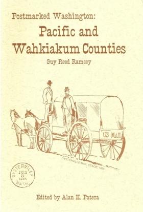
Postmarked Washington: Pacific and Wahkiakum Counties by Guy Reed Ramsey and Alan H. Patera is a meticulously researched 1987 reference book that chronicles the complete postal history of two of Washington state's earliest coastal counties. The work catalogs the establishment, operation, and eventual closure of numerous local post offices, while also documenting the pioneer postmasters and early mail routes that connected these remote frontier communities. Ultimately, it serves as an invaluable resource for philatelists, genealogists, and regional historians seeking to understand the pioneer communication networks of the Pacific Northwest.
148 pages : illustrations ; 22 cm
Non-circulating [ 1 ]
A pioneer scrapbook of the Columbia River North-Shore communities Wahkiakum and Pacific Counties, Washington, 1900-1985 by Carlton E. Appelo
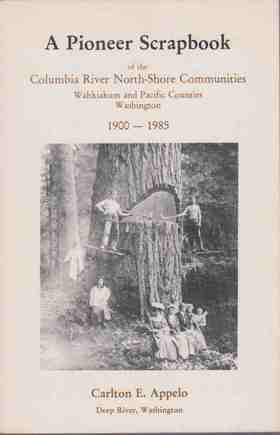
A Pioneer Scrapbook of the Columbia River North-Shore Communities: Wahkiakum and Pacific Counties, Washington, 1900-1985 by Carlton E. Appelo is a richly detailed local history compilation that captures the everyday life and grassroots heritage of the lower Columbia River basin. Structured as an expansive historical scrapbook, the volume gathers a wealth of archival photographs, family anecdotes, newspaper clippings, and regional lore to chronicle the development of the area's vital logging, fishing, and agricultural communities over an 85-year span. Ultimately, it serves as an invaluable, community-driven resource for genealogists and regional historians seeking a highly personal and visual record of the resilient pioneer families who shaped the rural coastal landscapes of southwestern Washington.
132 pages : illustrations ; 24 cm
Non-circulating [ 1 ]
Cottardi Station, Wahkiakum County, Washington by Carlton E. Appelo
By Carlton Appelo: Whenever the local phone book was printed there was always a wonderful historical book in the back. This one is about Cottardi Station, Washington located on the north side of the Columbia River near Altoona. Now just a memory not even a Ghost Town.
80 pages : illustrations ; 24 cm
Non-circulating [ 1 ]
Deep River the C. Arthur Appelo story : Wahkiakum County, Washington by Carlton E. Appelo
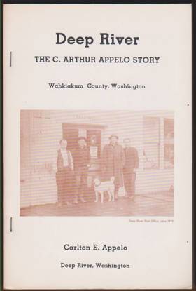
Deep River chronicles the industrial and pioneer history of a remote logging community nestled within the dense, rain-soaked coastal forests of southwestern Washington's Wahkiakum County. The narrative details how the area's profound geographic isolation—wedged between the sprawling lower Columbia River estuary and steep, heavily timbered hills—forced early settlers to rely entirely on a network of tidal waterways to transport massive old-growth logs and essential supplies. By tracing the Appelo family's mercantile and civic efforts, the book illustrates the immense physical labor required to sustain a permanent settlement amidst a soggy, stump-littered wilderness where rugged riverboats served as the only reliable connection to the outside world. Ultimately, this localized biography provides a vivid spatial history of how the formidable maritime climate and impenetrable riverine topography of the Pacific Northwest coast inherently defined the grueling rhythm of early logging camps.
107 pages : illustrations ; 24 cm
Non-circulating [ 1 ]
Altoona, Wahkiakum County, Washington by Carlton E. Appelo
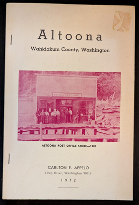
Altoona, Wahkiakum County, Washington examines the isolated industrial cannery settlement and intense maritime resource extraction situated along the steep, heavily timbered northern banks of the lower Columbia River estuary. Appelo details how the region's rugged estuarine topography—specifically the precipitous coastal bluffs plunging directly into the tidewater, the sprawling tidal mudflats, and the powerful, nutrient-rich currents of the Columbia's lower reach—strictly dictated the margins of commercial salmon packing, early pioneer homesteading, and local transportation. By mapping the construction of massive cannery complexes and pile-driven fish traps built precariously out over the water, functioning entirely independent of the rugged overland terrain through a total reliance on riverboat transit, the narrative highlights how this specific riparian geography anchored a highly specialized, water-bound economy. Ultimately, this community record serves as a deeply localized spatial history, demonstrating how the severe overland isolation, immense estuarine abundance, and dominant hydrological forces of this Pacific Northwest waterway fundamentally shaped the highly resilient, cannery-driven character of early Altoona.
88 pages illustrations 23 cm
Non-circulating [ 1 ]
Pillar Rock, Wahkiakum County, Washington by Carlton E. Appelo
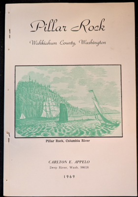
Pillar Rock, Wahkiakum County, Washington examines the rich indigenous folklore, early maritime exploration milestones, and nineteenth-century industrial salmon canning situated along the isolated, tide-swept northern shore of the lower Columbia River. Appelo details how the region's formidable riverine macro-geography—specifically the towering basalt monolith rising directly out of the deep-water channel, the shifting, treacherous currents of the lower estuary, and the densely forested, steep Wahkiakum County hills that strictly isolated the area from overland transit—strictly dictated the margins of native Chinookan settlement, early fur-trade salteries, and precarious water-bound industrialization. By mapping the transformation of this remote promontory—from a sacred landmark and summer village site noted by Lewis and Clark to a bustling late-nineteenth-century cannery enclave reliant entirely on gillnet fleets and river steamers to bridge its severe geographic isolation—the narrative highlights how this specific localized river geography anchored a profoundly resilient, maritime-dependent frontier community. Ultimately, this local historical and pictorial record serves as a localized spatial history, demonstrating how the severe topographic barriers, vital aquatic highways, and prominent natural landmarks of this Pacific Northwest landscape fundamentally shaped the highly specific, river-centric character of the lower Columbia.
40 pages : illustrations ; 23 cm
Non-circulating [ 1 ]
Brookfield the Joe Megler story (Wahkiakum County) Washington by Carlton E. Appelo
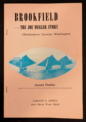
Carlton E. Appelo’s Brookfield: The Joe Megler Story chronicles the rise and fall of a pioneering salmon cannery town situated along the remote, timbered shores of the lower Columbia River in Wahkiakum County, Washington. The narrative maps the rugged estuarine geography where J.G. Megler established his bustling fishing enterprise, nestled between dense coastal rainforests and the sweeping tidal waters near the river's treacherous mouth. By detailing the daily operations of this isolated riverfront community, the book illustrates how the region's immense salmon runs and strategic aquatic access directly fueled the Pacific Northwest's early maritime economy. Ultimately, the text captures the distinct historical footprint of southwestern Washington’s coastal inlets, preserving the memory of a vibrant industrial settlement that was eventually reclaimed by the surrounding wilderness.
40 pages illustrations, maps, portraits 24 cm
Non-circulating [ 1 ]
Cathlamet on the Columbia Recollections of the indian people and short stories of early pioneer days in the valley of the lower Columbia river. by Thomas Nelson Strong
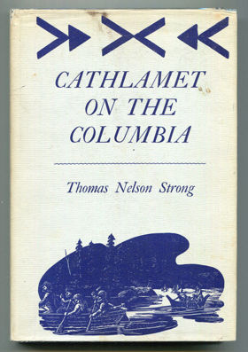
Published in 1906, Thomas Nelson Strong’s Cathlamet on the Columbia provides a vivid historical account of early pioneer life along the lower Columbia River during the mid-to-late 19th century. The book chronicles the foundational days of the Cathlamet settlement in Washington State, highlighting the complex interactions between incoming settlers and the indigenous Chinookan tribes. Through personal recollections and short stories, Strong documents the region's cultural shifts, the tragic decline of local Native American populations due to disease, and the rugged realities of frontier survival. It remains a valuable primary source for understanding the social and environmental transformation of the Pacific Northwest prior to heavy industrialization.
xv, 170 pages, 1 unnumbered leaf of plates : colour, mounted illustration ; 21 cm
ONLINE Circulation [ 1 ] Non-circulating [ 1 ]
Related Online Resources
Wahkiakum County
- Altoona
- Brookfield
- Carlson Landing
- Town of Cathlamet
- Dahlia
- Deep River
- Eagle Cliff
- East Cathlamet
- Eden
- Flandersville
- Grays River
- Oneida
- Rosburg
- Skamokawa
- Sleepy Hollow
- State Camp
- Svensens Landing
- Waterford
Political Boundaries
Last updated: 2017-06-29