Northern Rockies Regional Municipality Regional District
The Northern Rockies Regional Municipality (NRRM) is a single-tier municipality in British Columbia that was incorporated on February 6, 2009. It is the first regional municipality in the province and officially combines the former Town of Fort Nelson and the Northern Rockies Regional District. The boundaries of the new municipality mimic that of the previous regional district, encompassing about 10% of the province's landmass (85,148.87 km2 or 32,876.16 square miles). The area that is now the NRRM has a long and rich history, dating back to the arrival of the First Nations peoples thousands of years ago. The first Europeans to arrive in the area were fur traders in the early 1800s. The town of Fort Nelson was founded in 1805 by the North West Company as a fur trading post. The town grew slowly over the next century, but it experienced rapid growth in the early 1900s with the construction of the Alaska Highway.
Mapped Location
Northern Rockies Regional Municipality: The mapped location is an approximation and should not be used for navigation or wayfinding.
Information
General information on Northern Rockies Regional Municipality
- Feature Type: Regional District
- Regional District Administrative Centre: Fort Nelson
- Established: Friday, February 6, 2009
Official, historical, colloquial and alternative toponyms for Northern Rockies Regional Municipality
A brief list of names that this geographic feature has been named
| Name | Description |
|---|---|
| Northern Rockies Regional Municipality | Official |
Related Catalog Titles
A Bibliography for Northern Rockies Regional Municipality, Regional District
Surveying Northern British Columbia a photojournal of Frank Swannell by Jay Sherwood, F. C. Swannell
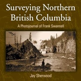
"Frank Swannell surveyed much of northern British Columbia in the early part of the 20th century. As well as keeping a journal of what he saw and what his survey crews did, he also kept a photographic record of his seven trips through the North." "This book includes both well-known photographs and others previously unpublished. As the 100th year of the Corporation of Land Surveyors of British Columbia approaches, Surveying Northern British Columbia is finally being produced and acknowledges the contributions of a man, a surveyor, a photographer, and a journalist."--BOOK JACKET
vii, 166 p. : ill., maps, ports ; 27 cm.
CIRC [ 0 ]
Northern Rockies Regional Municipality
- Coal River
- Fireside
- Fontas
- Fort Nelson
- Kahntah
- Liard River
- Magnum Mine
- Muncho Lake
- Muskwa
- Nelson Forks
- District of Northern Rockies Regional Municipality
- Old Fort Nelson
- Prophet River
- Skooks Landing
- Smith River
- Snake River
- Steamboat
- Summit Lake
- Toad River
Political Boundaries
Last updated: 2025-09-23