Fort Nelson Northern Rockies Regional Municipality, British Columbia
Community - An unincorporated populated place, generally with a population of 50 or more, and having a recognized central area that might contain a post office, store and/or community hall, etc, intended for the use of the general public in the region. W of junction of Muskwa and Fort Nelson Rivers, Peace River Land District
Mapped Location
Fort Nelson: The mapped location is an approximation and should not be used for navigation or wayfinding.
Information
General information on Fort Nelson
- Feature Type: Place
Official, historical, colloquial and alternative toponyms for Fort Nelson
A brief list of names that this geographic feature has been named
| Name | Description |
|---|---|
| Fort Nelson | Official |
Origin Notes and History of Fort Nelson
References to Fort Nelson that document the origin of its place name
Muskwa (Settlement) adopted in this location 27 December 1944 on 94NE; name rescinded 17 January 1951 on NTS 94. Muskwa (Post Office) adopted 11 December 1952 on 94NE. Name changed to Fort Nelson (Post Office) 8 November 1957 on 94J/15. Incorporated as a Village Municipality 8 April 1971; Fort Nelson (Village) confirmed 17 August 1978 on 94J/15. Re-incorporated as a Town Municipality, effective 31 October 1987 per Letters Patent; confirmed 28 June 1988 on 94J/15. Letters Patent for the Town of Fort Nelson are revoked effective 6 February 2009. [at the same time, the new Northern Rockies Regional Municipality was incorporated, encompassing the same boundary as the former Northern Rockies Regional District, including the Fort Nelson area.] Form of name changed to Fort Nelson (community) 6 February 2009.
Muskwa Post Office was opened in this location 16 April 1942, situated on Lot 1591. Fort Nelson Post Office (previously located at 58 48 x 122 43 - todays Old Fort Nelson) was relocated here 9 January 1958, following a shift in the focal point of trade in the area.
Founded in 1805...apparently named after Horatio, Lord Nelson (1758-1805), the British naval hero.
Related Catalog Titles
A Bibliography for Fort Nelson, Northern Rockies Regional Municipality, British Columbia
Surveying Northern British Columbia a photojournal of Frank Swannell by Jay Sherwood, F. C. Swannell
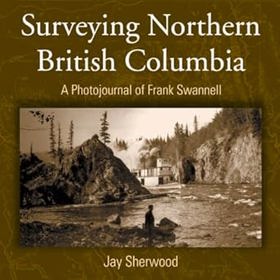
"Frank Swannell surveyed much of northern British Columbia in the early part of the 20th century. As well as keeping a journal of what he saw and what his survey crews did, he also kept a photographic record of his seven trips through the North." "This book includes both well-known photographs and others previously unpublished. As the 100th year of the Corporation of Land Surveyors of British Columbia approaches, Surveying Northern British Columbia is finally being produced and acknowledges the contributions of a man, a surveyor, a photographer, and a journalist."--BOOK JACKET
vii, 166 p. : ill., maps, ports ; 27 cm.
CIRC [ 0 ]
Northern Rockies Regional Municipality
- Coal River
- Fireside
- Fontas
- Fort Nelson
- Kahntah
- Liard River
- Magnum Mine
- Muncho Lake
- Muskwa
- Nelson Forks
- District of Northern Rockies Regional Municipality
- Old Fort Nelson
- Prophet River
- Skooks Landing
- Smith River
- Snake River
- Steamboat
- Summit Lake
- Toad River
Political Boundaries
Last updated: 2025-09-23