Regional District of Fraser-Fort George Regional District
The Regional District of Fraser-Fort George (RDFFG) is a regional district in the Central Interior of British Columbia, Canada. It was incorporated on March 8, 1967, as one of 27 regional districts in the province. Before 1965, British Columbia's rural areas did not have a uniform local government structure, and relied on the province or incorporated as a local improvement district to access basic services. The RDFFG was created to provide a more efficient and effective way to deliver services to the residents of the region. The RDFFG is home to a diverse population, including First Nations, Métis, and European settlers. The region is rich in natural resources, including timber, oil and gas, and minerals. The RDFFG is also home to a number of important cultural and historical sites, including Fort George, the oldest continuously operating fur trading post in North America.
Mapped Location
Regional District of Fraser-Fort George: The mapped location is an approximation and should not be used for navigation or wayfinding.
Information
General information on Regional District of Fraser-Fort George
- Feature Type: Regional District
- Regional District Administrative Centre: City of Prince George
- Established: Wednesday, March 8, 1967
Official, historical, colloquial and alternative toponyms for Regional District of Fraser-Fort George
A brief list of names that this geographic feature has been named
| Name | Description |
|---|---|
| Regional District of Fraser-Fort George | Official |
Related Catalog Titles
A Bibliography for Regional District of Fraser-Fort George, Regional District
Surveying Northern British Columbia a photojournal of Frank Swannell by Jay Sherwood, F. C. Swannell
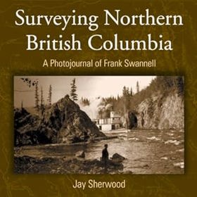
"Frank Swannell surveyed much of northern British Columbia in the early part of the 20th century. As well as keeping a journal of what he saw and what his survey crews did, he also kept a photographic record of his seven trips through the North." "This book includes both well-known photographs and others previously unpublished. As the 100th year of the Corporation of Land Surveyors of British Columbia approaches, Surveying Northern British Columbia is finally being produced and acknowledges the contributions of a man, a surveyor, a photographer, and a journalist."--BOOK JACKET
vii, 166 p. : ill., maps, ports ; 27 cm.
CIRC [ 0 ]
Related Online Resources
University of Northern British Columbia: Northern BC Digital Collection
The Northern BC Digital Collection holds digitized publications pertaining to Northern BC history, culture, and industrial development. Use the map below to navigate to content from each of Northern BC's regions.
WEB LINK
Regional District of Fraser-Fort George
- Albreda
- Aleza Lake
- Anzac
- Azu Ski Village
- Baldy Hughes
- Bear Lake
- Beaverley
- Bonnet Hill
- Buckhorn
- Carlson
- Cedarside
- Charella Garden
- College Heights
- Crescent Spur
- Croydon
- Dome Creek
- Dunster
- Eddy
- Ferndale
- Foreman
- Giscome
- Hart Highlands
- Hixon
- Island Cache
- Isle Pierre
- Lamming Mills
- Longworth
- Loos
- Lucerne
- District of Mackenzie
- Village of McBride
- McGregor
- McLeod Lake
- Miworth
- Mount Robson
- Mud River
- Newlands
- North Nechako
- Nukko Lake
- Otway
- Penny
- Pineview
- City of Prince George
- Punchaw
- Red Pass
- Red Rock
- Reid Lake
- Salmon Valley
- Shady Valley
- Shelley
- Shere
- Sinclair Mills
- South Fort George
- Stoner
- Summit Lake
- Telachick
- Tête Jaune Cache
- Upper Fraser
- Village of Valemount
- Vanway
- Willow River
- Woodpecker
Political Boundaries
Last updated: 2025-09-23