City of Nanaimo Regional District of Nanaimo, British Columbia
City - A populated place with legally defined boundaries, incorporated as a city municipality under the provincial Municipal Act. SE side of Vancouver Island, Nanaimo Land District
Mapped Location
City of Nanaimo: The mapped location is an approximation and should not be used for navigation or wayfinding.
Information
General information on City of Nanaimo
- Feature Type: Incorporated
Official, historical, colloquial and alternative toponyms for City of Nanaimo
A brief list of names that this geographic feature has been named
| Name | Description |
|---|---|
| City of Nanaimo | Official |
Origin Notes and History of City of Nanaimo
References to City of Nanaimo that document the origin of its place name
Incorporated as a City 24 December 1874. Nanaimo (City) confirmed 12 December 1939 on C.3577.
Nanaimo is an anglicization of the Halkemelem word for the area. This general area was the site of 5 fall and winter villages of the Nanaimo Coast Salish, each occupied by a named group or extended family. Anthropologist D. Jenness identified the villages as Solachwan, Tewahlchin, Anuweenis, Kwalsiarwahl and Ishihan. Summer villages were located at Gabriola Island and along the lower Fraser River. Various translations all touch on the notion of a shared locale: Sna Ney Mous, "meeting place" (Nanaimo Bastion); Sne-ny-mo, "group of many people" or "people of many names" (Provincial Archives, 1990); Snenaymexw, where the suffix mexw means "bunch, people" (Smithsonian, 1990); Snanaimooh (Tolmie & Dawson, 1884); Snanaimuq (Boas, 1889); Sne ney mux (Coull, 1996); Sne-ny-mo (Walbran, 1909); Sne-ny-mous, "gathering place" (Canadian Encyclopedia).
"This important BC coastal city takes its name from the Island Halkomelem First Nation inhabitants, the Snuneymuxw, who still occupy the region. Many different spelling for this name are found in early documents, including Sna Ney Mous, Sne-ny-mo and Snanaimuq. The Snuneymuxw were a confederacy of five extended families whose winter villages - Solachwan, Tewahlchin, Ishihan, Anuweenis and Kwalsiarwahl - were located in the general area. The exact meaning of the name is uncertain, but it seems to refer to a shared locale; "meeting place" or "people of many names" are two common translations." (p. 417)
"You will proceed with all possible diligence to Wintuhuysen inlet, commonly known as Nanymo bay, and formally take possession of the coal beds lately discovered...." (24 August 1852 letter from Governor James Douglas to Joseph MacKay). Mr McKay duly proceeded [there]...his first despatch to Governor Douglas being dated 'Wintuhuysen inlet, 1 September 1852'. This name is used by McKay until 8 March 1853, when he adopts 'Nanaimo'.
The settlement is marked Colvilletown [sic] on the war office map of 1859, also on the Nanaimo District official map of the same year (named after Andrew Colvile, governor of the Hudson's Bay Company 1852 - 1856). Letters for the settlement, previous to 1859, were usually addressed "Colville Town, Nanaimo, V. I." After that date the first name was gradually discontinued and has not been used since 1860. See Walbran for extensive additional description.......
In Dallas Square, Parks Canada has installed a National Historic Site monument "to mark the site of the first commercial coal mine in British Columbia, discovered in 1852." See also the municipality's own website.
Related Catalog Titles
A Bibliography for City of Nanaimo, Regional District of Nanaimo, British Columbia
Nanaimo the harbour city by Goody Niosi, Terry Patterson
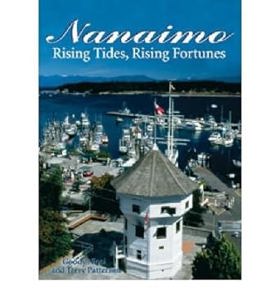
Published in 2004, Nanaimo: The Harbour City is an engaging travel guide and visual keepsake written by Goody Niosi with photography by Terry Patterson. The book chronicles the history and cultural evolution of this Vancouver Island community, tracing its growth from an early Aboriginal settlement into a thriving, modern port city. Alongside Patterson's vibrant images of the bustling harbour and local seascape, Niosi provides readers with detailed walking tours of historic neighborhoods and insights into the area's natural beauty. It serves as both a practical resource for travelers and a colorful celebration of Nanaimo's unique coastal heritage.
112 pages : illustrations (chiefly color), 1 color map, portraits ; 28 cm
CIRC [ 1 ]
Newcastle Island a place of discovery by Bill Merilees

Authored by naturalist and historian Bill Merilees, Newcastle Island: A Place of Discovery explores the rich natural and industrial heritage of the historic island park located off the coast of Nanaimo, British Columbia. The book traces the island's multifaceted past, from its early significance to the Snuneymuxw First Nation and its late 19th-century boom as a bustling coal-mining and sandstone-quarrying hub to its eventual transition into a beloved coastal recreation area. Through archival photographs, maps, and detailed natural history notes, the text captures how a small marine island became a microcasm of regional resource extraction and leisure. A keen insight drawn from the work is how industrial wastelands can be successfully reclaimed by nature and public memory; by documenting the physical transition from smoky coal pits to tranquil park trails, the narrative reveals that the landscape itself acts as a resilient archivist, quietly healing its extraction scars to offer new generations a sanctuary for ecological discovery.
128 pages : illustrations, facsimiles, maps, portraits ; 22 cm
CIRC [ 1 ]
Nanaimo retrospective the first century by E. Blanche Norcross, Nanaimo Historical Society
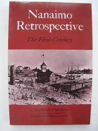
Edited by E. Blanche Norcross and published by the Nanaimo Historical Society, Nanaimo Retrospective: The First Century offers a scholarly yet accessible chronicle of the region's formative hundred years. The volume carefully examines the area's early industrial development, including coal mining and logging, alongside the intricate social dynamics between Indigenous communities and diverse waves of immigrants. Drawing upon archival materials and historical photographs, the text provides researchers and local history enthusiasts with a comprehensive foundational study of the municipality's evolution.
xxi, 169 p., [28] p. of plates : ill., map, ports. ; 23 cm.
CIRC [ 1 ]
Discover Nanaimo an illustrated history by Charles Lillard, Lynn Welburn, Greater Nanaimo Chamber of Commerce
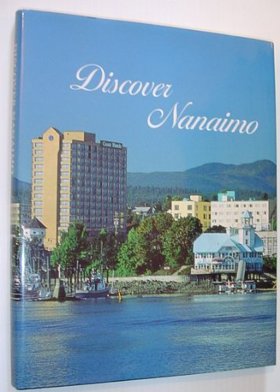
Published in 1992 by the Greater Nanaimo Chamber of Commerce, Discover Nanaimo: An Illustrated History by Charles Lillard and Lynn Welburn provides a richly documented examination of the city's past. The authors skillfully weave together archival photography and narrative text to trace Nanaimo's transformation from a resource-extraction hub into a vibrant coastal community. By balancing civic milestones with everyday social history, the volume offers scholars and regional enthusiasts an engaging window into the Pacific Northwest's economic and cultural development.
149 p. : ill. (some col.), ports. ; 29 cm.
CIRC [ 0 ]
Related Online Resources
The Canadian Letters and Images Project
The Canadian Letters and Images Project is an online archive of the Canadian war experience, from any war, home front and battlefront, as told through the letters and images of Canadians themselves. Begun in August 2000, the Project is located in the Department of History at Vancouver Island University. Through the digitization of contemporary letters, diaries, photographs, and other related materials, the Project permits Canadians to tell their story, and Canada’s story, through their own words
WEB LINK
Regional District of Nanaimo
- Boat Harbour
- Bowser
- Cassidy
- Cedar
- Chase River
- Cinnabar Valley
- Coombs
- Dashwood
- Deep Bay
- Departure Bay
- Dolphin Beach
- Dunsmuir
- East Wellington
- Errington
- Extension
- French Creek
- Gabriola
- Harmac
- Hilliers
- District of Lantzville
- City of Nanaimo
- Nanoose Bay
- Newcastle
- Northfield
- City of Parksville
- Qualicum Bay
- Town of Qualicum Beach
- South Wellington
- Wellington
- Whisky Creek
Political Boundaries
Last updated: 2023-09-27