Town of Qualicum Beach Regional District of Nanaimo, British Columbia
Town - A populated place with legally defined boundaries, incorporated as a town municipality under the provincial Municipal Act. E side of Vancouver Island just N of Parksville, between Nanaimo and Courtenay, Newcastle Land District
Mapped Location
Town of Qualicum Beach: The mapped location is an approximation and should not be used for navigation or wayfinding.
Information
General information on Town of Qualicum Beach
- Feature Type: Incorporated
Official, historical, colloquial and alternative toponyms for Town of Qualicum Beach
A brief list of names that this geographic feature has been named
| Name | Description |
|---|---|
| Town of Qualicum Beach | Official |
Origin Notes and History of Town of Qualicum Beach
References to Town of Qualicum Beach that document the origin of its place name
Incorporated as a Village Municipality 5 May 1942. Incorrectly adopted as Qualicum Beach (settlement) 28 July 1945 on C.3579, and 4 October 1945 on C3590. Form of name changed to Qualicum Beach (Village) 11 December 1952 on 92F/8, in keeping with the incorporated status of the municipality. Re-incorporated as a Town Municipality 7 January 1983.
Qualicum Beach Post Office was opened 1 November 1913. So-labelled on BC Lands' map 2A, 1913. See also the municipality's own website.
Related Catalog Titles
A Bibliography for Town of Qualicum Beach, Regional District of Nanaimo, British Columbia
Secret beaches of southern Vancouver Island Qualicum to the Malahat by Theo Dombrowski
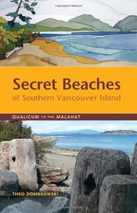
This is your guide to dozens of spectacular and often hidden beaches on the eastern coast of Vancouver Island between Qualicum and the Malahat. While some of them are well used by people living nearby, many are virtually impossible to find without combing through official maps and back-road guides. From tiny rocky coves to broad sandy beaches, these public-access spots are enormously diverse. Just as important as finding these spots is knowing what to expect. Thus each location is accompanied by detailed information that any beach explorer should know before setting out. Is the beach a few level steps from a vehicle or down a high, steep bank? Is the beach suitable for children? Large groups? Kayakers?
255 pages : illustrations (chiefly color), maps ; 22 cm
CIRC [ 0 ]
Qualicum Beach a history of Vancouver Island's best kept secrets by Brad Wylie
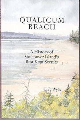
Qualicum Beach: A History of Vancouver Island's Best Kept Secrets is a non-fiction historical work by Brad Wylie, first published in 1992. The book offers a detailed look at the history of the Qualicum Beach region, highlighting its cultural heritage and place within Canadian history. Across its 222 pages, Wylie traces the area's early stories, first settlements, and key regional milestones that helped shape this beautiful coastal community on Vancouver Island. It provides an engaging and informative resource for readers interested in local lore, heritage, and the fascinating historical development of one of British Columbia's unique communities.
219 p. : ill. ; 21 cm.
CIRC [ 1 ]
Regional District of Nanaimo
- Boat Harbour
- Bowser
- Cassidy
- Cedar
- Chase River
- Cinnabar Valley
- Coombs
- Dashwood
- Deep Bay
- Departure Bay
- Dolphin Beach
- Dunsmuir
- East Wellington
- Errington
- Extension
- French Creek
- Gabriola
- Harmac
- Hilliers
- District of Lantzville
- City of Nanaimo
- Nanoose Bay
- Newcastle
- Northfield
- City of Parksville
- Qualicum Bay
- Town of Qualicum Beach
- South Wellington
- Wellington
- Whisky Creek
Political Boundaries
Last updated: 2025-09-23