City of Bellingham Whatcom County, Washington
Mapped Location
City of Bellingham: The mapped location is an approximation and should not be used for navigation or wayfinding.
Information
General information on City of Bellingham
- Feature Type: Incorporated
Official, historical, colloquial and alternative toponyms for City of Bellingham
A brief list of names that this geographic feature has been named
| Name | Description |
|---|---|
| City of Bellingham | Official |
| Bellingham | Official |
Origin Notes and History of City of Bellingham
References to City of Bellingham that document the origin of its place name

BELLINGHAM, a city on the bay of the same name in Whatcom County. The first white man to enter the bay was the Spaniard Eliza, 1791, who named it Seño de Gaston or Gulf of Gaston. On June 11, 1792, the bay was surveyed by Joseph Whidbey in a boat excursion under Vancouver. The latter, on receiving his officer's report, charted the name Bellingham Bay. He does not say for whom the name was given, but he frequently associated the surnames and Christian names of those honored by giving them to nearby or related geographic features. He gave the name of Point William to the prominent point south of the entrance to the bay. In studying up his contemporaries, it was found that Sir William Bellingham checked over Vancouver's supplies and accounts as he was leaving England. There is very little doubt that Sir William Bellingham was the man thus honored. In that same year, 1792, the Spaniards of the "Sutil y Mexicana" Expedition again charted the bay and sought to retain a form of Spanish name by calling it Bahia de Gaston. The Spanish charts were not published for years, while the British charts appeared promptly and fixed the name permanently. David Thompson of the North-West Company of Montreal referred to the bay as "Ballsam Bay." The United States Coast Survey in 1854 showed the northern portion of the bay as "Gaston Bay," a partial recognition of the older Spanish name. The first town on the bay was given the Indian name Whatcom. Later there were established the towns of Sehome and Fairhaven. There were several combinations of these rival settlements, all of which later joined in the one City of Bellingham. Mrs. Ella Higginson, the poet, says she has had the distinction of having lived in three cities of Washington -- Sehome, New Whatcom and Bellingham -- without having moved out of her house.
A Selected Bibliography of City of Bellingham, Whatcom County, Washington
A compilation of essential readings detailing the history, geography, and culture of the region.
Fairhaven a history by Brian L. Griffin
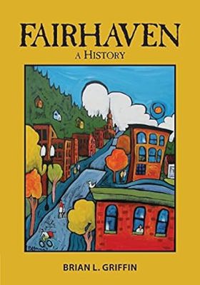
The complete history of that most southerly community on Bellingham Bay, one of the four original towns that were consolidated in 1904 to become the present City of Bellingham. Fairhaven, Washington--from the glaciers to today--the places, the participants, and the grand possibilities. A new arrival in 1889 said, "only crude raw beginnings, the primeval forest of giant firs and cedars barely pushed back to the hillsides, mud streets gouged out, raw with jumbled piles of burning stumps, flames and smoke obscuring the sky. On the beach, tents flap in the breeze and a few unpainted wooden structures suggest civilization is to come." In 2015, what would be recognizable to any of those old-timers would be the enterprising spirit of the latest inhabitants, who have done so much to create Fairhaven's modern growth and economic strength
xi, 275 pages : illustrations, maps ; 26 cm
Non-circulating [ 1 ]
The birth, death, and resurrection of Fairhaven by George Hunsby

The birth, death, and resurrection of Fairhaven chronicles the grueling industrial boom, speculative collapse, and gradual civic reclamation of a coastal maritime enclave situated along the steep, heavily timbered shores of Bellingham Bay in northwestern Washington. Hunsby details how the region's formidable physical barriers—specifically the towering, impenetrable stands of old-growth coastal rainforest, the sheer, rocky sandstone bluffs plunging directly into the tidal wash, and the rugged, isolating ridges of the Chuckanut Mountains—strictly dictated the margins of early human survival, speculative urban planning, and aggressive resource extraction. By mapping the immense physical labor required to blast precarious railway grades through solid coastal bedrock, strip massive timber from the precipitous slopes, and forcibly engineer sprawling deepwater wharves and heavy brick commercial blocks directly into the unyielding hillside, the narrative highlights the monumental effort necessary to anchor a permanent industrial boomtown in this demanding maritime environment. The profound geographic isolation from established southern rail hubs initially forced these remote speculators and laborers into an absolute reliance on the perilous marine highway, completely anchoring their fleeting commercial existence and early economic survival to the coastal timber and coal trade, and the precise tidal topography of the bay. Ultimately, this local historical record serves as a deeply localized spatial history, demonstrating how the extreme coastal geography, immense physical labor, and shifting maritime realities of this Pacific Northwest frontier fundamentally shaped the fiercely resilient, economically volatile, and distinctly terrain-dependent character of Fairhaven's dramatic urban lifecycle.
101 leaves, 7 unnumbered leaves of plates : illustrations ; 22 cm
Non-circulating [ 1 ]
Whatcom seascapes the influence of the sea on Whatcom County. An exhibition of the Whatcom Museum of History and Art, Bellingham, Washington, October 9, 1970--April 30, 1971 by Whatcom Museum of History and Art, Susan H. L. Barrow
Whatcom seascapes the influence of the sea on Whatcom County examines the deep maritime commerce, coastal resource extraction, and early aquatic infrastructure situated along the deeply indented, island-studded littoral margin of northwestern Washington. Barrow details how the region's formidable coastal topography—specifically the sheltered deep-water harbors of Bellingham Bay, the labyrinthine, tide-swept channels of the San Juan archipelago, and the towering, impassable alpine barrier of the Cascade Range that restricted overland access—strictly dictated the margins of early native canoe trade, commercial salmon fishing, and aggressive maritime shipping. By mapping the development of these isolated coastal communities that relied entirely on the sea as their primary highway to connect remote timber camps and coal mines with regional markets, the narrative highlights how this specific maritime geography anchored a profoundly water-bound, industrially driven frontier society. Ultimately, this exhibition and historical record serves as a localized spatial history, demonstrating how the severe overland barricades, rich estuarine fisheries, and vital deep-water access of this Pacific Northwest landscape fundamentally shaped the highly maritime-dependent, commercial character of early Whatcom County.
78 pages illustrations, map (on inside covers) 24 cm
Non-circulating [ 1 ]
The fourth corner highlights from the early Northwest by Lelah Jackson Edson, Whatcom Museum of History and Art
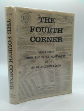
Lelah Jackson Edson’s The Fourth Corner: Highlights from the Early Northwest chronicles the pioneer history and coastal geography of the extreme upper-left corner of Washington State. The narrative focuses extensively on the early settlements of Whatcom County, tracing the development of communities nestled along the shores of Bellingham Bay and beneath the towering peak of Mount Baker. By documenting the establishment of outposts like Fort Bellingham and the challenging expansion of local railroad networks, the book vividly maps how settlers adapted to this rugged maritime terrain just south of the British Columbia border.
xxiii, 298 pages illustrations, facsimile, maps, plans, portraits 27 cm
Non-circulating [ 1 ]
Whatcom County
- Acme
- Agate Bay
- Alabama Hill
- Alderwood
- Anacortes Crossing
- Balford
- Barron
- Beach
- City of Bellingham
- Birch Bay
- Birch Bay Circle Grange
- Birchwood
- City of Blaine
- Blue Canyon
- Boundary
- Boundary Bay
- Brennan
- Cedar Crossing
- Cedarville
- Chuckanut
- Clearbrook
- Clipper
- Columbia
- Comar
- Cottonwood Beach
- Custer
- Delta
- Deming
- Dewey
- Diablo
- Doran
- Eureka
- City of Everson
- Fairhaven
- City of Ferndale
- Forest Ridge
- Geneva
- Glacier
- Goshen
- Greenwood
- Gulfaire Mobile Villa
- Hampton
- Haynie
- Hillsdale
- Huntingdon
- Kendall
- Kickerville
- Kulshan
- Lakeway
- Larson Mill
- Laurel
- Lawrence
- Limestone Junction
- Lummi
- Lummi Island
- City of Lynden
- Maple Beach
- Maple Falls
- Marietta
- Mirror Lake
- Mountain View
- Neptune Beach
- Newhalem
- City of Nooksack
- Nooksack Salmon Hatchery
- Noon
- Northwood
- Nugents Corner
- Parkview
- Peaceful Valley
- Pleasant Valley
- Point Roberts
- Roosevelt
- Ruby (historical)
- Saxon
- Semiahmoo
- South Beach
- Sudden Valley
- City of Sumas
- Sunnyside
- Tenmile
- Tsawwassen Beach
- Van Wyck
- Van Zandt
- Victor
- Wahl
- Warnick
- Washington Colony (historical)
- Welcome
- Wickersham
Political Boundaries
Last updated: 2025-09-23