Point Roberts Whatcom County, Washington
Mapped Location
Point Roberts: The mapped location is an approximation and should not be used for navigation or wayfinding.
Information
General information on Point Roberts
- Feature Type: Place
Official, historical, colloquial and alternative toponyms for Point Roberts
A brief list of names that this geographic feature has been named
| Name | Description |
|---|---|
| Point Roberts | Official |
Origin Notes and History of Point Roberts
References to Point Roberts that document the origin of its place name

POINT ROBERTS, two such names appear in the geographic history of Washington. One has been supplanted by the name of Alki Point, now within the limits of Seattle. That point was charted as "Point Roberts" by the Wilkes Expedition, 1841, in honor of Humphrey Roberts, Armorer in one of the crews. (Hydrography, Volume XXIII., Atlas, chart 78.) See Alki Point. The other is an older name, given by Captain George Vancouver on June 12, 1792, "after my esteemed friend and predecessor in the Discovery." That entry points directly to Captain Henry Roberts of the British Navy. (Meany's Vancouver's Discovery of Puget Sound, page 182 and note.) Its location gives it peculiar prominence, lying at the end of a peninsula across which runs the international boundary. The point thus becomes the northwestern extremity of Whatcom County. The point attracted the attention of the Spanish explorers. Captain Eliza, in 1791, thought it an island and called it "Isla de Zepeda" and Captains Galliano and Valdes, in 1792, called it "Punta Cepeda." One other form of the Spanish word was "Cesseda." (United States Public Documents, Serial Number 1557, charts K. and L. and Pacific Railroad Reports, Volume XII., Part I, chapter XV., page 305.)
Related Catalog Titles
A Bibliography for Point Roberts, Whatcom County, Washington
Point Roberts backstory tales, trails and trivia from an American enclave by Mark Swenson
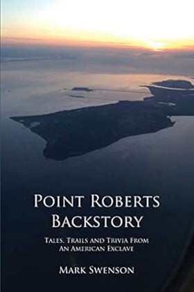
"Point Roberts Backstory tells the fascinating story of a one-of-a-kind American town. Perched on the tip of a Canadian peninsula which extends into U.S. waters, Point Roberts is a community like no other. Residents--including the school kids--have to drive through Canada to get to this unique 'enclave' from the U.S. mainland. Point Roberts has seen i tall: mysterious middens, smugglers, pirates, squatters, Icelandic-speaking settlers, rock stars and thousands of Canadians. They all mix in an unbelievable history all the more amazing when you learn it all happened in its tiny five square miles. Join Point Roberts Backstory for a tour of this incredible town in an isolated corner of America, "--Page 4 of cover
587 pages : illustrations, maps ; 23 cm
CIRC [ 0 ]
Point Roberts, U.S.A. the history of a Canadian enclave by Richard Eugene Clark , Runa Thordarson (Photographer), Robert B. Lindquist (Contributor)
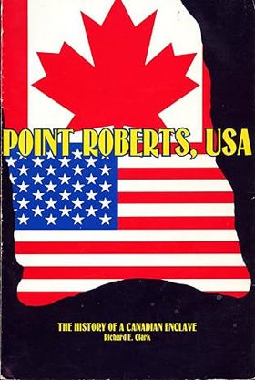
When the June 15, 1846 Treaty of Washington was signed by representatives of the United States and Great Britain, it established the forty-ninth parallel of north latitude as the boundary to the middle of the channel which separates the North American continent from Vancouver Island. That decision, probably unknowingly, left a small piece of real estate below the line but isolated by marine waters from the rest of United States / Washington land. That promontory subsequently became known as Point Roberts, a unique and interesting community, greatly influenced by Canada but fiercely American. Point Roberts is a story of political and geographic accident; it is also a story of the people who settled there, who fished and farmed, who lived under difficult circumstances and isolation. It is a chronicle of good times and bad, rising expectations and tragic events. It includes the efforts of people to create social and cultural institutions to solve their problems and to pass their culture on from one generation to the next — governmental units, churches, schools, water districts, even a cemetery. Point Roberts is also a study of two nations and their people facing off, sharing, trying to learn how to live together. That chapter still is not complete, nor is the history of Point Roberts. But its history has begun, and we are indebted to Richard Clark for gathering the existing bits and pieces to date together in this book. It teaches some valuable lessons — that human perseverance can overcome adversity, that human institutions and social inventions do advance a people, and that Point Roberts is an extremely interesting and valuable part of Washington State and the United States of America.
viii, 137 pages : illustrations ; 23 cm
CIRC [ 0 ]
Whatcom County
- Acme
- Agate Bay
- Alabama Hill
- Alderwood
- Anacortes Crossing
- Balford
- Barron
- Beach
- City of Bellingham
- Birch Bay
- Birch Bay Circle Grange
- Birchwood
- City of Blaine
- Blue Canyon
- Boundary
- Boundary Bay
- Brennan
- Cedar Crossing
- Cedarville
- Chuckanut
- Clearbrook
- Clipper
- Columbia
- Comar
- Cottonwood Beach
- Custer
- Delta
- Deming
- Dewey
- Diablo
- Doran
- Eureka
- City of Everson
- Fairhaven
- City of Ferndale
- Forest Ridge
- Geneva
- Glacier
- Goshen
- Greenwood
- Gulfaire Mobile Villa
- Hampton
- Haynie
- Hillsdale
- Huntingdon
- Kendall
- Kickerville
- Kulshan
- Lakeway
- Larson Mill
- Laurel
- Lawrence
- Limestone Junction
- Lummi
- Lummi Island
- City of Lynden
- Maple Beach
- Maple Falls
- Marietta
- Mirror Lake
- Mountain View
- Neptune Beach
- Newhalem
- City of Nooksack
- Nooksack Salmon Hatchery
- Noon
- Northwood
- Nugents Corner
- Parkview
- Peaceful Valley
- Pleasant Valley
- Point Roberts
- Roosevelt
- Ruby (historical)
- Saxon
- Semiahmoo
- South Beach
- Sudden Valley
- City of Sumas
- Sunnyside
- Tenmile
- Tsawwassen Beach
- Van Wyck
- Van Zandt
- Victor
- Wahl
- Warnick
- Washington Colony (historical)
- Welcome
- Wickersham
Political Boundaries
Last updated: 2025-09-23