City of Cannon Beach Clatsop County, Oregon
Mapped Location
City of Cannon Beach: The mapped location is an approximation and should not be used for navigation or wayfinding.
Information
General information on City of Cannon Beach
- Feature Type: Incorporated
Official, historical, colloquial and alternative toponyms for City of Cannon Beach
A brief list of names that this geographic feature has been named
| Name | Description |
|---|---|
| City of Cannon Beach | Official |
| Cannon Beach | Official |
A Selected Bibliography of City of Cannon Beach, Clatsop County, Oregon
A compilation of essential readings detailing the history, geography, and culture of the region.
Comin' in over the rock a storyteller's history of Cannon Beach by Peter Lindsey

An anecdotal history of Cannon Beach, Oregon, written by someone who has been there for sixty years. Witness the beginnings, the character and the characters of this timeless ocean community.
170 pages : illustrations ; 23 cm
Non-circulating [ 1 ]
Cannon Beach a place by the sea by Terence O'Donnell, Cannon Beach Historical Society
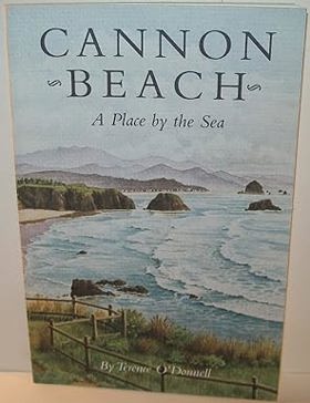
Cannon Beach: A Place by the Sea was published in 1996 by the Oregon Historical Society Press. The book chronicles the colorful heritage of this iconic Oregon coastal community. The book weaves together historical accounts and local lore to trace the area's evolution from a remote wilderness into a beloved seaside destination. O'Donnell highlights key figures, early homesteaders, and the enduring natural landscapes that defined the character of the northern Oregon coast. It stands as an informative and engaging chronicle for anyone interested in Pacific Northwest coastal history.
xxiii, 164 pages : illustrations, maps ; 23 cm
Non-circulating [ 1 ]
Reflections on early Cannon Beach by John Delbert Griffin
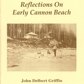
Reflections on early Cannon Beach captures the profound geographic isolation and subsequent environmental transformation of a small, rugged coastal enclave situated on the northern Oregon seaboard. Griffin details how the area's imposing physical barriers—specifically the towering, densely timbered prominence of Tillamook Head and the steep slopes of the Coast Range—rendered early overland travel exceptionally arduous, completely severing the community from inland population centers. By mapping the grueling pioneer journey that required boat transit from Astoria, rail to Seaside, and a precarious wagon ride over rough toll trails to Elk Creek, the narrative illustrates how the physical beach itself often served as the only viable highway. This intense spatial isolation initially preserved a primitive, resource-rich ecosystem where early residents relied entirely on the abundant marine life of the tidal zones. Ultimately, this localized memoir serves as a vital spatial history, demonstrating how the eventual penetration of these coastal barriers by large-scale logging and modern highways shattered the region's isolation, fundamentally transforming a resilient, self-sufficient frontier outpost into a heavily trafficked tourist landscape.
14 pages : illustrations ; 22 cm
Non-circulating [ 1 ]
Clatsop County
- Arch Cape
- City of Astoria
- Biddle (historical)
- Blind Slough (historical)
- Bradwood
- Brownsmead
- Burnside (historical)
- City of Cannon Beach
- Carnahan
- Chadwell (historical)
- Clifton
- Denver (historical)
- Elsie
- Fern Hill
- Flavel (historical)
- City of Gearhart
- Grand Rapids
- Hamlet
- Jeffers Garden
- Jewell
- Knappa
- Lukarilla
- Melville
- Miles Crossing
- Mishawaka
- Navy Heights
- Necanicum (historical)
- Oklahoma Hill
- Olney
- City of Seaside
- Sunset Beach
- Surf Pines
- Svensen
- Svensen Junction
- Taylorville
- Tideport
- Tolovana Park
- Tongue Point Village
- Uniontown
- Vinemaple
- City of Warrenton
- Wauna
- Westport
Political Boundaries
Last updated: 2017-01-16