City of Ocean Shores Grays Harbor County, Washington
Mapped Location
City of Ocean Shores: The mapped location is an approximation and should not be used for navigation or wayfinding.
Information
General information on City of Ocean Shores
- Feature Type: Incorporated
Official, historical, colloquial and alternative toponyms for City of Ocean Shores
A brief list of names that this geographic feature has been named
| Name | Description |
|---|---|
| City of Ocean Shores | Official |
| Ocean Shores | Official |
A Selected Bibliography of City of Ocean Shores, Grays Harbor County, Washington
A compilation of essential readings detailing the history, geography, and culture of the region.
Ocean Shores, Washington, the exciting growth years by Margaret L. Rasmussen (Compiler)
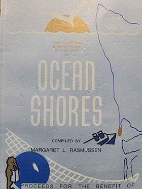
Ocean Shores, Washington, the exciting growth years examines the rapid, master-planned coastal development situated on the sandy, wind-swept Point Brown peninsula that divides the pounding Pacific Ocean from the sheltered waters of Grays Harbor. Rasmussen details how the region's dynamic coastal topography—specifically the shifting sand dunes, the dense tracts of stunted coastal pine, and the low-lying estuarine margins—strictly dictated the limitations of early access and subsequent resort engineering. By mapping the aggressive mid-century transformation of this isolated coastal spit through the dredging of extensive freshwater canal networks and the stabilization of shifting sands for gridded expansion, the narrative highlights how the specific peninsular geography was forcibly molded to anchor a recreational economy. Ultimately, this local historical record serves as a localized spatial history, demonstrating how the fragile dune ecology, pervasive maritime exposure, and distinct estuarine boundaries of this Pacific Northwest coastline fundamentally shaped the highly engineered, recreation-dependent character of modern Ocean Shores.
104 pages : illustrations, 1 map (folded color in pocket) ; 22 cm
Non-circulating [ 1 ]
Grays Harbor County
- City of Aberdeen
- Aberdeen Gardens
- Aberdeen Junction
- Alder Grove
- Aloha
- Amanda Park
- Artic
- Axford
- Balch
- Bay City
- Bel-Aire
- Brady
- Broadway Heights
- Burrows
- Carlisle
- Carlisle East
- Carlisle West
- Cedarville
- Central Park
- Chehalis Village
- Cohassett
- Cohassett Beach
- Copalis Beach
- Copalis Crossing
- City of Cosmopolis
- East Aberdeen
- East Hoquiam
- City of Elma
- Fuller
- Garden City
- Gray Gables
- Grayland
- Grays Harbor City
- Greenwood
- Grisdale
- Herbig Heights
- Highland Heights
- City of Hoquiam
- Humptulips
- Iron Springs
- Junction City
- Laidlow
- Lankner
- Malone
- Markham
- City of McCleary
- McCleary Junction
- Melbourne
- Moclips
- City of Montesano
- Neilton
- New London
- Newton
- Nisson
- North Aberdeen
- Norwood
- City of Oakville
- Ocean City
- Ocean Grove
- City of Ocean Shores
- Ocosta
- Onslow
- Oyehut
- Pacific Beach
- Pilgrim Heights
- Porter
- Quinault
- Rayville
- Rony
- Saginaw
- Sampson
- Satsop
- Sine
- South Arbor
- South Elma
- South Montesano
- Sunset Beach
- Taholah
- Township 21-9
- Tulips
- Vesta
- Weatherwax
- Weikswood
- Westhaven
- City of Westport
- Wishkah
- Woodlawn
Political Boundaries
Last updated: 2025-09-23