Ocosta Grays Harbor County, Washington
Mapped Location
Ocosta: The mapped location is an approximation and should not be used for navigation or wayfinding.
Information
General information on Ocosta
- Feature Type: Place
Official, historical, colloquial and alternative toponyms for Ocosta
A brief list of names that this geographic feature has been named
| Name | Description |
|---|---|
| Ocosta | Official |
Origin Notes and History of Ocosta
References to Ocosta that document the origin of its place name

OCOSTA, a town near the Pacific Ocean on the south shore of Grays Harbor, in the southwestern part of Grays Harbor County. The Indian name of the place was "Nushiatska." The present name was chosen about 1891 while George E. Filley was Trustee of the land company owning the site. Mrs. Filley and Hon. William H. Calkins of Tacoma in discussing the matter took the Spanish La costa meaning "the coast" and prefixed the "O" for the sake of euphony. (C. J. Coglan, of Ocosta in Names MSS. Letter 605.)
A Selected Bibliography of Ocosta, Grays Harbor County, Washington
A compilation of essential readings detailing the history, geography, and culture of the region.
OCOSTA-BY-THE-SEA by LILA BIGGS MITCHELL
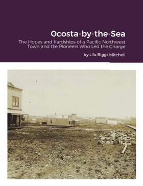
Ocosta-by-the-Sea, the site chosen by the Northern Pacific Railroad as its Washington Territory western terminus, is an historical account of a young town's hopes and hardships, and the pioneers who were willing to take the risks necessary to create what was expected to be the "San Francisco of the Washington coast."
Desiderata

Grays Harbor County
- City of Aberdeen
- Aberdeen Gardens
- Aberdeen Junction
- Alder Grove
- Aloha
- Amanda Park
- Artic
- Axford
- Balch
- Bay City
- Bel-Aire
- Brady
- Broadway Heights
- Burrows
- Carlisle
- Carlisle East
- Carlisle West
- Cedarville
- Central Park
- Chehalis Village
- Cohassett
- Cohassett Beach
- Copalis Beach
- Copalis Crossing
- City of Cosmopolis
- East Aberdeen
- East Hoquiam
- City of Elma
- Fuller
- Garden City
- Gray Gables
- Grayland
- Grays Harbor City
- Greenwood
- Grisdale
- Herbig Heights
- Highland Heights
- City of Hoquiam
- Humptulips
- Iron Springs
- Junction City
- Laidlow
- Lankner
- Malone
- Markham
- City of McCleary
- McCleary Junction
- Melbourne
- Moclips
- City of Montesano
- Neilton
- New London
- Newton
- Nisson
- North Aberdeen
- Norwood
- City of Oakville
- Ocean City
- Ocean Grove
- City of Ocean Shores
- Ocosta
- Onslow
- Oyehut
- Pacific Beach
- Pilgrim Heights
- Porter
- Quinault
- Rayville
- Rony
- Saginaw
- Sampson
- Satsop
- Sine
- South Arbor
- South Elma
- South Montesano
- Sunset Beach
- Taholah
- Township 21-9
- Tulips
- Vesta
- Weatherwax
- Weikswood
- Westhaven
- City of Westport
- Wishkah
- Woodlawn
Political Boundaries
Last updated: 2017-06-29