City of Stanwood Snohomish County, Washington
Mapped Location
City of Stanwood: The mapped location is an approximation and should not be used for navigation or wayfinding.
Information
General information on City of Stanwood
- Feature Type: Incorporated
Official, historical, colloquial and alternative toponyms for City of Stanwood
A brief list of names that this geographic feature has been named
| Name | Description |
|---|---|
| City of Stanwood | Official |
| Stanwood | Official |
Origin Notes and History of City of Stanwood
References to City of Stanwood that document the origin of its place name

STANWOOD, a town in the northwestern part of Snohomish County, first settled in 1866 as a trading post by Robert Fulton. Later George Kyle secured the claim and established a postoffice known as Centerville. In 1877, D. O. Pearson built a store, wharf and warehouse. He became postmaster and had the name changed to Stanwood, in honor of his wife's maiden name. (History of Skagit and Snohomish Counties, pages 349-354.)
A Selected Bibliography of City of Stanwood, Snohomish County, Washington
A compilation of essential readings detailing the history, geography, and culture of the region.
Pioneers of the Stillaguamish by Dennis Conroy, Carol Husby Ronken
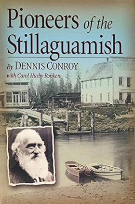
Published by local historians Dennis Conroy and Carol Husby Ronken, Pioneers of the Stillaguamish compiles extensive genealogical records, historical photographs, and pioneer recollections to chronicle the early European-American settlement of the Stillaguamish River valley in Washington. The book details the arduous process of clearing dense old-growth timber, establishing homesteads, and building rudimentary roads and schools along the unpredictable river corridor during the late 19th and early 20th centuries. By centering the struggles and daily lives of ordinary families, the text preserves the foundational social fabric of communities like Arlington and Stanwood. A keen insight drawn from the work is how local pioneer histories capture the immense cognitive dissonance of frontier expansion; by meticulously detailing the relentless destruction of ancient forests to plant farms, the text unwittingly reveals how the triumph of civilization for homesteaders was simultaneously an act of catastrophic ecological erasure for the valley's original inhabitants
viii, 149 pages : illustrations, maps ; 23 cm
Non-circulating [ 1 ]
The Stanwood story Volume Two by Alice Essex

The Stanwood story Volume Two chronicles the grueling agricultural reclamation and isolated pioneer settlement situated at the marshy, flood-prone delta of the Stillaguamish River in northwestern Washington. Essex details how the region's formidable physical barriers—specifically the dense, impenetrable coastal tidelands, the unpredictable, violent winter flooding of the meandering Stillaguamish, and the heavily timbered, waterlogged soils of the valley floor—strictly dictated the margins of early human survival and agrarian expansion. By mapping the immense physical labor required to construct massive earthen dikes against the intruding saline tides of Port Susan and to painstakingly extract deep-rooted old-growth cedar stumps from the damp earth, the narrative highlights the monumental cooperative effort necessary to forcibly convert this dense estuarine environment into highly productive agricultural and commercial tracts. The initial geographic isolation from deeper marine anchorages forced these remote riverine homesteads into a strict reliance on the shallow-draft navigation of the river estuary, completely anchoring their physical survival and early timber economy to the severe hydrological realities of the delta and the precise tidal rhythms of Puget Sound. Ultimately, this civic and historical record serves as a deeply localized spatial history, demonstrating how the extreme estuarine geography, heavy maritime precipitation, and immense physical labor of this Pacific Northwest frontier fundamentally shaped the fiercely resilient, tightly knit, and strictly riverine-dependent character of the Stanwood settlement.
volumes illustrations 28 cm
Non-circulating [ 1 ]
Snohomish County
- Alderwood Manor
- Andron
- City of Arlington
- Arlington Heights
- Arlington Junction
- Barco
- Bedal
- Beverly Acres
- City of Bothell
- City of Brier
- Bromart
- Bryant
- Casino Corner
- Cathan
- Cathcart
- Cavalero Corner
- Cedar Valley
- Cicero
- Clearview
- Town of Darrington
- Echo Lake
- Edgecomb
- City of Edmonds
- English
- Esperance
- City of Everett
- Everett Junction
- Fairmont
- Firdale
- Florence
- Fobes Hill
- Forest Glade
- Fortson
- Fryelands
- Galena
- Getchell
- City of Gold Bar
- Grace
- City of Granite Falls
- Halford
- Halterman
- Hazel
- High Rock
- Hyland
- Town of Index
- Jamison Corner
- John Sam Lake
- Jordan
- Kennard Corner
- Kruse
- Kruse Junction
- Lake Bosworth
- Lake Goodwin
- Lake Ketchum
- Lake Roesiger
- City of Lake Stevens
- Lake Stickney
- Lakewood
- Larimers Corner
- Lochsloy
- City of Lynnwood
- Machias
- Maltby
- Martha Lake
- City of Marysville
- May Creek
- McKees Beach
- Meadowdale
- City of Mill Creek
- Mission Beach
- City of Monroe
- Monte Cristo
- City of Mountlake Terrace
- City of Mukilteo
- Murphys Corner
- Nelsons Corner
- Norman
- North Creek
- North Lynnwood
- North Marysville
- North Stanwood
- North Sultan
- Osborn Corner
- Oso
- Pearson Eddy
- Picnic Point
- Pilchuck
- Pilchuck
- Priest Point
- Rees Corner
- Reiter
- Riverside
- Robe
- Roosevelt
- Rowan
- Seattle Heights
- Seattle Hill
- Serene
- Shaker Church
- Silvana
- Silvana Terraces
- Silver Firs
- Silverton
- Sisco
- Sisco Heights
- City of Snohomish
- Sobey
- South Snohomish
- Spee-Bi-Dah
- City of Stanwood
- Startup
- Stimson Crossing
- City of Sultan
- Sunny Shores
- Swede Heaven
- Thrashers Corner
- Three Lakes
- Totem Park
- Trafton
- Tulalip
- Tulalip Bay
- Tulare Beach
- Tulker
- Turner Corner
- Verlot
- Wagner
- Warm Beach
- Weallup Lake
- West Lake Stevens
- White Horse
- Wintermutes Corner
- Woodruff
- Woods Creek
- City of Woodway
Political Boundaries
Last updated: 2017-06-29