Black River Feature
Mapped Location
Black River: The mapped location is an approximation and should not be used for navigation or wayfinding.
Information
General information on Black River
- Feature Type: Feature
Official, historical, colloquial and alternative toponyms for Black River
A brief list of names that this geographic feature has been named
| Name | Description |
|---|---|
| Black River | Official |
Origin Notes and History of Black River
References to Black River that document the origin of its place name

BLACK RIVER, two rivers of that name, one in King County, the other in Thurston County. The one in King County drained Lake Washington into the Duwamish River. This Black River at the present site of Renton had the name of "Quo-doultz-spu-den" in the Duwamish language. Recent changes are doing away with this "Black River" as a geographic name The river of that name in Thurston County has a longer history. In the Journal of John Work of the Hudson's Bay Company (published in the Washington Historical Quarterly, July 1912) we have one of the earliest known records of the river. When the North-West Company of Montreal was absorbed by the Hudson's Bay Company, Governor George Simpson brought out Doctor John McLoughlin to be Chief Factor of the Columbia District. Arriving at Fort George (Astoria) in November, 1824, Governor Simpson ordered an expedition to proceed northward to discover the mouth of Fraser River. Under James McMillan a party of forty-three, including John Work as one of the clerks, started on November 18, 1824, by way of what is now Willapa Harbor, a portage to Grays Harbor and up the Chehalis River. On Sunday, November 28, they continued up that stream "to where it receives a little river called the Black River from the Northward." Such a reference in the journal indicates that the name may have been used before the arrival of this party. In the same day's entry Work says: "The Black River, so named from the colour of its water, is from 20 to 0 yards wide." On the next day they sent to an Indian village seeking Pierre Charles, "who has been with the Indians for some time." This is another evidence that this party was not the discoverers of Black River. On reaching Black Lake, Work simply remarks it as the source of the river, but on the return trip, under the date of December 26, he refers to it as "Scaadchet Lake." The Wilkes Expedition, 1841, refers to the river and lake as "Sachal." The Secret Mission of Warre and Vavasour reported, 1846, that light baggage could be forwarded by way of "the Satchet or Black River." (Washington Historical Quarterly, April, 1912, page 151.) George Gibbs in 1854 (Pacific Railroad Reports, Volume I., page 468) called the river "Satchall." Work declares in 1824 that there was ample evidence that the portages had long been used by Indians, which helps to account for the Indian names.
A Selected Bibliography of Black River, Feature
A compilation of essential readings detailing the history, geography, and culture of the region.
Renton, where the water took wing an illustrated history by David M. Buerge, Cynthia Barker, Nada Oakley
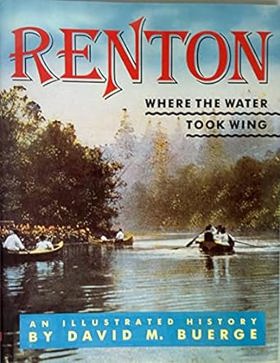
David M. Buerge, Cynthia Barker, and Nada Oakley’s Renton, where the water took wing: an illustrated history chronicles the profound industrial and civic transformation of the fertile lowlands at the southern shores of Lake Washington. Set against the coal-rich Cascade foothills and a historically dynamic hydrological landscape, the narrative details how early homesteaders, immigrant miners, and indigenous communities navigated a terrain fundamentally altered by massive civic engineering—most notably the 1916 lowering of Lake Washington, which permanently dried up the vital Black River and redirected the Cedar River. By tracing the transition from rugged, resource-extraction frontier towns and river-dependent settlements into a pioneering aviation manufacturing hub built on the newly exposed lakeshores, the text reveals how tight-knit ethnic neighborhoods and industrial workforces coalesced through shared labor and rapid environmental adaptation. Ultimately, this illustrated history demonstrates how collaboratively harnessing both the region's natural waterways and its radically re-engineered geography successfully transformed a scattered mining settlement into a cohesive, enduring modern city whose legacy of flight reshaped the Pacific Northwest.
135 pages : illustrations (some color), map ; 29 cm
Non-circulating [ 1 ]
Last updated: 2017-04-01